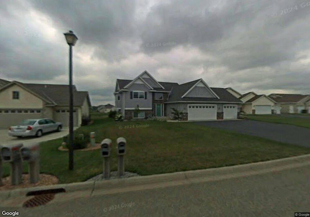
1284 Fieldstone Dr Sauk Rapids, MN 56379
Estimated Value: $324,208 - $341,000
4
Beds
2
Baths
1,190
Sq Ft
$277/Sq Ft
Est. Value
About This Home
This home is located at 1284 Fieldstone Dr, Sauk Rapids, MN 56379 and is currently estimated at $329,302, approximately $276 per square foot. 1284 Fieldstone Dr is a home located in Benton County with nearby schools including Mississippi Heights Elementary School, Sauk Rapids-Rice Middle School, and Sauk Rapids-Rice Senior High School.
Ownership History
Date
Name
Owned For
Owner Type
Purchase Details
Closed on
Oct 20, 2005
Sold by
Marmorine Monte L and Marmorine Kathleen F
Bought by
Hollen Ted A and Hollen Jennifer L
Current Estimated Value
Home Financials for this Owner
Home Financials are based on the most recent Mortgage that was taken out on this home.
Original Mortgage
$156,700
Outstanding Balance
$85,819
Interest Rate
6.13%
Mortgage Type
New Conventional
Estimated Equity
$243,483
Create a Home Valuation Report for This Property
The Home Valuation Report is an in-depth analysis detailing your home's value as well as a comparison with similar homes in the area
Home Values in the Area
Average Home Value in this Area
Purchase History
| Date | Buyer | Sale Price | Title Company |
|---|---|---|---|
| Hollen Ted A | $287,444 | -- |
Source: Public Records
Mortgage History
| Date | Status | Borrower | Loan Amount |
|---|---|---|---|
| Open | Hollen Ted A | $156,700 |
Source: Public Records
Tax History Compared to Growth
Tax History
| Year | Tax Paid | Tax Assessment Tax Assessment Total Assessment is a certain percentage of the fair market value that is determined by local assessors to be the total taxable value of land and additions on the property. | Land | Improvement |
|---|---|---|---|---|
| 2025 | $3,884 | $319,200 | $34,100 | $285,100 |
| 2024 | $3,838 | $316,700 | $34,100 | $282,600 |
| 2023 | $3,662 | $321,800 | $34,100 | $287,700 |
| 2022 | $3,418 | $283,000 | $31,000 | $252,000 |
| 2021 | $3,116 | $243,400 | $31,000 | $212,400 |
| 2018 | $2,806 | $187,000 | $27,091 | $159,909 |
| 2017 | $2,806 | $172,600 | $26,719 | $145,881 |
| 2016 | $2,742 | $186,500 | $29,800 | $156,700 |
| 2015 | $2,706 | $149,600 | $26,010 | $123,590 |
| 2014 | -- | $121,600 | $24,871 | $96,729 |
| 2013 | -- | $121,600 | $24,871 | $96,729 |
Source: Public Records
Map
Nearby Homes
- 1294 Stone Ridge Rd
- 1000 10th Ave NE
- 1424 Hillside Ct
- 1 Skyview Dr
- 1408 10th St NE
- 1021 5th St S
- xxx Lot 3
- 100 9th Ave S
- 1526 Prairie View Ln NE
- xxx Lot 2
- 970 Golden Spike Rd NE
- 1804 8th Ave S
- 1803 8th Ave S
- 880 Golden Spike Rd NE
- 608 Summit Ave S
- 112 Summit Ave S
- 55xx Mayhew Lake Rd NE
- XXXX Golden Spike Rd NE
- 1930 Prospect Dr NE
- TBD Lot D Mayhew Lake Rd NE
- 1286 Fieldstone Dr
- 1282 Fieldstone Dr
- 1288 Fieldstone Dr
- 1280 Fieldstone Dr
- 1281 Fieldstone Dr
- 1283 Fieldstone Dr
- 1285 Fieldstone Dr
- 1290 Fieldstone Dr
- 1252 Stone Ridge Rd
- 1274 Fieldstone Dr
- 1281 Agate Ct
- 1256 Stone Ridge Rd
- 1283 Agate Ct
- 1260 Stone Ridge Rd
- 1270 Fieldstone Dr
- 1292 Fieldstone Dr
- 1285 Agate Ct
- 1264 Stone Ridge Rd
- 1294 Fieldstone Dr
- 1287 Agate Ct