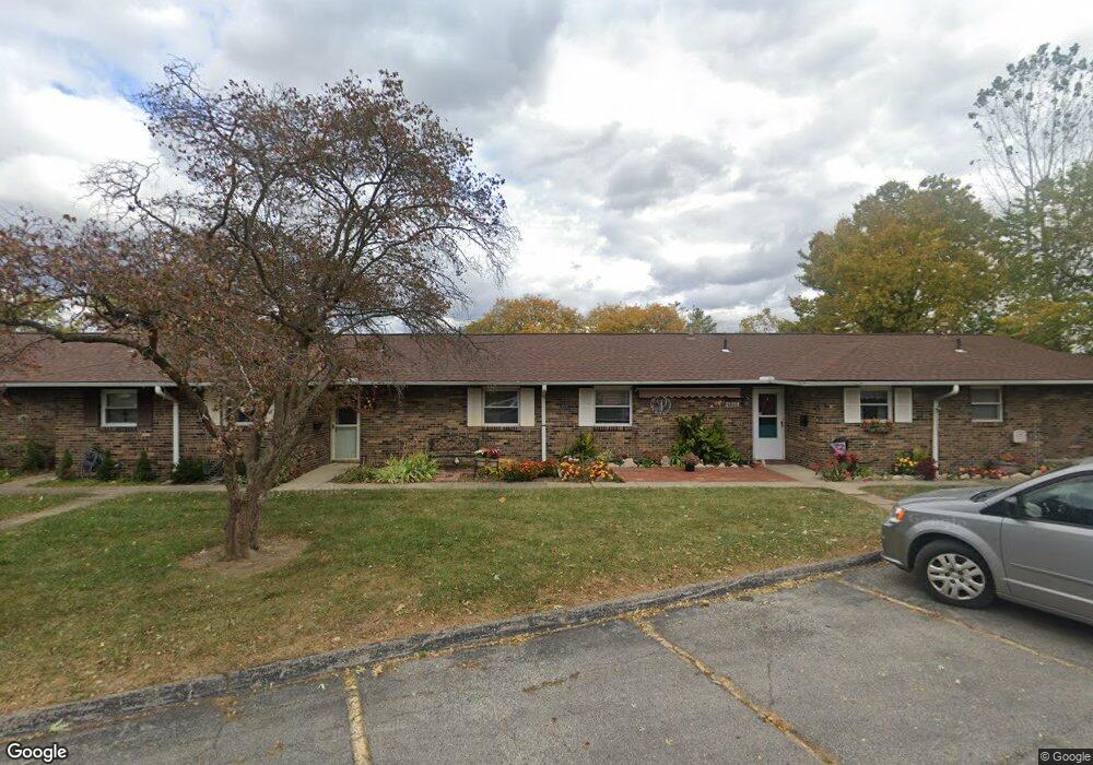
1284 Woodbrook Ln Columbus, OH 43223
Brookshire NeighborhoodEstimated Value: $98,619 - $150,000
2
Beds
1
Bath
894
Sq Ft
$129/Sq Ft
Est. Value
About This Home
This home is located at 1284 Woodbrook Ln, Columbus, OH 43223 and is currently estimated at $115,655, approximately $129 per square foot. 1284 Woodbrook Ln is a home located in Franklin County with nearby schools including Lindbergh Elementary School, Hilltonia Middle School, and Briggs High School.
Ownership History
Date
Name
Owned For
Owner Type
Purchase Details
Closed on
Oct 30, 2023
Sold by
Sheriff Of Franklin County Ohio
Bought by
Grimes Derek and Grimes Willanda
Current Estimated Value
Purchase Details
Closed on
Jul 9, 2001
Sold by
Camp Lorie A
Bought by
Bright Harold D
Home Financials for this Owner
Home Financials are based on the most recent Mortgage that was taken out on this home.
Original Mortgage
$54,100
Interest Rate
7.22%
Mortgage Type
Purchase Money Mortgage
Purchase Details
Closed on
Feb 6, 2001
Sold by
Burns Veronica M
Bought by
Camp Lorie A
Home Financials for this Owner
Home Financials are based on the most recent Mortgage that was taken out on this home.
Original Mortgage
$52,350
Interest Rate
7.18%
Mortgage Type
FHA
Purchase Details
Closed on
Oct 20, 1988
Purchase Details
Closed on
May 1, 1984
Create a Home Valuation Report for This Property
The Home Valuation Report is an in-depth analysis detailing your home's value as well as a comparison with similar homes in the area
Home Values in the Area
Average Home Value in this Area
Purchase History
| Date | Buyer | Sale Price | Title Company |
|---|---|---|---|
| Grimes Derek | $60,700 | None Listed On Document | |
| Bright Harold D | $57,000 | Independent Title | |
| Camp Lorie A | $54,000 | Independent Title | |
| -- | -- | -- | |
| -- | $31,900 | -- |
Source: Public Records
Mortgage History
| Date | Status | Borrower | Loan Amount |
|---|---|---|---|
| Previous Owner | Bright Harold D | $54,100 | |
| Previous Owner | Camp Lorie A | $52,350 |
Source: Public Records
Tax History Compared to Growth
Tax History
| Year | Tax Paid | Tax Assessment Tax Assessment Total Assessment is a certain percentage of the fair market value that is determined by local assessors to be the total taxable value of land and additions on the property. | Land | Improvement |
|---|---|---|---|---|
| 2024 | $1,132 | $24,710 | $5,250 | $19,460 |
| 2023 | $1,268 | $24,710 | $5,250 | $19,460 |
| 2022 | $768 | $11,620 | $1,540 | $10,080 |
| 2021 | $769 | $11,620 | $1,540 | $10,080 |
| 2020 | $149 | $11,620 | $1,540 | $10,080 |
| 2019 | $32 | $9,280 | $1,230 | $8,050 |
| 2018 | $87 | $9,280 | $1,230 | $8,050 |
| 2017 | $94 | $9,280 | $1,230 | $8,050 |
| 2016 | $156 | $11,100 | $1,300 | $9,800 |
| 2015 | $141 | $11,100 | $1,300 | $9,800 |
| 2014 | $142 | $11,100 | $1,300 | $9,800 |
| 2013 | $0 | $12,320 | $1,435 | $10,885 |
Source: Public Records
Map
Nearby Homes
- 1258 Woodbrook Cir W Unit 199
- 2336 Woodbrook Cir N Unit 92 B
- 2362 Woodbrook Cir N Unit 81
- 0 S Central Ave
- 1119 Hardesty Place E Unit 1
- 2382 Hardesty Dr S Unit Q-5
- 1085 Hardesty Place E Unit 4
- 2210 October Ridge Dr
- 2337 Hardesty Ct Unit 1
- 2436 Hardesty Dr S Unit 4
- 2322 Hardesty Ct Unit I11
- 2334 Hardesty Ct Unit 5
- 2180 Eakin Rd
- 1543 Red Leaf Ln
- 2547 Rosedale Ave
- 2367 Hardesty Dr N Unit 1-1
- 1607 Red Leaf Ln
- 2610 Spaatz Ave
- 1994 Little Ave
- 2491 Vanderberg Ave
- 1286 Woodbrook Ln
- 1286 Woodbrook Ln Unit 262
- 1282 Woodbrook Ln Unit 260
- 1280 Woodbrook Ln
- 1268 Woodbrook Ln
- 1268 Woodbrook Ln Unit 265
- 1264 Woodbrook Ln Unit 263
- 1266 Woodbrook Ln
- 1266 Woodbrook Ln Unit 264
- 1278 Woodbrook Ln
- 1278 Woodbrook Ln Unit 258
- 1270 Woodbrook Ln
- 1272 Woodbrook Ln
- 1290 Woodbrook Ln Unit 252
- 1276 Woodbrook Ln
- 1276 Woodbrook Ln Unit 257
- 1294 Woodbrook Ln
- 1274 Woodbrook Ln Unit 268
- 1292 Woodbrook Ln Unit 253
- 1288 Woodbrook Ln