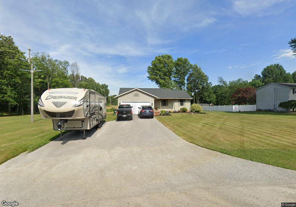
12844 Wentz Ave NE Alliance, OH 44601
Estimated Value: $246,000 - $299,000
3
Beds
2
Baths
1,360
Sq Ft
$202/Sq Ft
Est. Value
About This Home
This home is located at 12844 Wentz Ave NE, Alliance, OH 44601 and is currently estimated at $274,411, approximately $201 per square foot. 12844 Wentz Ave NE is a home located in Stark County with nearby schools including Marlington High School.
Ownership History
Date
Name
Owned For
Owner Type
Purchase Details
Closed on
Sep 23, 1999
Sold by
Mitchell Andrew A and Mitchell Lisa L
Bought by
Mitchell Andrew A and Mitchell Lisa L
Current Estimated Value
Home Financials for this Owner
Home Financials are based on the most recent Mortgage that was taken out on this home.
Original Mortgage
$109,600
Interest Rate
7.93%
Mortgage Type
Balloon
Purchase Details
Closed on
Jul 2, 1991
Purchase Details
Closed on
Aug 22, 1988
Create a Home Valuation Report for This Property
The Home Valuation Report is an in-depth analysis detailing your home's value as well as a comparison with similar homes in the area
Home Values in the Area
Average Home Value in this Area
Purchase History
| Date | Buyer | Sale Price | Title Company |
|---|---|---|---|
| Mitchell Andrew A | -- | -- | |
| -- | $5,500 | -- | |
| -- | $2,800 | -- |
Source: Public Records
Mortgage History
| Date | Status | Borrower | Loan Amount |
|---|---|---|---|
| Closed | Mitchell Andrew A | $109,600 |
Source: Public Records
Tax History Compared to Growth
Tax History
| Year | Tax Paid | Tax Assessment Tax Assessment Total Assessment is a certain percentage of the fair market value that is determined by local assessors to be the total taxable value of land and additions on the property. | Land | Improvement |
|---|---|---|---|---|
| 2025 | -- | $79,560 | $26,570 | $52,990 |
| 2024 | -- | $79,560 | $26,570 | $52,990 |
| 2023 | $2,556 | $69,510 | $20,230 | $49,280 |
| 2022 | $2,565 | $69,510 | $20,230 | $49,280 |
| 2021 | $2,574 | $69,510 | $20,230 | $49,280 |
| 2020 | $2,339 | $57,890 | $17,010 | $40,880 |
| 2019 | $2,322 | $57,890 | $17,010 | $40,880 |
| 2018 | $2,217 | $57,890 | $17,010 | $40,880 |
| 2017 | $2,135 | $51,600 | $14,810 | $36,790 |
| 2016 | $2,136 | $51,600 | $14,810 | $36,790 |
| 2015 | $2,001 | $51,600 | $14,810 | $36,790 |
| 2014 | $14 | $44,940 | $12,880 | $32,060 |
| 2013 | $985 | $44,940 | $12,880 | $32,060 |
Source: Public Records
Map
Nearby Homes
- 8736 Lynn Park St NE
- 14265 Reeder Ave NE
- 0 New Milford Rd Unit 5119787
- 7377 Pontius St NE
- 167 State Route 44
- 6180 Edison St NE
- 4829 Laubert Rd
- 3952 Laubert Rd
- 0 Pontius St NE
- 5615 Laubert Rd
- 12415 Snode St NE
- 12355 Edison St NE
- 14920 Mccallum Ave NE
- 3990 Edison St NE
- 12561 Duquette Ave NE
- 11960 Freshley Ave NE
- 10666 Wilma Ave NE
- 13109 Edison St NE
- 5296 Eberly Rd
- 90 N Jefferson St
- 12824 Wentz Ave NE
- 8863 Lynn Park St NE
- 8862 Lynn Park St NE
- 8841 Lynn Park St NE
- 12786 Wentz Ave NE
- 12931 Wentz Ave NE
- 8821 Lynn Park St NE
- 12775 Wentz Ave NE
- 8820 Lynn Park St NE
- 12750 Wentz Ave NE
- 8805 Lynn Park St NE
- 8865 Lynnett St NE
- 8825 Lynnett St NE
- 8780 Lynn Park St NE
- 8775 Lynn Park St NE
- 8754 Lynn Park St NE
- 8757 Lynn Park St NE
- 8890 Lynnett St NE
- 8800 Lynnett St NE
- 8705 Lynn Park St NE