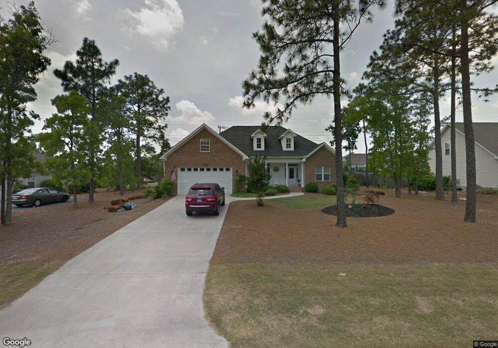
1285 Burning Tree Rd Unit 13 Pinehurst, NC 28374
Estimated Value: $451,877 - $515,000
3
Beds
2
Baths
2,068
Sq Ft
$236/Sq Ft
Est. Value
About This Home
This home is located at 1285 Burning Tree Rd Unit 13, Pinehurst, NC 28374 and is currently estimated at $487,719, approximately $235 per square foot. 1285 Burning Tree Rd Unit 13 is a home located in Moore County with nearby schools including Pinehurst Elementary School, Southern Middle School, and Pinecrest High School.
Ownership History
Date
Name
Owned For
Owner Type
Purchase Details
Closed on
Nov 29, 2010
Sold by
Landmark Homes Of Pinehurst Llc
Bought by
Walls James C and Walls Michele
Current Estimated Value
Home Financials for this Owner
Home Financials are based on the most recent Mortgage that was taken out on this home.
Original Mortgage
$168,000
Outstanding Balance
$99,699
Interest Rate
2.75%
Mortgage Type
New Conventional
Estimated Equity
$388,020
Create a Home Valuation Report for This Property
The Home Valuation Report is an in-depth analysis detailing your home's value as well as a comparison with similar homes in the area
Home Values in the Area
Average Home Value in this Area
Purchase History
| Date | Buyer | Sale Price | Title Company |
|---|---|---|---|
| Walls James C | $210,000 | None Available |
Source: Public Records
Mortgage History
| Date | Status | Borrower | Loan Amount |
|---|---|---|---|
| Open | Walls James C | $168,000 |
Source: Public Records
Tax History
| Year | Tax Paid | Tax Assessment Tax Assessment Total Assessment is a certain percentage of the fair market value that is determined by local assessors to be the total taxable value of land and additions on the property. | Land | Improvement |
|---|---|---|---|---|
| 2025 | $2,147 | $385,100 | $56,250 | $328,850 |
| 2024 | $2,205 | $385,100 | $56,250 | $328,850 |
| 2023 | $2,301 | $385,100 | $56,250 | $328,850 |
| 2022 | $2,132 | $255,320 | $26,250 | $229,070 |
| 2021 | $2,209 | $255,320 | $26,250 | $229,070 |
| 2020 | $2,186 | $255,320 | $26,250 | $229,070 |
| 2019 | $2,186 | $255,320 | $26,250 | $229,070 |
| 2018 | $1,877 | $234,570 | $24,000 | $210,570 |
| 2017 | $1,853 | $234,570 | $24,000 | $210,570 |
| 2015 | $1,818 | $234,570 | $24,000 | $210,570 |
| 2014 | $1,777 | $232,350 | $27,000 | $205,350 |
| 2013 | -- | $232,350 | $27,000 | $205,350 |
Source: Public Records
Map
Nearby Homes
- 1280 Burning Tree Rd
- 35 Westlake Pointe Dr
- 1220 Burning Tree Rd Unit 12
- 9 Lake Side
- 21 Lake Pinehurst Villas Rd
- 1360 Burning Tree Rd
- 2 Beryl Cir
- 30 Lake Pinehurst Villas Rd
- 6 Westlake Pointe Dr
- 9 Tull Ln
- 1 Lake Vista Ln
- 350 Pine Vista Dr
- 3 Gingham Place Unit 12
- 620 Diamondhead Dr S
- 90 Lake Shore Dr
- 165 Catalpa Ln S
- 850 Burning Tree Rd Unit 12
- 305 Sloan Ln
- 315 Sloan Ln
- 5 Pin Oak Ct
- 1275 Burning Tree Rd Unit 13
- 1295 Burning Tree Rd
- 20 Beryl Cir
- 1265 Burning Tree Rd Unit 12
- 18 Beryl Cir
- 1260 Burning Tree Rd
- 22 Beryl Cir Unit 13
- 1305 Burning Tree Rd
- 3 Lakeside Ln
- 1290 Burning Tree Rd Unit ID1302626P
- 1290 Burning Tree Rd
- 16 Beryl Cir
- 24 Beryl Cir
- 1250 Burning Tree Rd Unit 12
- 1255 Burning Tree Rd Unit 12
- 15 Lake Side Ln
- 1315 Burning Tree Rd
- 1300 Burning Tree Rd
- 14 Beryl Cir
- 35 Westlake Point Dr
Your Personal Tour Guide
Ask me questions while you tour the home.