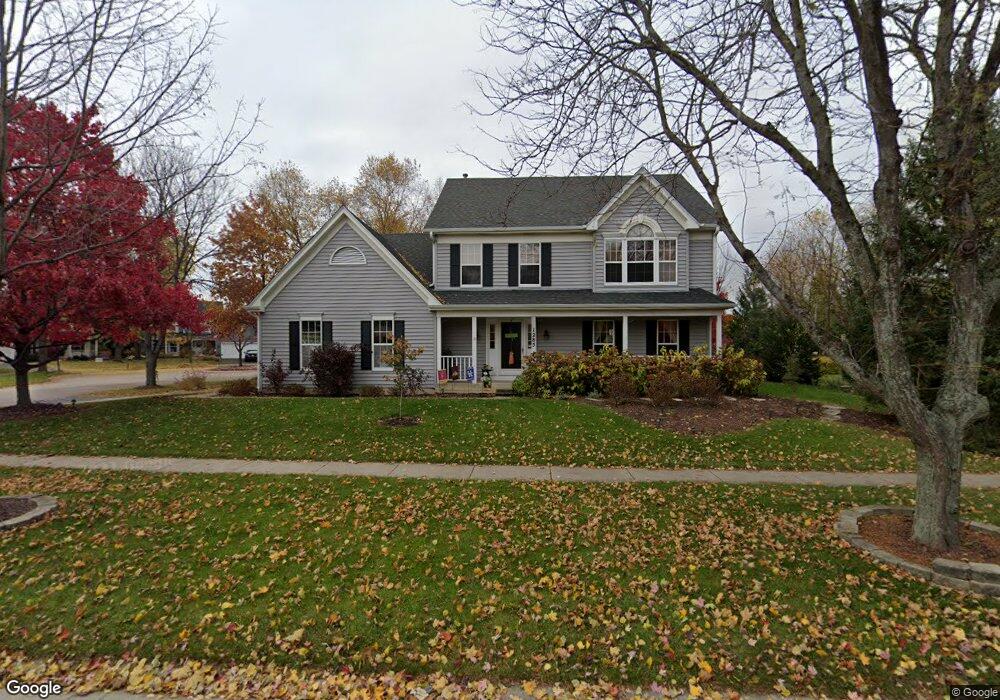
1285 Lewis Rd Unit 11 Geneva, IL 60134
Southwest Geneva NeighborhoodEstimated Value: $498,651 - $534,000
4
Beds
3
Baths
2,212
Sq Ft
$236/Sq Ft
Est. Value
About This Home
This home is located at 1285 Lewis Rd Unit 11, Geneva, IL 60134 and is currently estimated at $521,413, approximately $235 per square foot. 1285 Lewis Rd Unit 11 is a home located in Kane County with nearby schools including Williamsburg Elementary School, Geneva Community High School, and St. Peter School.
Ownership History
Date
Name
Owned For
Owner Type
Purchase Details
Closed on
Apr 4, 1995
Sold by
Westway Construction Corp
Bought by
Lee Russell J and Lee Luisa L
Current Estimated Value
Home Financials for this Owner
Home Financials are based on the most recent Mortgage that was taken out on this home.
Original Mortgage
$173,600
Interest Rate
7.62%
Create a Home Valuation Report for This Property
The Home Valuation Report is an in-depth analysis detailing your home's value as well as a comparison with similar homes in the area
Home Values in the Area
Average Home Value in this Area
Purchase History
| Date | Buyer | Sale Price | Title Company |
|---|---|---|---|
| Lee Russell J | $217,000 | Fox Title Company |
Source: Public Records
Mortgage History
| Date | Status | Borrower | Loan Amount |
|---|---|---|---|
| Closed | Lee Russell J | $173,600 |
Source: Public Records
Tax History Compared to Growth
Tax History
| Year | Tax Paid | Tax Assessment Tax Assessment Total Assessment is a certain percentage of the fair market value that is determined by local assessors to be the total taxable value of land and additions on the property. | Land | Improvement |
|---|---|---|---|---|
| 2024 | $9,371 | $130,207 | $33,506 | $96,701 |
| 2023 | $9,103 | $118,370 | $30,460 | $87,910 |
| 2022 | $8,728 | $109,989 | $28,303 | $81,686 |
| 2021 | $8,201 | $105,901 | $27,251 | $78,650 |
| 2020 | $8,104 | $104,285 | $26,835 | $77,450 |
| 2019 | $8,080 | $102,311 | $26,327 | $75,984 |
| 2018 | $8,482 | $107,106 | $26,327 | $80,779 |
| 2017 | $8,385 | $101,278 | $25,625 | $75,653 |
| 2016 | $8,297 | $98,474 | $25,279 | $73,195 |
| 2015 | -- | $93,624 | $24,034 | $69,590 |
| 2014 | -- | $93,552 | $24,034 | $69,518 |
| 2013 | -- | $93,552 | $24,034 | $69,518 |
Source: Public Records
Map
Nearby Homes
- Unit 6A Prairie Grove Dr
- Unit 5B Prairie Grove Dr
- Unit 4A Prairie Grove Dr
- Unit 5A Prairie Grove Dr
- Unit 7A Prairie Grove Dr
- Unit 6C Prairie Grove Dr
- Unit 5C Prairie Grove Dr
- Unit 6B Prairie Grove Dr
- Unit 7C Prairie Grove Dr
- 839 S Randall Rd
- 2528 Heritage Ct Unit 1
- 2147 Fargo Blvd
- 644 Branson Dr
- 3497 Winding Meadow Ln
- 558 Schroeder Trail
- 869 Cambridge Dr
- 441 Freedlund Course
- 433 Freedlund Course
- 425 Freedlund Course
- 417 Freedlund Course
- 1255 Thornhill Ct
- 2575 Miller Rd Unit 11
- 4920 Thornhill Dr
- 2555 Miller Rd Unit 11
- 1245 Thornhill Ct Unit 11
- 1213 Lewis Rd
- 1038 Lilyrose Ln
- 1076 Lilyrose Ln
- 1124 Lilyrose Ln
- 1136 Lilyrose Ln
- 1182 Lilyrose Ln
- 1300 Lewis Rd Unit 5A
- 1340 Lewis Rd
- 1280 Lewis Rd Unit 5A
- 1235 Thornhill Ct Unit 11
- 1215 Thornhill Ct
- 1225 Thornhill Ct
- 1260 Lewis Rd
- 1199 Lewis Rd
- 2638 Danford Way