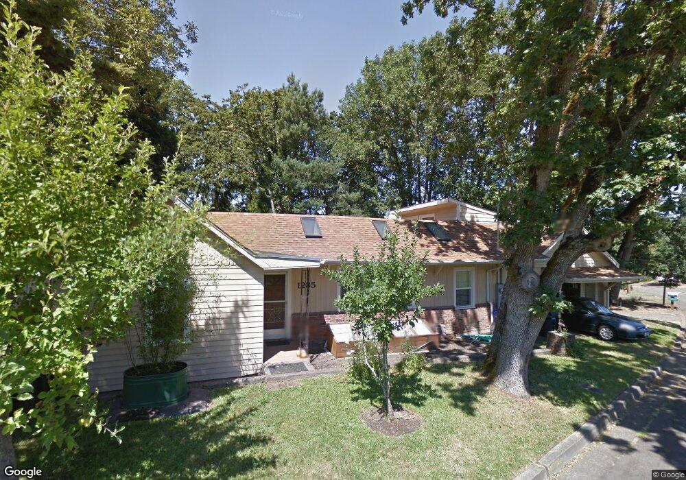
1285 Mclean Blvd Unit 1 Eugene, OR 97405
Crest Drive NeighborhoodEstimated Value: $449,000 - $500,000
3
Beds
2
Baths
1,498
Sq Ft
$317/Sq Ft
Est. Value
About This Home
This home is located at 1285 Mclean Blvd Unit 1, Eugene, OR 97405 and is currently estimated at $474,796, approximately $316 per square foot. 1285 Mclean Blvd Unit 1 is a home located in Lane County with nearby schools including Adams Elementary School, Arts And Technology Academy At Jefferson, and Churchill High School.
Ownership History
Date
Name
Owned For
Owner Type
Purchase Details
Closed on
Jul 9, 2001
Sold by
Taylor Stanley N
Bought by
Taylor Stan and Wren Ruth H
Current Estimated Value
Home Financials for this Owner
Home Financials are based on the most recent Mortgage that was taken out on this home.
Original Mortgage
$98,000
Interest Rate
7.26%
Purchase Details
Closed on
May 21, 1999
Sold by
Taylor Mike F
Bought by
Taylor Stanley N
Create a Home Valuation Report for This Property
The Home Valuation Report is an in-depth analysis detailing your home's value as well as a comparison with similar homes in the area
Home Values in the Area
Average Home Value in this Area
Purchase History
| Date | Buyer | Sale Price | Title Company |
|---|---|---|---|
| Taylor Stan | -- | Western Pioneer Title Co | |
| Taylor Stanley N | $20,000 | -- |
Source: Public Records
Mortgage History
| Date | Status | Borrower | Loan Amount |
|---|---|---|---|
| Closed | Taylor Stan | $98,000 |
Source: Public Records
Tax History
| Year | Tax Paid | Tax Assessment Tax Assessment Total Assessment is a certain percentage of the fair market value that is determined by local assessors to be the total taxable value of land and additions on the property. | Land | Improvement |
|---|---|---|---|---|
| 2025 | $4,161 | $213,549 | -- | -- |
| 2024 | $4,109 | $207,330 | -- | -- |
| 2023 | $4,109 | $201,292 | $0 | $0 |
| 2022 | $3,849 | $195,430 | $0 | $0 |
| 2021 | $3,616 | $189,738 | $0 | $0 |
| 2020 | $3,628 | $184,212 | $0 | $0 |
| 2019 | $3,504 | $178,847 | $0 | $0 |
| 2018 | $3,299 | $168,581 | $0 | $0 |
| 2017 | $3,151 | $168,581 | $0 | $0 |
| 2016 | $3,011 | $163,671 | $0 | $0 |
| 2015 | $2,984 | $158,904 | $0 | $0 |
| 2014 | $2,924 | $154,276 | $0 | $0 |
Source: Public Records
Map
Nearby Homes
- 3087 Whitbeck Blvd
- 0 Mclean Blvd Unit 24671448
- 0 Mclean Blvd Unit 697374759
- 3160 Whitten Dr
- 1783 Graham Dr
- 865 W 28th Ave
- 951 W 27th Ave
- 1 Storey Blvd
- 2 Storey Blvd
- 2673 Garfield St
- 2850 Garfield St
- 870 W 25th Ave
- 0 Hidden Meadows
- 605 Fulvue Dr
- 3023 Ashley Loop
- 3093 Soloman Loop
- 2037 Morning View Dr
- 2225 W 28th Ave
- 2030 W 34th Ave
- 453 Dellwood Dr
- 1265 Mclean Blvd
- 1290 Mclean Blvd
- 1260 Mclean Blvd
- 2871 Taylor St
- 2910 Powell St
- 1245 Mclean Blvd
- 2873 Taylor St
- 1325 Mclean Blvd
- 2980 Powell St
- 2869 Taylor St
- 2915 Durbin St
- 2875 Taylor St
- 2925 Powell St
- 2883 Taylor St
- 2937 Powell St
- 2889 Taylor St
- 1240 Mclean Blvd
- 2986 Powell St
- 2925 Durbin St
- 2865 Taylor St
Your Personal Tour Guide
Ask me questions while you tour the home.