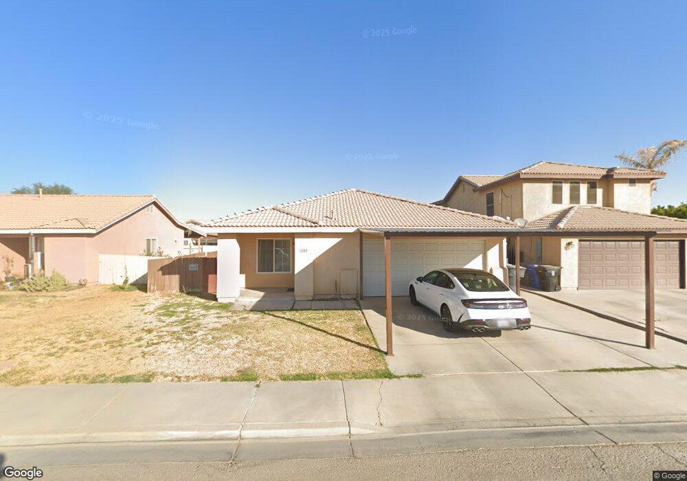
1285 R Santos St Calexico, CA 92231
Estimated Value: $401,000 - $432,000
3
Beds
2
Baths
1,285
Sq Ft
$320/Sq Ft
Est. Value
About This Home
This home is located at 1285 R Santos St, Calexico, CA 92231 and is currently estimated at $410,848, approximately $319 per square foot. 1285 R Santos St is a home located in Imperial County with nearby schools including Cesar Chavez Elementary School, Enrique Camarena Junior High School, and Calexico High School.
Ownership History
Date
Name
Owned For
Owner Type
Purchase Details
Closed on
Aug 5, 2002
Sold by
Victoria Eastland Llc
Bought by
Briceno Ricardo G and Briceno Lupe S
Current Estimated Value
Home Financials for this Owner
Home Financials are based on the most recent Mortgage that was taken out on this home.
Original Mortgage
$110,026
Outstanding Balance
$46,158
Interest Rate
6.43%
Mortgage Type
FHA
Estimated Equity
$364,690
Create a Home Valuation Report for This Property
The Home Valuation Report is an in-depth analysis detailing your home's value as well as a comparison with similar homes in the area
Home Values in the Area
Average Home Value in this Area
Purchase History
| Date | Buyer | Sale Price | Title Company |
|---|---|---|---|
| Briceno Ricardo G | $129,000 | First American Title Ins Co |
Source: Public Records
Mortgage History
| Date | Status | Borrower | Loan Amount |
|---|---|---|---|
| Open | Briceno Ricardo G | $110,026 | |
| Closed | Briceno Ricardo G | $19,950 |
Source: Public Records
Tax History Compared to Growth
Tax History
| Year | Tax Paid | Tax Assessment Tax Assessment Total Assessment is a certain percentage of the fair market value that is determined by local assessors to be the total taxable value of land and additions on the property. | Land | Improvement |
|---|---|---|---|---|
| 2025 | $2,184 | $186,807 | $43,440 | $143,367 |
| 2023 | $2,184 | $179,554 | $41,754 | $137,800 |
| 2022 | $2,112 | $176,035 | $40,936 | $135,099 |
| 2021 | $2,048 | $172,584 | $40,134 | $132,450 |
| 2020 | $1,972 | $170,815 | $39,723 | $131,092 |
| 2019 | $1,913 | $167,467 | $38,945 | $128,522 |
| 2018 | $1,894 | $164,184 | $38,182 | $126,002 |
| 2017 | $1,756 | $160,966 | $37,434 | $123,532 |
| 2016 | $1,673 | $157,810 | $36,700 | $121,110 |
| 2015 | $1,643 | $155,440 | $36,149 | $119,291 |
| 2014 | $1,396 | $133,518 | $40,000 | $93,518 |
Source: Public Records
Map
Nearby Homes
- 2186 G Woo Ave
- 1000 E Cole Rd
- 0 E Cole Rd Unit Lot 1 250029524
- 1336 Albright St
- 2117 Descanso Dr
- 1268 Topaz Ct
- 1900 Rancho Frontera Ave Unit H59
- 1252 Fiesta Ave
- 950 Santa Ana St
- 952 Alameda St
- 839 E Cole Blvd
- 900 Paseo de Alteza St
- 1245 C N Perry Rd
- 901 E Rivera Ave
- 0 Avenida de Oro
- 711 N Preston Dr
- 825 Andrade Ave
- 105 John Kennedy St
- 0 California 98
- 1236 T Boman St
- 1291 R Santos St
- 1279 R Santos St
- 1268 P and F Alvarado Dr
- 1272 P and F Alvarado Dr
- 1273 R Santos St
- 1264 P and F Alvarado Dr
- 1260 P and F Alvarado Dr
- 1284 R Santos St
- 1267 R Santos St
- 1278 R Santos St
- 1290 R Santos St
- 1256 P and F Alvarado Dr
- 1272 R Santos St
- 2266 G Woo Ave
- 2272 G Woo Ave
- 2260 G Woo Ave
- 2278 G Woo Ave
- 1261 R Santos St
- 2256 G Woo Ave
- 1266 R Santos St