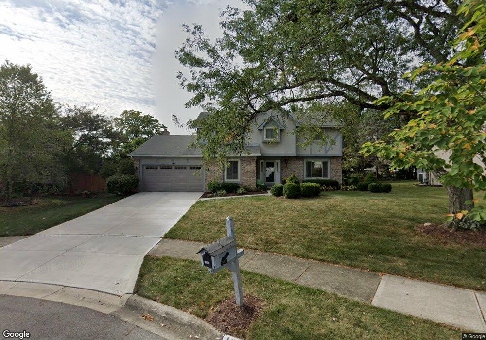
1285 Scituate Ct Westerville, OH 43081
Estimated Value: $453,000 - $514,000
4
Beds
3
Baths
2,674
Sq Ft
$182/Sq Ft
Est. Value
About This Home
This home is located at 1285 Scituate Ct, Westerville, OH 43081 and is currently estimated at $486,478, approximately $181 per square foot. 1285 Scituate Ct is a home located in Franklin County with nearby schools including Mcvay Elementary School, Walnut Springs Middle School, and Westerville-North High School.
Ownership History
Date
Name
Owned For
Owner Type
Purchase Details
Closed on
Feb 4, 2010
Sold by
Gerberry Joan L
Bought by
Bechtold Jason N and Bechtold Jennifer L
Current Estimated Value
Home Financials for this Owner
Home Financials are based on the most recent Mortgage that was taken out on this home.
Original Mortgage
$202,366
Outstanding Balance
$132,856
Interest Rate
4.87%
Mortgage Type
FHA
Estimated Equity
$353,622
Purchase Details
Closed on
Dec 20, 1983
Bought by
Gerberry John E
Create a Home Valuation Report for This Property
The Home Valuation Report is an in-depth analysis detailing your home's value as well as a comparison with similar homes in the area
Home Values in the Area
Average Home Value in this Area
Purchase History
| Date | Buyer | Sale Price | Title Company |
|---|---|---|---|
| Bechtold Jason N | -- | Real Living | |
| Gerberry John E | $122,000 | -- |
Source: Public Records
Mortgage History
| Date | Status | Borrower | Loan Amount |
|---|---|---|---|
| Open | Bechtold Jason N | $202,366 |
Source: Public Records
Tax History Compared to Growth
Tax History
| Year | Tax Paid | Tax Assessment Tax Assessment Total Assessment is a certain percentage of the fair market value that is determined by local assessors to be the total taxable value of land and additions on the property. | Land | Improvement |
|---|---|---|---|---|
| 2024 | $7,573 | $133,250 | $33,250 | $100,000 |
| 2023 | $7,412 | $133,250 | $33,250 | $100,000 |
| 2022 | $6,951 | $95,410 | $23,170 | $72,240 |
| 2021 | $7,009 | $95,410 | $23,170 | $72,240 |
| 2020 | $6,990 | $95,410 | $23,170 | $72,240 |
| 2019 | $6,120 | $78,860 | $19,290 | $59,570 |
| 2018 | $5,899 | $78,860 | $19,290 | $59,570 |
| 2017 | $6,003 | $78,860 | $19,290 | $59,570 |
| 2016 | $5,987 | $71,410 | $21,530 | $49,880 |
| 2015 | $5,799 | $71,410 | $21,530 | $49,880 |
| 2014 | $5,803 | $71,410 | $21,530 | $49,880 |
| 2013 | $2,759 | $68,005 | $20,510 | $47,495 |
Source: Public Records
Map
Nearby Homes
- 1209 Chatham Ridge Rd
- 1146 Forest Rise Dr
- 1368 Nutmeg Ct
- 750 Autumn Branch Rd
- 737 Autumn Branch Rd
- 613 Valley Wood Ct
- 1003 Autumn Meadows Dr
- 994 Autumn Lake Ct
- 969 Farrington Dr
- 1201 Wallean Dr
- 640 Brook Run Dr
- 800 S Spring Rd
- 5769 Burntwood Way
- 90 Spring Creek Dr
- 806 Watten Ln
- 4540 Central College Rd
- 6452 Rockhold Dr
- 810 Applewood Ln
- 5518 Seclusion Dr
- 371 Delaware Dr
- 1275 Scituate Ct
- 483 S Sunbury Rd
- 1293 Scituate Ct
- 658 Ipswich St
- 1265 Scituate Ct
- 1300 Scituate Ct
- 497 S Sunbury Rd
- 1284 Scituate Ct
- 1278 Scituate Ct
- 1294 NE Scituate
- 664 Ipswich St
- 1294 Scituate Ct
- 1270 Scituate Ct
- 1274 Chatham Ridge Rd
- 1282 Chatham Ridge Rd
- 1262 Scituate Ct
- 649 Ipswich St
- 1266 Chatham Ridge Rd
- 1292 Chatham Ridge Rd
- 1273 Smoke Burr Dr