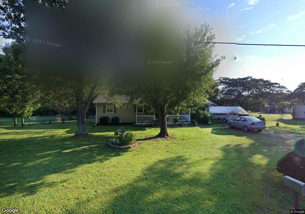
1285 Shoal Rd Lincolnton, NC 28092
Estimated Value: $228,769 - $281,000
3
Beds
2
Baths
1,296
Sq Ft
$187/Sq Ft
Est. Value
About This Home
This home is located at 1285 Shoal Rd, Lincolnton, NC 28092 and is currently estimated at $242,192, approximately $186 per square foot. 1285 Shoal Rd is a home located in Lincoln County with nearby schools including Union Elementary School, West Lincoln Middle, and West Lincoln High School.
Ownership History
Date
Name
Owned For
Owner Type
Purchase Details
Closed on
Aug 4, 2004
Bought by
Richard Shirley
Current Estimated Value
Purchase Details
Closed on
Mar 18, 2004
Bought by
Chase Manhattan Mortgage Corporation
Purchase Details
Closed on
Nov 30, 2000
Bought by
Green John D
Purchase Details
Closed on
Apr 3, 2000
Bought by
Caldwell Steve W and Caldwell Dorothy E
Purchase Details
Closed on
Apr 29, 1999
Bought by
Amerus Life Insurance Co Fka American Mu
Purchase Details
Closed on
Apr 11, 1995
Bought by
Rainwater Robert E and Rainw Trudy W
Create a Home Valuation Report for This Property
The Home Valuation Report is an in-depth analysis detailing your home's value as well as a comparison with similar homes in the area
Home Values in the Area
Average Home Value in this Area
Purchase History
| Date | Buyer | Sale Price | Title Company |
|---|---|---|---|
| Richard Shirley | $65,500 | -- | |
| Chase Manhattan Mortgage Corporation | $56,100 | -- | |
| Green John D | $78,500 | -- | |
| Caldwell Steve W | $52,000 | -- | |
| Amerus Life Insurance Co Fka American Mu | $64,000 | -- | |
| Rainwater Robert E | $56,000 | -- |
Source: Public Records
Tax History Compared to Growth
Tax History
| Year | Tax Paid | Tax Assessment Tax Assessment Total Assessment is a certain percentage of the fair market value that is determined by local assessors to be the total taxable value of land and additions on the property. | Land | Improvement |
|---|---|---|---|---|
| 2025 | $1,135 | $156,860 | $25,548 | $131,312 |
| 2024 | $1,115 | $156,860 | $25,548 | $131,312 |
| 2023 | $1,110 | $156,860 | $25,548 | $131,312 |
| 2022 | $822 | $93,715 | $20,000 | $73,715 |
| 2021 | $822 | $93,715 | $20,000 | $73,715 |
| 2020 | $688 | $93,715 | $20,000 | $73,715 |
| 2019 | $689 | $93,809 | $20,000 | $73,809 |
| 2018 | $706 | $82,563 | $18,500 | $64,063 |
| 2017 | $605 | $82,563 | $18,500 | $64,063 |
| 2016 | $605 | $82,563 | $18,500 | $64,063 |
| 2015 | $689 | $82,563 | $18,500 | $64,063 |
| 2014 | $697 | $87,436 | $19,000 | $68,436 |
Source: Public Records
Map
Nearby Homes
- 940 Guy Heavner Rd
- 00 Flay Rd
- 4850 Gideon Dr
- 5118 Flay Rd
- 4832 Gideon Dr
- 5199 Helms End of Trail
- 508 Shoal Rd
- 00 McCurry Farm Ln Unit F1 & F2
- 2124 Shoal Rd
- 3987 W Highway 27
- 00 Westwinds Rd Unit F3
- 4773 Westwinds Rd
- 5740 Crouse Rd
- 00 Wilson Ct Unit 15
- 00 Wilson Ct Unit 13
- 00 Wilson Ct Unit 12
- 1495 Leonards Fork Church Rd
- 2488 Shoal Rd
- 2449 Leonhardt Rd
- 142 Alf Hoover Rd
- 1297 Shoal Rd
- 1317 Shoal Rd
- 1314 Shoal Rd
- 1256 Shoal Rd
- 1257 Shoal Rd
- 1293 Overbrook Trail
- 1245 Shoal Rd
- 1248 Shoal Rd
- 1324 Shoal Rd
- 1331 Shoal Rd
- 1294 Overbrook Trail
- 1237 Shoal Rd
- 1345 Shoal Rd
- 1312 Overbrook Trail
- 1344 Shoal Rd
- 1213 Shoal Rd
- 4572 Shoal Rd
- 1202 Shoal Rd
- 1346 Overbrook Trail
- 36 Creekside Dr