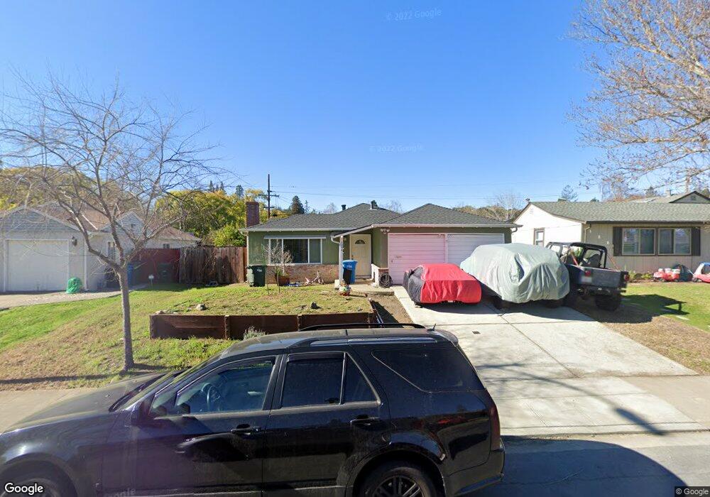
1286 Crompton Rd Redwood City, CA 94061
Woodside Plaza NeighborhoodEstimated Value: $1,437,000 - $1,904,000
3
Beds
2
Baths
970
Sq Ft
$1,792/Sq Ft
Est. Value
About This Home
This home is located at 1286 Crompton Rd, Redwood City, CA 94061 and is currently estimated at $1,738,426, approximately $1,792 per square foot. 1286 Crompton Rd is a home located in San Mateo County with nearby schools including Roosevelt Elementary School, John F. Kennedy Middle School, and Woodside High School.
Ownership History
Date
Name
Owned For
Owner Type
Purchase Details
Closed on
Mar 26, 2012
Sold by
Obrien Helen Gabis
Bought by
Obrien William N
Current Estimated Value
Home Financials for this Owner
Home Financials are based on the most recent Mortgage that was taken out on this home.
Original Mortgage
$397,093
Outstanding Balance
$272,254
Interest Rate
3.83%
Mortgage Type
New Conventional
Estimated Equity
$1,466,172
Purchase Details
Closed on
Mar 12, 2012
Sold by
Obrien Michael W and Obrien Patricia F
Bought by
Obrien Michael W and Obrien Patricia F
Home Financials for this Owner
Home Financials are based on the most recent Mortgage that was taken out on this home.
Original Mortgage
$397,093
Outstanding Balance
$272,254
Interest Rate
3.83%
Mortgage Type
New Conventional
Estimated Equity
$1,466,172
Purchase Details
Closed on
Jul 1, 2008
Sold by
Obrien Helen Gabis
Bought by
Obrien William N
Purchase Details
Closed on
Jun 30, 2008
Sold by
Obrien Michael W
Bought by
Obrien Michael W and Obrien Patricia F
Purchase Details
Closed on
Apr 25, 2008
Sold by
Obrien Patricia F
Bought by
Obrien Michael W
Home Financials for this Owner
Home Financials are based on the most recent Mortgage that was taken out on this home.
Original Mortgage
$417,000
Interest Rate
5.81%
Mortgage Type
New Conventional
Purchase Details
Closed on
Dec 30, 2002
Sold by
Obrien Michael W and Obrien Patricia F
Bought by
Obrien Michael W and Obrien Patricia F
Purchase Details
Closed on
Dec 11, 2000
Sold by
Obrien Michael W and Obrien Patricia F
Bought by
Michael W & Patricia F Obrien 1992 Trust and Obrien William N
Purchase Details
Closed on
Aug 9, 2000
Sold by
Curry Maurice H
Bought by
Obrien Michael W and Obrien Patricia F
Home Financials for this Owner
Home Financials are based on the most recent Mortgage that was taken out on this home.
Original Mortgage
$350,000
Interest Rate
7.87%
Create a Home Valuation Report for This Property
The Home Valuation Report is an in-depth analysis detailing your home's value as well as a comparison with similar homes in the area
Home Values in the Area
Average Home Value in this Area
Purchase History
| Date | Buyer | Sale Price | Title Company |
|---|---|---|---|
| Obrien William N | -- | First American Title Company | |
| Obrien Michael W | -- | First American Title Company | |
| Obrien Michael W | -- | First American Title Company | |
| Obrien Michael W | -- | First American Title Company | |
| Obrien William N | -- | None Available | |
| Obrien Michael W | -- | None Available | |
| Obrien Michael W | -- | California Counties Title Co | |
| Obrien Michael W | -- | California Counties Title Co | |
| Obrien Michael W | -- | -- | |
| Michael W & Patricia F Obrien 1992 Trust | -- | -- | |
| Obrien Michael W | $541,000 | American Title Co |
Source: Public Records
Mortgage History
| Date | Status | Borrower | Loan Amount |
|---|---|---|---|
| Open | Obrien Michael W | $397,093 | |
| Closed | Obrien Michael W | $417,000 | |
| Previous Owner | Obrien Michael W | $350,000 |
Source: Public Records
Tax History Compared to Growth
Tax History
| Year | Tax Paid | Tax Assessment Tax Assessment Total Assessment is a certain percentage of the fair market value that is determined by local assessors to be the total taxable value of land and additions on the property. | Land | Improvement |
|---|---|---|---|---|
| 2025 | $9,618 | $769,492 | $384,746 | $384,746 |
| 2023 | $9,618 | $739,616 | $369,808 | $369,808 |
| 2022 | $9,001 | $725,116 | $362,558 | $362,558 |
| 2021 | $7,853 | $710,900 | $355,450 | $355,450 |
| 2020 | $7,748 | $703,612 | $351,806 | $351,806 |
| 2019 | $7,720 | $689,818 | $344,909 | $344,909 |
| 2018 | $7,520 | $676,294 | $338,147 | $338,147 |
| 2017 | $7,439 | $663,036 | $331,518 | $331,518 |
| 2016 | $7,308 | $650,036 | $325,018 | $325,018 |
| 2015 | $7,036 | $640,274 | $320,137 | $320,137 |
| 2014 | $6,902 | $627,734 | $313,867 | $313,867 |
Source: Public Records
Map
Nearby Homes
- 1103 Connecticut Dr
- 2504 Hastings Ave
- 1159 Chesterton Ave
- 2474 Washington Ave
- 2423 Palm Ave
- 3694 Country Club Dr
- 1640 Connecticut Dr
- 2013 Oregon Ave
- 3622 Farm Hill Blvd
- 155 Normandy Ln
- 949 Pleasant Hill Rd
- 1465 Bonnie Ct
- 2665 Carolina Ave
- 1 Doris Ct
- 697 Glennan Dr
- 938 Round Hill Rd
- 2627 Ohio Ave
- 3676 Mcnulty Way
- 2718 Ohio Ave
- 1830 Vera Ave
- 1280 Crompton Rd
- 1292 Crompton Rd
- 2812 Carson St
- 1276 Crompton Rd
- 1293 Westwood St
- 1287 Westwood St
- 1270 Crompton Rd
- 1287 Crompton Rd
- 1281 Crompton Rd
- 1281 Westwood St
- 1293 Crompton Rd
- 1277 Crompton Rd
- 2809 Carson St
- 1271 Crompton Rd
- 1266 Crompton Rd
- 1277 Westwood St
- 2819 Carson St
- 2803 Carson St
- 2727 Carson St
- 2829 Carson St