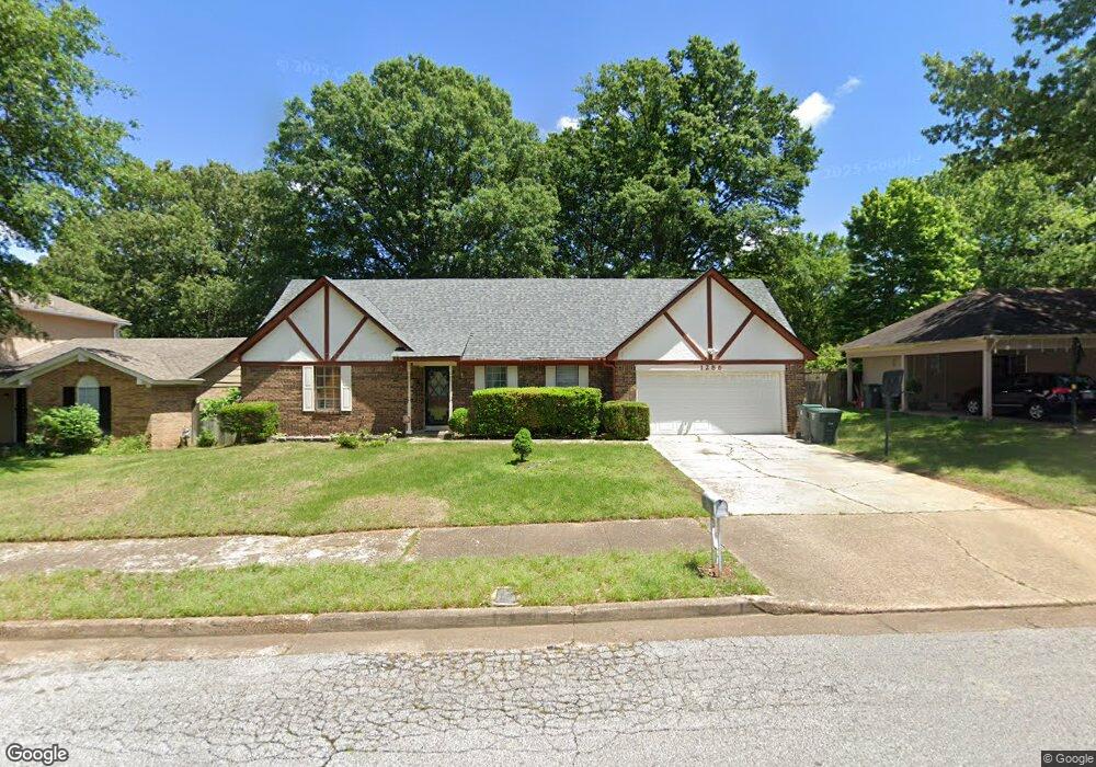
1286 Greenland Rd Memphis, TN 38134
Cordova NeighborhoodEstimated Value: $201,090 - $223,000
3
Beds
2
Baths
2,266
Sq Ft
$94/Sq Ft
Est. Value
About This Home
This home is located at 1286 Greenland Rd, Memphis, TN 38134 and is currently estimated at $212,523, approximately $93 per square foot. 1286 Greenland Rd is a home located in Shelby County with nearby schools including Dexter Elementary School, White Station Middle, and White Station High.
Ownership History
Date
Name
Owned For
Owner Type
Purchase Details
Closed on
May 1, 2002
Sold by
Briggs Hazen S
Bought by
Heng Sethy and Heng Unica K
Current Estimated Value
Home Financials for this Owner
Home Financials are based on the most recent Mortgage that was taken out on this home.
Original Mortgage
$76,000
Interest Rate
7.12%
Purchase Details
Closed on
Mar 29, 1996
Bought by
Yarbrough Wm R and Yarbrough Sandra H
Create a Home Valuation Report for This Property
The Home Valuation Report is an in-depth analysis detailing your home's value as well as a comparison with similar homes in the area
Home Values in the Area
Average Home Value in this Area
Purchase History
| Date | Buyer | Sale Price | Title Company |
|---|---|---|---|
| Heng Sethy | $95,000 | -- | |
| Yarbrough Wm R | $82,000 | -- |
Source: Public Records
Mortgage History
| Date | Status | Borrower | Loan Amount |
|---|---|---|---|
| Closed | Heng Sethy | $76,000 |
Source: Public Records
Tax History Compared to Growth
Tax History
| Year | Tax Paid | Tax Assessment Tax Assessment Total Assessment is a certain percentage of the fair market value that is determined by local assessors to be the total taxable value of land and additions on the property. | Land | Improvement |
|---|---|---|---|---|
| 2025 | $1,121 | $44,525 | $5,750 | $38,775 |
| 2024 | $1,121 | $33,075 | $4,250 | $28,825 |
| 2023 | $2,015 | $33,075 | $4,250 | $28,825 |
| 2022 | $2,015 | $33,075 | $4,250 | $28,825 |
| 2021 | $2,038 | $33,075 | $4,250 | $28,825 |
| 2020 | $1,594 | $22,000 | $4,250 | $17,750 |
| 2019 | $1,594 | $22,000 | $4,250 | $17,750 |
| 2018 | $1,594 | $22,000 | $4,250 | $17,750 |
| 2017 | $904 | $22,000 | $4,250 | $17,750 |
| 2016 | $953 | $21,800 | $0 | $0 |
| 2014 | $953 | $21,800 | $0 | $0 |
Source: Public Records
Map
Nearby Homes
- 1339 Mullins Station Rd
- 1289 Heathcliff Dr
- 6690 Whitten Pine Dr
- 1472 Kinilwood St
- 0 Mullins Station Rd
- 6774 Whitten Pine Dr
- 6378 Limewood Ave
- 1461 Phillips Rd
- 6830 Garmin Ln
- 6838 Lagrange Cir N
- 6840 Lagrange Pines Rd
- 6880 Wrigley Dr
- 6916 Lagrange Pines Rd
- 6925 Raleigh Lagrange Rd
- 7004 Presmond Rd
- 7035 S Estacada Way
- 7020 Wynne Ridge Rd N
- 6990 Parkbrook Ln
- 7115 Lindsey Leaf Cove
- 7194 Charlton Way
- 1278 Greenland Rd
- 1296 Greenland Rd
- 1291 Oak Park Cove
- 1283 Oak Park Cove
- 1304 Greenland Rd
- 6496 Oak Park Dr
- 1275 Oak Park Cove
- 1287 Greenland Rd
- 1295 Oak Park Cove
- 1295 Greenland Rd
- 1273 Greenland Rd
- 6499 Mill Creek Rd
- 6506 Oak Park Dr
- 1301 Greenland Rd
- 1300 Oak Park Cove
- 6474 Oak Park Dr
- 1313 Greenland Rd
- 1282 Oak Park Cove
- 6507 Mill Creek Rd
- 6497 Oak Park Dr