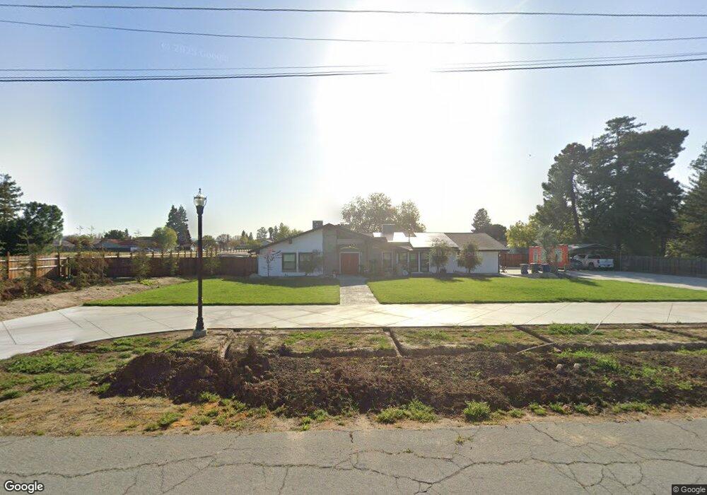
1286 Massasso St Merced, CA 95341
Estimated Value: $430,000 - $596,000
3
Beds
2
Baths
2,058
Sq Ft
$257/Sq Ft
Est. Value
About This Home
This home is located at 1286 Massasso St, Merced, CA 95341 and is currently estimated at $527,896, approximately $256 per square foot. 1286 Massasso St is a home located in Merced County with nearby schools including Leontine Gracey Elementary School, Tenaya Middle School, and El Capitan High School.
Ownership History
Date
Name
Owned For
Owner Type
Purchase Details
Closed on
Jul 11, 2019
Sold by
Martinez Nicole D
Bought by
Martinez Ronny
Current Estimated Value
Home Financials for this Owner
Home Financials are based on the most recent Mortgage that was taken out on this home.
Original Mortgage
$320,336
Outstanding Balance
$281,103
Interest Rate
3.9%
Mortgage Type
FHA
Estimated Equity
$246,793
Purchase Details
Closed on
Apr 17, 2019
Sold by
Robbins Larry E and Robbins Vickie
Bought by
Martinez Ronny
Purchase Details
Closed on
Jul 20, 1999
Sold by
Schmidt and Elizabeth
Bought by
Robbins Larry E and Robbins Vickie
Home Financials for this Owner
Home Financials are based on the most recent Mortgage that was taken out on this home.
Original Mortgage
$188,700
Interest Rate
7.56%
Mortgage Type
VA
Create a Home Valuation Report for This Property
The Home Valuation Report is an in-depth analysis detailing your home's value as well as a comparison with similar homes in the area
Purchase History
| Date | Buyer | Sale Price | Title Company |
|---|---|---|---|
| Martinez Ronny | -- | Fidelity National Title Co | |
| Martinez Ronny | $400,000 | Fidelity National Title Co | |
| Robbins Larry E | $185,000 | Fidelity National Title Co |
Source: Public Records
Mortgage History
| Date | Status | Borrower | Loan Amount |
|---|---|---|---|
| Open | Martinez Ronny | $320,336 | |
| Previous Owner | Robbins Larry E | $188,700 |
Source: Public Records
Tax History
| Year | Tax Paid | Tax Assessment Tax Assessment Total Assessment is a certain percentage of the fair market value that is determined by local assessors to be the total taxable value of land and additions on the property. | Land | Improvement |
|---|---|---|---|---|
| 2025 | $4,610 | $437,454 | $191,386 | $246,068 |
| 2024 | $4,610 | $428,878 | $187,634 | $241,244 |
| 2023 | $4,546 | $420,469 | $183,955 | $236,514 |
| 2022 | $4,486 | $412,226 | $180,349 | $231,877 |
| 2021 | $4,475 | $404,144 | $176,813 | $227,331 |
| 2020 | $4,510 | $400,000 | $175,000 | $225,000 |
| 2019 | $2,805 | $254,882 | $89,551 | $165,331 |
| 2018 | $2,557 | $249,886 | $87,796 | $162,090 |
| 2017 | $2,653 | $244,987 | $86,075 | $158,912 |
| 2016 | $2,610 | $240,185 | $84,388 | $155,797 |
| 2015 | $2,567 | $236,578 | $83,121 | $153,457 |
| 2014 | $2,510 | $231,944 | $81,493 | $150,451 |
Source: Public Records
Map
Nearby Homes
- 2044 W State Highway 140
- 980 Sydney Ln
- 965 N Bryant
- 1803 Lopes Ave
- 2051 Wardrobe Ave
- 1664 W North Bear Creek Dr Unit 5
- 1656 W North Bear Creek Dr Unit 9
- 1646 W North Bear Creek Dr
- 1648 W North Bear Creek Dr
- 2500 N State Highway 59 Unit 36
- 2500 N State Highway 59 Unit 278
- 2500 N State Highway 59 Unit 239
- 2500 N State Highway 59 Unit 18
- 2500 N State Highway 59
- 817 T St
- 2790 N State Highway 59
- 1541 W North Bear Creek Dr
- 1251 W 9th St
- 1438 W 19th St
- 915 R St
- 1286 Massasso St
- 1248 Massasso St
- 1340 Massacio St
- 1281 Massasso St
- 1271 Massasso St
- 1325 Massasso St
- 1261 Massasso St
- 1341 Massasso St
- 1355 Massasso St
- 2057 W State Highway 140
- 1945 Fultz Ct
- 1342 Massasso St
- 1377 Massasso St
- 1950 Rogina Ave
- 2015 W State Highway 140
- 2078 W State Highway 140
- 1947 Fultz Ct
- 1986 W State Highway 140
- 1949 Fultz Ct
- 1943 Fultz Ct
Your Personal Tour Guide
Ask me questions while you tour the home.