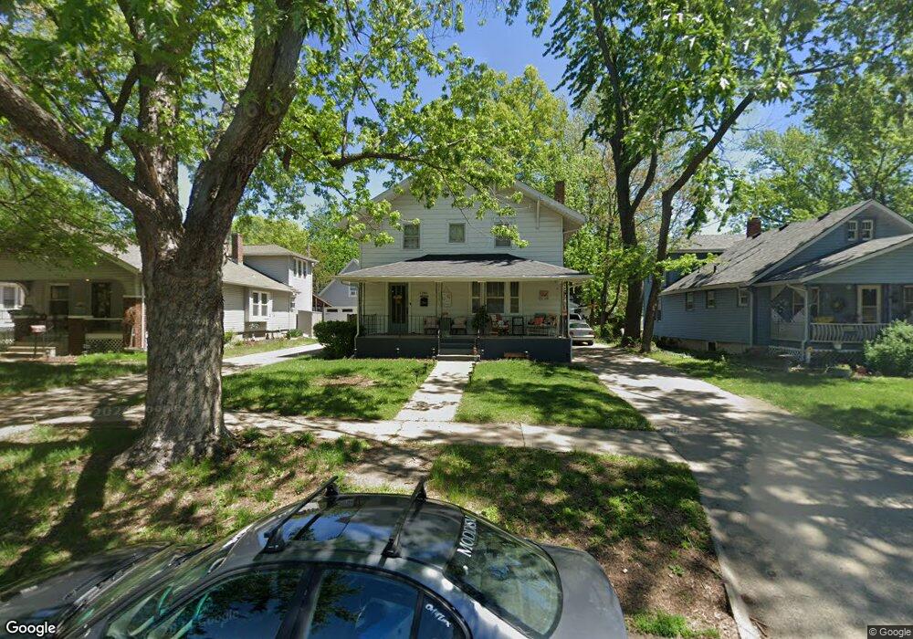
1286 SW High Ave Topeka, KS 66604
Randolph NeighborhoodEstimated Value: $151,000 - $185,000
4
Beds
1
Bath
1,680
Sq Ft
$98/Sq Ft
Est. Value
About This Home
This home is located at 1286 SW High Ave, Topeka, KS 66604 and is currently estimated at $165,180, approximately $98 per square foot. 1286 SW High Ave is a home located in Shawnee County with nearby schools including Buckeye Elementary School, Rosenwald Elementary School, and Martin Park Elementary School.
Ownership History
Date
Name
Owned For
Owner Type
Purchase Details
Closed on
Aug 12, 2025
Sold by
Richardson Michael R and Richardson Vanessa H
Bought by
Richardson Michael R and Richardson Vanessa H
Current Estimated Value
Purchase Details
Closed on
Dec 21, 2012
Sold by
Richardson Michael R and Richardson Lauren D
Bought by
Richardson Michael R
Home Financials for this Owner
Home Financials are based on the most recent Mortgage that was taken out on this home.
Original Mortgage
$94,118
Interest Rate
3.44%
Mortgage Type
FHA
Purchase Details
Closed on
Nov 15, 2009
Sold by
Weaver Amy L and Laubach Jeffrey
Bought by
Richardson Michael R and Richardson Lauren D
Home Financials for this Owner
Home Financials are based on the most recent Mortgage that was taken out on this home.
Original Mortgage
$93,769
Interest Rate
4.83%
Mortgage Type
FHA
Create a Home Valuation Report for This Property
The Home Valuation Report is an in-depth analysis detailing your home's value as well as a comparison with similar homes in the area
Home Values in the Area
Average Home Value in this Area
Purchase History
| Date | Buyer | Sale Price | Title Company |
|---|---|---|---|
| Richardson Michael R | -- | Kansas Secured Title | |
| Richardson Michael R | -- | First American Els | |
| Richardson Michael R | -- | First American Title |
Source: Public Records
Mortgage History
| Date | Status | Borrower | Loan Amount |
|---|---|---|---|
| Previous Owner | Richardson Michael R | $94,118 | |
| Previous Owner | Richardson Michael R | $93,769 |
Source: Public Records
Tax History Compared to Growth
Tax History
| Year | Tax Paid | Tax Assessment Tax Assessment Total Assessment is a certain percentage of the fair market value that is determined by local assessors to be the total taxable value of land and additions on the property. | Land | Improvement |
|---|---|---|---|---|
| 2025 | $2,121 | $15,865 | -- | -- |
| 2023 | $2,121 | $14,396 | $0 | $0 |
| 2022 | $1,844 | $12,518 | $0 | $0 |
| 2021 | $1,696 | $10,885 | $0 | $0 |
| 2020 | $1,595 | $10,366 | $0 | $0 |
| 2019 | $1,572 | $10,162 | $0 | $0 |
| 2018 | $1,527 | $9,867 | $0 | $0 |
| 2017 | $1,531 | $9,867 | $0 | $0 |
| 2014 | $1,640 | $10,454 | $0 | $0 |
Source: Public Records
Map
Nearby Homes
- 2516 SW Huntoon St
- 1432 SW MacVicar Ave
- 1355 SW Medford Ave
- 1181 SW MacVicar Ave
- 1503 SW MacVicar Ave
- 1421 SW Jewell Ave
- 2812 SW Huntoon St
- 1164 SW MacVicar Ave
- 1156 SW Woodward Ave
- 1327 SW College Ave
- 1610 SW Plass Ave
- 1150 SW Collins Ave
- 1147 SW Webster Ave
- 1216 SW College Ave
- 1115 SW Woodward Ave
- 3100 SW Canterbury Ln
- 1717 SW 15th St
- 1520 SW Oakley Ave
- 1225 SW Lakeside Dr
- 1022 SW MacVicar Ave
- 1290 SW High Ave
- 1282 SW High Ave
- 1294 SW High Ave
- 1287 SW Wayne Ave
- 1291 SW Wayne Ave
- 1283 SW Wayne Ave
- 1274 SW High Ave
- 1295 SW Wayne Ave
- 1279 SW Wayne Ave
- 1285 SW High Ave
- 1287 SW High Ave
- 1283 SW High Ave
- 1270 SW High Ave
- 1275 SW Wayne Ave
- 1297 SW High Ave
- 1281 SW High Ave
- 1271 SW Wayne Ave
- 1266 SW High Ave
- 1301 SW Wayne Ave
- 1273 SW High Ave