12860 Highway 78 Fruithurst, AL 36262
Estimated Value: $282,000 - $514,000
7
Beds
4
Baths
2,777
Sq Ft
$143/Sq Ft
Est. Value
About This Home
This home is located at 12860 Highway 78, Fruithurst, AL 36262 and is currently estimated at $395,752, approximately $142 per square foot. 12860 Highway 78 is a home located in Cleburne County.
Ownership History
Date
Name
Owned For
Owner Type
Purchase Details
Closed on
Jul 28, 2023
Sold by
Clay Kelly
Bought by
Fruithurst General Store Inc
Current Estimated Value
Home Financials for this Owner
Home Financials are based on the most recent Mortgage that was taken out on this home.
Original Mortgage
$328,000
Outstanding Balance
$181,294
Interest Rate
6.71%
Mortgage Type
Credit Line Revolving
Estimated Equity
$180,671
Create a Home Valuation Report for This Property
The Home Valuation Report is an in-depth analysis detailing your home's value as well as a comparison with similar homes in the area
Home Values in the Area
Average Home Value in this Area
Purchase History
| Date | Buyer | Sale Price | Title Company |
|---|---|---|---|
| Fruithurst General Store Inc | $500 | None Listed On Document |
Source: Public Records
Mortgage History
| Date | Status | Borrower | Loan Amount |
|---|---|---|---|
| Open | Fruithurst General Store Inc | $328,000 |
Source: Public Records
Tax History Compared to Growth
Tax History
| Year | Tax Paid | Tax Assessment Tax Assessment Total Assessment is a certain percentage of the fair market value that is determined by local assessors to be the total taxable value of land and additions on the property. | Land | Improvement |
|---|---|---|---|---|
| 2024 | $1,568 | $57,556 | $17,496 | $40,060 |
| 2023 | $1,568 | $53,040 | $17,280 | $35,760 |
| 2022 | $1,416 | $53,040 | $17,280 | $35,760 |
| 2021 | $1,417 | $53,256 | $17,496 | $35,760 |
| 2020 | $1,499 | $55,596 | $17,616 | $37,980 |
| 2019 | $1,499 | $55,596 | $17,616 | $37,980 |
| 2018 | $1,499 | $55,596 | $17,616 | $37,980 |
| 2017 | $1,482 | $55,596 | $17,616 | $37,980 |
| 2016 | $1,052 | $35,413 | $0 | $0 |
| 2015 | $1,052 | $354,130 | $0 | $0 |
| 2014 | $1,052 | $354,130 | $0 | $0 |
| 2013 | $1,052 | $354,130 | $0 | $0 |
Source: Public Records
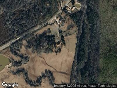
Map
Nearby Homes
- 0 Frances Rd Unit 10504332
- 4146 Depot St
- 873 County Road 69
- 4777 County Road 66
- 00 County Road 66
- 3206 County Road 59
- 0 E Highway 78 Unit 21.66 acres 21385878
- 704 County Road 437
- 999 County Road 61
- 0 County Road 61 Unit 366.92 acres 864516
- 1279 County Road 459
- 0 County Road 459 Unit 21395427
- 0 County Road 295 Unit 89.88 21385474
- 0-TR 5 County Road 408
- 0-TR 5 County Rd 408
- 75 Johnson St
- 226 County Road 261
- 0 County Road 49 Unit 10505681
- 0 County Road 49 Unit 1 21416550
- 278 County Road 449