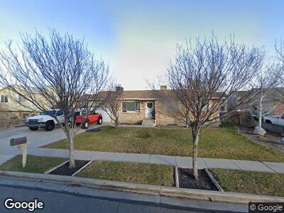
12867 S 1980 W Riverton, UT 84065
Estimated Value: $498,000 - $557,000
3
Beds
2
Baths
2,232
Sq Ft
$235/Sq Ft
Est. Value
About This Home
This home is located at 12867 S 1980 W, Riverton, UT 84065 and is currently estimated at $524,881, approximately $235 per square foot. 12867 S 1980 W is a home located in Salt Lake County with nearby schools including Riverton School, Hidden Valley Middle School, and Riverton High School.
Ownership History
Date
Name
Owned For
Owner Type
Purchase Details
Closed on
Mar 27, 2008
Sold by
Steele John and Steele Kathleen
Bought by
Phister Mark A and Phister Lara
Current Estimated Value
Home Financials for this Owner
Home Financials are based on the most recent Mortgage that was taken out on this home.
Original Mortgage
$216,502
Interest Rate
5.72%
Mortgage Type
FHA
Purchase Details
Closed on
May 11, 2001
Sold by
Snider Kiward R and Snider Phyllis P
Bought by
Steele John and Steele Kathleen
Home Financials for this Owner
Home Financials are based on the most recent Mortgage that was taken out on this home.
Original Mortgage
$142,759
Interest Rate
6.89%
Mortgage Type
FHA
Create a Home Valuation Report for This Property
The Home Valuation Report is an in-depth analysis detailing your home's value as well as a comparison with similar homes in the area
Home Values in the Area
Average Home Value in this Area
Purchase History
| Date | Buyer | Sale Price | Title Company |
|---|---|---|---|
| Phister Mark A | -- | United Title Services | |
| Steele John | -- | Backman Stewart Title Servic |
Source: Public Records
Mortgage History
| Date | Status | Borrower | Loan Amount |
|---|---|---|---|
| Open | Phister Mark A | $80,000 | |
| Open | Phister Mark A | $218,529 | |
| Closed | Phister Mark A | $216,502 | |
| Previous Owner | Steele John | $142,759 |
Source: Public Records
Tax History Compared to Growth
Tax History
| Year | Tax Paid | Tax Assessment Tax Assessment Total Assessment is a certain percentage of the fair market value that is determined by local assessors to be the total taxable value of land and additions on the property. | Land | Improvement |
|---|---|---|---|---|
| 2023 | $2,580 | $421,000 | $183,600 | $237,400 |
| 2022 | $2,680 | $428,900 | $180,000 | $248,900 |
| 2021 | $2,647 | $327,900 | $109,000 | $218,900 |
| 2020 | $2,447 | $287,700 | $109,000 | $178,700 |
| 2019 | $2,443 | $283,600 | $102,800 | $180,800 |
| 2018 | $2,360 | $262,300 | $102,800 | $159,500 |
| 2017 | $2,144 | $243,900 | $102,800 | $141,100 |
| 2016 | $1,998 | $217,600 | $102,800 | $114,800 |
| 2015 | $1,802 | $210,100 | $104,800 | $105,300 |
| 2014 | $1,796 | $198,200 | $99,900 | $98,300 |
Source: Public Records
Map
Nearby Homes
- 12875 S Aspen Glen Cir
- 2028 W 12820 S
- 1838 W 13070 S
- 12867 S 2200 W
- 12734 S 1630 W
- 1601 W 12800 S
- 12978 S 2420 W
- 2332 W 13145 S
- 13105 S 2420 W
- 2162 W Kimber Ln
- 12647 S 2525 W
- 2597 W 12820 S
- 1915 W 13400 S
- 2401 W Adelaide Dr
- 16158 S Railcar Ln Unit 1031
- 1722 W Shade Ln
- 12418 S Redwood Rd
- 2531 W Mont Sur Dr
- 1056 W Kate Springs Ln S Unit 10
- 2057 W Marblewood Dr
- 12867 S 1980 W
- 12855 S 1980 W
- 12881 S 1980 W
- 12843 S 1980 W
- 12845 S 1980 W
- 12893 S 1980 W
- 12868 S 1980 W
- 1917 W Berlynn Dr
- 12776 S Mccartney Way
- 12776 S Mccartney Way Unit 109
- 12788 S Mccartney Way Unit 110
- 12856 S 1980 W
- 12850 S 1980 W
- 12882 S 1980 W
- 1251 W Frank Ln Unit 116
- 12883 S Berlynn Dr
- 1941 Rips Ct
- 12844 S 1980 W
- 12871 S Berlynn Dr
- 1961 W 12820 S