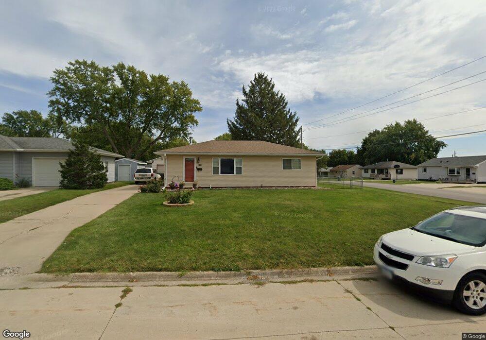
1287 Deloris Dr Waterloo, IA 50701
Alabar Hills NeighborhoodEstimated Value: $178,000 - $195,000
3
Beds
2
Baths
960
Sq Ft
$193/Sq Ft
Est. Value
About This Home
This home is located at 1287 Deloris Dr, Waterloo, IA 50701 and is currently estimated at $185,072, approximately $192 per square foot. 1287 Deloris Dr is a home located in Black Hawk County with nearby schools including Becker Elementary School, Central Middle School, and West High School.
Ownership History
Date
Name
Owned For
Owner Type
Purchase Details
Closed on
Jan 13, 2006
Sold by
Campbell Ann M
Bought by
Dizdarevic Sulejman and Dizdarevic Senada
Current Estimated Value
Home Financials for this Owner
Home Financials are based on the most recent Mortgage that was taken out on this home.
Original Mortgage
$100,700
Outstanding Balance
$56,510
Interest Rate
6.34%
Mortgage Type
New Conventional
Estimated Equity
$128,562
Create a Home Valuation Report for This Property
The Home Valuation Report is an in-depth analysis detailing your home's value as well as a comparison with similar homes in the area
Home Values in the Area
Average Home Value in this Area
Purchase History
| Date | Buyer | Sale Price | Title Company |
|---|---|---|---|
| Dizdarevic Sulejman | $106,000 | Title Services Corporation |
Source: Public Records
Mortgage History
| Date | Status | Borrower | Loan Amount |
|---|---|---|---|
| Open | Dizdarevic Sulejman | $100,700 |
Source: Public Records
Tax History Compared to Growth
Tax History
| Year | Tax Paid | Tax Assessment Tax Assessment Total Assessment is a certain percentage of the fair market value that is determined by local assessors to be the total taxable value of land and additions on the property. | Land | Improvement |
|---|---|---|---|---|
| 2025 | $3,160 | $172,350 | $19,140 | $153,210 |
| 2024 | $3,160 | $155,890 | $19,140 | $136,750 |
| 2023 | $2,644 | $155,890 | $19,140 | $136,750 |
| 2022 | $2,572 | $129,240 | $19,140 | $110,100 |
| 2021 | $2,446 | $129,240 | $19,140 | $110,100 |
| 2020 | $2,378 | $115,550 | $19,140 | $96,410 |
| 2019 | $2,378 | $115,550 | $19,140 | $96,410 |
| 2018 | $2,382 | $115,550 | $19,140 | $96,410 |
| 2017 | $2,382 | $115,550 | $19,140 | $96,410 |
| 2016 | $2,424 | $115,550 | $19,140 | $96,410 |
| 2015 | $2,424 | $115,550 | $19,140 | $96,410 |
| 2014 | $2,470 | $115,550 | $19,140 | $96,410 |
Source: Public Records
Map
Nearby Homes
- 1269 Scott Ave
- 1742 Sager Ave
- 102 Bergen Dr
- 104 Bergen Dr
- 3913 Onawa Dr
- 3816 Monterey Dr
- 1137 Fleur Dr
- 3824 Monterey Dr
- 1726 Huntington Rd
- 3917 Del Matro Rd
- 915 Alabar Ave
- 814 Heartland Hills Dr
- Lot 19 Mark Dr
- Lot 22 Mark Dr
- Lot 20 Mark Dr
- Lot 15 Mark Dr
- Lot 21 Mark Dr
- Lot 16 Mark Dr
- Lot 23 Mark Dr
- 1114 Eleanor Dr
- 1281 Deloris Dr
- 1298 St Andrews
- 1286 Deloris Dr
- 1290 Saint Andrews Ave
- 2117 Downing Ave
- 1298 Saint Andrews Ave
- 1294 Saint Andrews Ave
- 1280 Deloris Dr
- 2205 Downing Ave
- 2129 Downing Ave
- 2109 Downing Ave
- 2103 Downing Ave
- 1274 Deloris Dr
- 1286 Saint Andrews Ave
- 1269 Deloris Dr
- 1270 Deloris Dr
- 1299 Saint Andrews Ave
- 1280 Saint Andrews Ave
- 2029 Downing Ave
- 1263 Deloris Dr