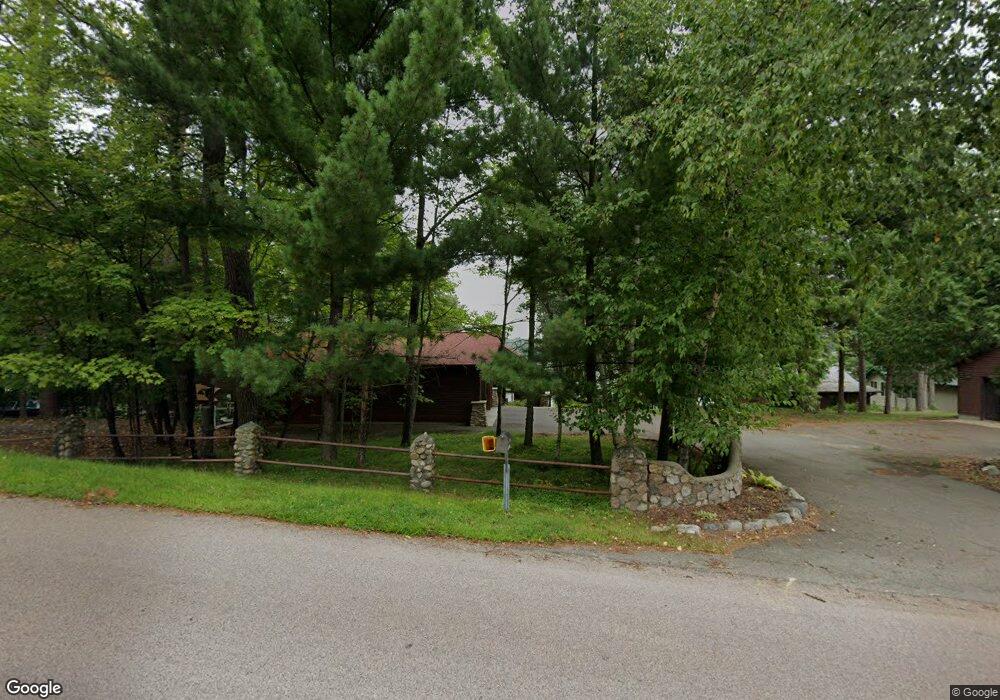
12880 Manhattan Point Blvd Crosslake, MN 56442
Estimated Value: $1,015,456 - $1,371,000
3
Beds
--
Bath
1,613
Sq Ft
$744/Sq Ft
Est. Value
About This Home
This home is located at 12880 Manhattan Point Blvd, Crosslake, MN 56442 and is currently estimated at $1,199,864, approximately $743 per square foot. 12880 Manhattan Point Blvd is a home located in Crow Wing County with nearby schools including Eagle View Elementary School, Pequot Lakes Middle School, and Pequot Lakes Senior High School.
Ownership History
Date
Name
Owned For
Owner Type
Purchase Details
Closed on
Jan 10, 2025
Sold by
Thompson Steven K and Thompson Jeanne M
Bought by
Thompson Revocable Trust
Current Estimated Value
Purchase Details
Closed on
Sep 1, 2002
Sold by
Murray Douglas and Murray Colleen
Bought by
Thompson Steven and Thompson Jeanne
Create a Home Valuation Report for This Property
The Home Valuation Report is an in-depth analysis detailing your home's value as well as a comparison with similar homes in the area
Home Values in the Area
Average Home Value in this Area
Purchase History
| Date | Buyer | Sale Price | Title Company |
|---|---|---|---|
| Thompson Revocable Trust | $500 | None Listed On Document | |
| Thompson Steven | $458,800 | -- |
Source: Public Records
Tax History Compared to Growth
Tax History
| Year | Tax Paid | Tax Assessment Tax Assessment Total Assessment is a certain percentage of the fair market value that is determined by local assessors to be the total taxable value of land and additions on the property. | Land | Improvement |
|---|---|---|---|---|
| 2025 | $5,988 | $1,009,900 | $532,300 | $477,600 |
| 2024 | $5,988 | $905,500 | $441,600 | $463,900 |
| 2023 | $5,620 | $907,900 | $430,200 | $477,700 |
| 2022 | $4,930 | $787,200 | $328,500 | $458,700 |
| 2021 | $4,718 | $560,000 | $265,000 | $295,000 |
| 2020 | $4,620 | $511,200 | $238,000 | $273,200 |
| 2019 | $4,370 | $494,300 | $216,300 | $278,000 |
| 2018 | $4,240 | $463,800 | $203,300 | $260,500 |
| 2017 | $4,142 | $456,300 | $207,700 | $248,600 |
| 2016 | $4,126 | $435,500 | $197,200 | $238,300 |
| 2015 | $3,944 | $424,700 | $193,800 | $230,900 |
| 2014 | $1,366 | $291,100 | $101,900 | $189,200 |
Source: Public Records
Map
Nearby Homes
- 38720 South Landing
- 38738 Windsor Ave
- 12125 Whitefish Ave
- 12463 White Island Dr
- 13374 Cabin Cove Trail
- 11959 Northgate Ln
- 38277 Moccasin Dr
- 37639 Forest Lodge Rd
- 37713 Forest Lodge Rd
- 13380 Rush Harbor Dr
- 12391 Anchor Point Rd
- 40220 S Fox Lake Dr
- 37301 2nd St
- 40550 W Fox Lake Rd
- 37310 Silver Peak Rd
- TBD-Parcel C Staley Ln
- 39687 Swanberg Rd
- 36937 Sundance Loop Unit 821
- 36937 Sundance Loop Unit 831
- 36949 Sundance Loop Unit 825
- 12886 Manhattan Point Blvd
- 12934 Manhattan Point Blvd
- 12812 Manhattan Point Blvd
- 13002 Verna Dr
- 12857 Manhattan Point Blvd
- 12927 Manhattan Point Blvd
- 13010 Verna Dr
- 12786 Manhattan Point Blvd
- 12786 Manhattan Point Blvd
- 12805 Manhattan Point Blvd
- 12780 Manhattan Point Blvd
- 12772 Manhattan Point Blvd
- 12778 Manhattan Point Blvd
- 12781 Manhattan Point Blvd
- 13056 Verna Dr
- 12748 Manhattan Point Blvd
- 12961 Manhattan Point Blvd
- 12961 Manhattan Point Blvd
- 12736 Manhattan Point Blvd
- 12769 Manhattan Point Blvd