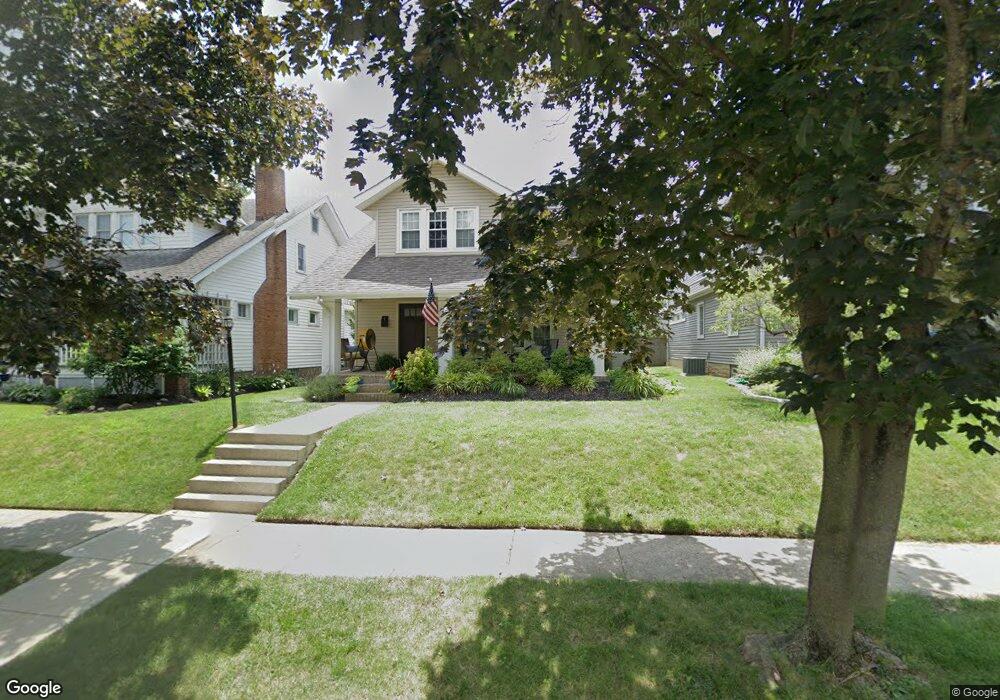
1289 Inglis Ave Columbus, OH 43212
Estimated Value: $754,503 - $898,000
4
Beds
3
Baths
2,400
Sq Ft
$349/Sq Ft
Est. Value
About This Home
This home is located at 1289 Inglis Ave, Columbus, OH 43212 and is currently estimated at $838,376, approximately $349 per square foot. 1289 Inglis Ave is a home located in Franklin County with nearby schools including Robert Louis Stevenson Elementary School, Larson Middle School, and Grandview Heights High School.
Ownership History
Date
Name
Owned For
Owner Type
Purchase Details
Closed on
May 28, 2010
Sold by
Keating William H and Keating William H
Bought by
Ferris Joseph E and Ferris Julia Nichole
Current Estimated Value
Home Financials for this Owner
Home Financials are based on the most recent Mortgage that was taken out on this home.
Original Mortgage
$297,600
Outstanding Balance
$201,108
Interest Rate
5.14%
Mortgage Type
New Conventional
Estimated Equity
$637,268
Purchase Details
Closed on
Nov 14, 2003
Sold by
Wohlstein William D and Wohlstein Kathleen A
Bought by
Keating William H and Keating Bettie L
Home Financials for this Owner
Home Financials are based on the most recent Mortgage that was taken out on this home.
Original Mortgage
$150,000
Interest Rate
5.81%
Mortgage Type
Purchase Money Mortgage
Purchase Details
Closed on
Jun 10, 1993
Purchase Details
Closed on
Jun 1, 1983
Create a Home Valuation Report for This Property
The Home Valuation Report is an in-depth analysis detailing your home's value as well as a comparison with similar homes in the area
Home Values in the Area
Average Home Value in this Area
Purchase History
| Date | Buyer | Sale Price | Title Company |
|---|---|---|---|
| Ferris Joseph E | $372,000 | Attorney | |
| Keating William H | $335,000 | Ohio Title | |
| -- | -- | -- | |
| -- | $57,000 | -- |
Source: Public Records
Mortgage History
| Date | Status | Borrower | Loan Amount |
|---|---|---|---|
| Open | Ferris Joseph E | $297,600 | |
| Closed | Keating William H | $150,000 |
Source: Public Records
Tax History Compared to Growth
Tax History
| Year | Tax Paid | Tax Assessment Tax Assessment Total Assessment is a certain percentage of the fair market value that is determined by local assessors to be the total taxable value of land and additions on the property. | Land | Improvement |
|---|---|---|---|---|
| 2024 | $12,055 | $206,680 | $87,890 | $118,790 |
| 2023 | $10,560 | $206,675 | $87,885 | $118,790 |
| 2022 | $12,514 | $208,570 | $47,600 | $160,970 |
| 2021 | $11,716 | $208,570 | $47,600 | $160,970 |
| 2020 | $11,667 | $208,570 | $47,600 | $160,970 |
| 2019 | $9,599 | $151,870 | $47,600 | $104,270 |
| 2018 | $9,600 | $151,870 | $47,600 | $104,270 |
| 2017 | $8,950 | $151,870 | $47,600 | $104,270 |
| 2016 | $9,643 | $140,080 | $38,540 | $101,540 |
| 2015 | $9,644 | $140,080 | $38,540 | $101,540 |
| 2014 | $9,673 | $140,080 | $38,540 | $101,540 |
| 2013 | $4,250 | $127,330 | $35,035 | $92,295 |
Source: Public Records
Map
Nearby Homes
- 945 Quay Ave Unit 945E
- 945 Quay Ave Unit G
- 932 Mcclain Rd
- 1225 Eastview Ave
- 1081 W 3rd Ave
- 1240 Oxley Rd
- 943 Timberman Rd
- 1242 Oxley Rd
- 1083 W 3rd Ave
- 1095 W 3rd Ave
- 1093 W 3rd Ave
- 1068 Edgehill Rd
- 1124 Edgehill Rd
- 1280 Broadview Ave
- 1378 Morning Ave
- 1343 Thornwood Place
- 1475 W 3rd Ave Unit 204
- 922 Northwest Blvd
- 910-912 Northwest Blvd
- 1317 Broadview Ave
- 1295 Inglis Ave
- 1285 Inglis Ave
- 1299 Inglis Ave
- 1279 Inglis Ave
- 1301 Inglis Ave
- 1300 Mulford Rd
- 1304 Mulford Rd
- 1292 Mulford Rd
- 1307 Inglis Ave
- 1308 Mulford Rd
- 1286 Mulford Rd
- 1273 Inglis Ave
- 1286 Inglis Ave
- 1292 Inglis Ave
- 1314 Mulford Rd
- 1282 Mulford Rd
- 1282 Inglis Ave
- 1298 Inglis Ave
- 1313 Inglis Ave
- 1094 Willard Ave