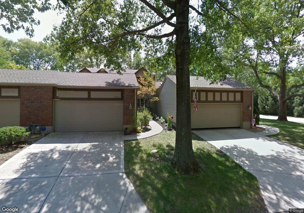
12890 Cambridge Ct Leawood, KS 66209
Estimated Value: $463,000 - $525,000
2
Beds
3
Baths
1,632
Sq Ft
$300/Sq Ft
Est. Value
About This Home
This home is located at 12890 Cambridge Ct, Leawood, KS 66209 and is currently estimated at $489,000, approximately $299 per square foot. 12890 Cambridge Ct is a home located in Johnson County with nearby schools including Leawood Elementary School, Leawood Middle School, and Blue Valley North High School.
Ownership History
Date
Name
Owned For
Owner Type
Purchase Details
Closed on
Oct 1, 2013
Sold by
Williams Robert E and Williams Jeanne A
Bought by
Williams Robert E and Williams Jeanne
Current Estimated Value
Purchase Details
Closed on
Nov 30, 2012
Sold by
Lutz Dave and Lutz David H
Bought by
Williams Robert E and Williams Jeanne A
Home Financials for this Owner
Home Financials are based on the most recent Mortgage that was taken out on this home.
Original Mortgage
$186,200
Outstanding Balance
$129,188
Interest Rate
3.4%
Mortgage Type
New Conventional
Estimated Equity
$359,812
Purchase Details
Closed on
Mar 31, 2008
Sold by
Cattron Patricia Ann Maher
Bought by
Lutz Dave and Lutz Meredith
Create a Home Valuation Report for This Property
The Home Valuation Report is an in-depth analysis detailing your home's value as well as a comparison with similar homes in the area
Home Values in the Area
Average Home Value in this Area
Purchase History
| Date | Buyer | Sale Price | Title Company |
|---|---|---|---|
| Williams Robert E | -- | None Available | |
| Williams Robert E | -- | Kansas City Title | |
| Lutz Dave | $176,000 | Kansas City Title |
Source: Public Records
Mortgage History
| Date | Status | Borrower | Loan Amount |
|---|---|---|---|
| Open | Williams Robert E | $186,200 |
Source: Public Records
Tax History Compared to Growth
Tax History
| Year | Tax Paid | Tax Assessment Tax Assessment Total Assessment is a certain percentage of the fair market value that is determined by local assessors to be the total taxable value of land and additions on the property. | Land | Improvement |
|---|---|---|---|---|
| 2024 | $5,272 | $47,875 | $6,555 | $41,320 |
| 2023 | $4,589 | $41,032 | $6,555 | $34,477 |
| 2022 | $4,223 | $36,984 | $5,704 | $31,280 |
| 2021 | $4,114 | $34,259 | $5,187 | $29,072 |
| 2020 | $4,132 | $33,707 | $5,187 | $28,520 |
| 2019 | $4,197 | $33,626 | $4,715 | $28,911 |
| 2018 | $3,787 | $29,831 | $4,100 | $25,731 |
| 2017 | $4,088 | $31,637 | $3,565 | $28,072 |
| 2016 | $3,701 | $28,704 | $3,565 | $25,139 |
| 2015 | $3,468 | $26,588 | $3,565 | $23,023 |
| 2013 | -- | $23,115 | $3,565 | $19,550 |
Source: Public Records
Map
Nearby Homes
- 12851 Pembroke Cir
- 12854 Cambridge Terrace
- 12854 Pembroke Cir
- 2218 Condolea Terrace
- 2229 Condolea Terrace
- 12768 Overbrook Rd
- 2549 W 132nd Terrace
- 12763 Overbrook Rd
- 12815 Pembroke Cir
- 703 Tam-O-shanter Dr
- 12725 High Dr
- 708 W 131st Place
- 2313 W 127th St
- 13201 Summit St
- The Forester Plan at East Village
- Fleetwood Villa Plan at East Village
- 12716 Oakmont Dr
- 12640 Oakmont Dr
- 719 W 132nd Terrace
- 13240 Falmouth St
- 12892 Cambridge Ct
- 12894 Cambridge Ct
- 12893 Cambridge Ct
- 2216 W 131st St
- 12864 Sagamore Rd
- 12891 Cambridge Ct
- 13100 Overbrook Rd
- 13004 Pembroke Ln
- 2212 W 131st St
- 12888 Cambridge Cir
- 12886 Cambridge Cir
- 12882 Cambridge Cir
- 12880 Cambridge Cir
- 12862 Sagamore Rd
- 12826 Overbrook Rd
- 12824 Overbrook Rd
- 12889 Cambridge Cir
- 12822 Overbrook Rd
- 12820 Overbrook Rd
- 13104 Overbrook Rd