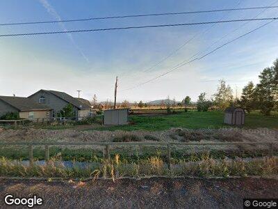
12895 SW Highway 126 Powell Butte, OR 97753
Estimated Value: $576,805 - $582,000
3
Beds
3
Baths
1,534
Sq Ft
$378/Sq Ft
Est. Value
About This Home
This home is located at 12895 SW Highway 126, Powell Butte, OR 97753 and is currently estimated at $579,403, approximately $377 per square foot. 12895 SW Highway 126 is a home located in Crook County with nearby schools including Crooked River Elementary School, Crook County Middle School, and Crook County High School.
Ownership History
Date
Name
Owned For
Owner Type
Purchase Details
Closed on
Apr 28, 2025
Sold by
Gage Mark and Gage Elli Lane
Bought by
Mcleod Damian and Mcleod Macy
Current Estimated Value
Home Financials for this Owner
Home Financials are based on the most recent Mortgage that was taken out on this home.
Original Mortgage
$569,050
Outstanding Balance
$569,050
Interest Rate
6.67%
Mortgage Type
New Conventional
Estimated Equity
$34,873
Purchase Details
Closed on
Feb 17, 2011
Sold by
Federal Home Loan Mortgage Corporation
Bought by
Gage Mark and Gage Elli Lane
Home Financials for this Owner
Home Financials are based on the most recent Mortgage that was taken out on this home.
Original Mortgage
$108,710
Interest Rate
4.75%
Mortgage Type
Purchase Money Mortgage
Create a Home Valuation Report for This Property
The Home Valuation Report is an in-depth analysis detailing your home's value as well as a comparison with similar homes in the area
Home Values in the Area
Average Home Value in this Area
Purchase History
| Date | Buyer | Sale Price | Title Company |
|---|---|---|---|
| Mcleod Damian | $599,000 | Amerititle | |
| Gage Mark | $108,710 | Service Link |
Source: Public Records
Mortgage History
| Date | Status | Borrower | Loan Amount |
|---|---|---|---|
| Open | Mcleod Damian | $569,050 | |
| Previous Owner | Gage Mark | $108,710 | |
| Previous Owner | Rothenbucher Alan D | $160,022 | |
| Previous Owner | Rothenbucher Alan D | $222,000 | |
| Previous Owner | Rothenbucher Alan D | $89,400 |
Source: Public Records
Tax History Compared to Growth
Tax History
| Year | Tax Paid | Tax Assessment Tax Assessment Total Assessment is a certain percentage of the fair market value that is determined by local assessors to be the total taxable value of land and additions on the property. | Land | Improvement |
|---|---|---|---|---|
| 2024 | $2,844 | $232,880 | -- | -- |
| 2023 | $2,746 | $226,100 | $0 | $0 |
| 2022 | $2,661 | $219,520 | $0 | $0 |
| 2021 | $2,661 | $213,130 | $0 | $0 |
| 2020 | $2,587 | $206,923 | $0 | $0 |
| 2019 | $2,495 | $195,045 | $0 | $0 |
| 2018 | $2,432 | $195,045 | $0 | $0 |
| 2017 | $2,396 | $189,364 | $0 | $0 |
| 2016 | $2,286 | $178,494 | $0 | $0 |
| 2015 | $2,186 | $178,494 | $0 | $0 |
| 2013 | -- | $168,248 | $0 | $0 |
Source: Public Records
Map
Nearby Homes
- 11288 Oregon 126
- 13501 SW Riggs Rd
- 5624 SW Reif Rd
- 7217 SW Mill Iron Cir Unit Lot 16
- 11158 SW Yates Ct
- 4088 SW Minson Rd
- 8385 SW Copley Rd
- 7006 SW Joshua Ct
- 6904 SW Joshua Ct
- 11311 SW Fleming Rd
- 10300 SW Nicole Dr
- 9280 SW Copley Rd
- 7536 SW Powell Butte Hwy
- 0 SW Red Cloud Rd Unit 1356 220203006
- 3068 SW Reif Rd
- 0 Talarus Tr
- 12855 SW Ayres Ln
- 9444 SW Copper Rd
- 2441 SW Minson Rd
- 8055 SW Powell Butte Hwy
- 12895 SW Highway 126
- 12909 SW Highway 126
- 12775 SW Highway 126
- 6261 SW Copley Rd
- 13150 SW Highway 126
- 13167 SW Hwy 126
- 13167 SW Highway 126
- 12555 Oregon 126
- 12555 SW Highway 126
- 13432 SW Highway 126
- 12340 SW Hwy 126
- 6420 SW Copley Rd
- 12340 SW Highway 126
- 13410 SW Highway 126
- 16543 SW Pinnacle Ct Unit 697
- 5909 SW Williams Rd
- 701 Pinnacle Ct
- 0 Westwood Rosewood Dr Unit 201507440
- Lot 81 Brasada Ranch
- Lot 1 SW Grandview Phase 1 Rd