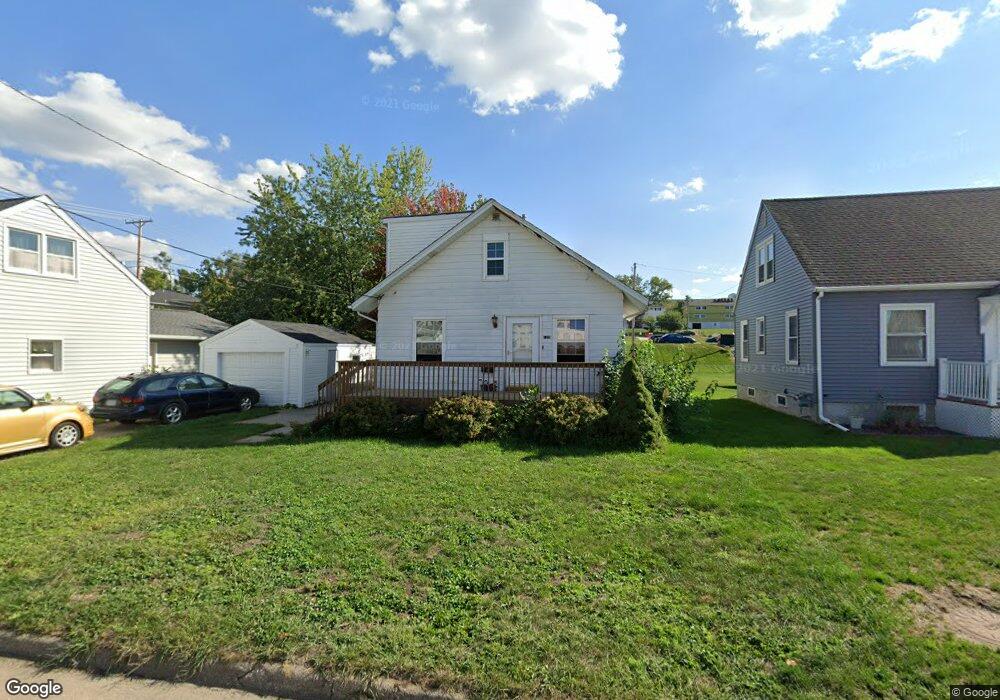
129 19th Ave SW Cedar Rapids, IA 52404
Southwest Area NeighborhoodEstimated Value: $132,982 - $169,000
3
Beds
1
Bath
1,111
Sq Ft
$135/Sq Ft
Est. Value
About This Home
This home is located at 129 19th Ave SW, Cedar Rapids, IA 52404 and is currently estimated at $150,246, approximately $135 per square foot. 129 19th Ave SW is a home located in Linn County with nearby schools including Junction City Elementary School, Grant Elementary School, and Bruce Hall Day Treatment Center.
Ownership History
Date
Name
Owned For
Owner Type
Purchase Details
Closed on
Sep 25, 2024
Sold by
Fisher Michael J and Fisher Jean A
Bought by
Spangler Joshua and Spangler Danielle
Current Estimated Value
Purchase Details
Closed on
Feb 17, 2009
Sold by
Willmsen Properties Lc Series 10
Bought by
Fisher Michael J and Fisher Jean A
Home Financials for this Owner
Home Financials are based on the most recent Mortgage that was taken out on this home.
Original Mortgage
$32,000
Interest Rate
5.06%
Mortgage Type
Unknown
Create a Home Valuation Report for This Property
The Home Valuation Report is an in-depth analysis detailing your home's value as well as a comparison with similar homes in the area
Home Values in the Area
Average Home Value in this Area
Purchase History
| Date | Buyer | Sale Price | Title Company |
|---|---|---|---|
| Spangler Joshua | $60,000 | None Listed On Document | |
| Spangler Joshua | $60,000 | None Listed On Document | |
| Fisher Michael J | $33,500 | None Available |
Source: Public Records
Mortgage History
| Date | Status | Borrower | Loan Amount |
|---|---|---|---|
| Previous Owner | Fisher Michael J | $32,000 |
Source: Public Records
Tax History Compared to Growth
Tax History
| Year | Tax Paid | Tax Assessment Tax Assessment Total Assessment is a certain percentage of the fair market value that is determined by local assessors to be the total taxable value of land and additions on the property. | Land | Improvement |
|---|---|---|---|---|
| 2025 | $1,944 | $126,600 | $34,900 | $91,700 |
| 2024 | $2,146 | $114,100 | $28,500 | $85,600 |
| 2023 | $2,146 | $109,900 | $25,900 | $84,000 |
| 2022 | $2,020 | $101,700 | $25,900 | $75,800 |
| 2021 | $2,108 | $97,500 | $25,900 | $71,600 |
| 2020 | $2,108 | $95,500 | $25,900 | $69,600 |
| 2019 | $1,846 | $85,600 | $22,000 | $63,600 |
| 2018 | $1,794 | $85,600 | $22,000 | $63,600 |
| 2017 | $1,522 | $84,000 | $22,000 | $62,000 |
| 2016 | $1,522 | $71,600 | $18,700 | $52,900 |
| 2015 | $1,566 | $73,590 | $18,692 | $54,898 |
| 2014 | $1,566 | $75,288 | $18,692 | $56,596 |
| 2013 | $1,568 | $75,288 | $18,692 | $56,596 |
Source: Public Records
Map
Nearby Homes
- 2021 Hamilton St SW
- 1756 Mallory St SW
- 186 22nd Ave SW
- 2212 Deborah Dr SW
- 1804 I St SW
- 2321 Lauren Dr SW
- 1411 1st St SW
- 192 15th Ave SW
- 2601 Teresa Dr SW
- 69 26th Ave SW
- 280 14th Ave SW
- 2818 Southland St SW
- 109 Evelyn Dr SW
- 90 29th Ave SW
- 329 12th Ave SE
- 1323 M St SW
- 51 29th Avenue Dr SW Unit 20
- 51 29th Avenue Dr SW Unit D11
- 51 29th Avenue Dr SW Unit C22
- 1435 N St SW
- 1902 Bowling St SW
- 131 19th Ave SW
- 1912 Bowling St SW
- 133 19th Ave SW
- 148 Bowling St SW
- 232 Bowling St SW
- 144 Bowling St SW
- 135 19th Ave SW
- 126 20th Ave SW Unit 1-6
- 164 19th Ave SW
- 140 Bowling St SW
- 147 Bowling St SW
- 137 19th Ave SW
- 25-85 Aossey Ln SW
- 132 20th Ave SW Unit E6
- 132 20th Ave SW Unit E5
- 132 20th Ave SW Unit E4
- 132 20th Ave SW Unit E3
- 132 20th Ave SW Unit E2
- 132 20th Ave SW Unit E1