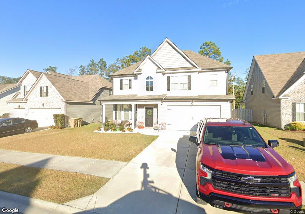
129 Annie Dr Guyton, GA 31312
Estimated Value: $382,844 - $425,000
5
Beds
3
Baths
2,936
Sq Ft
$139/Sq Ft
Est. Value
About This Home
This home is located at 129 Annie Dr, Guyton, GA 31312 and is currently estimated at $408,961, approximately $139 per square foot. 129 Annie Dr is a home located in Effingham County with nearby schools including Marlow Elementary School, South Effingham Middle School, and South Effingham High School.
Ownership History
Date
Name
Owned For
Owner Type
Purchase Details
Closed on
Feb 28, 2022
Sold by
Green Christopher
Bought by
Green Christopher and Green Cassandra Elaine
Current Estimated Value
Home Financials for this Owner
Home Financials are based on the most recent Mortgage that was taken out on this home.
Original Mortgage
$340,000
Outstanding Balance
$315,063
Interest Rate
3.69%
Mortgage Type
VA
Estimated Equity
$93,898
Purchase Details
Closed on
Feb 18, 2022
Sold by
Faircloth Homes Of Savannah Inc
Bought by
Green Christopher
Home Financials for this Owner
Home Financials are based on the most recent Mortgage that was taken out on this home.
Original Mortgage
$340,000
Outstanding Balance
$315,063
Interest Rate
3.69%
Mortgage Type
VA
Estimated Equity
$93,898
Create a Home Valuation Report for This Property
The Home Valuation Report is an in-depth analysis detailing your home's value as well as a comparison with similar homes in the area
Home Values in the Area
Average Home Value in this Area
Purchase History
| Date | Buyer | Sale Price | Title Company |
|---|---|---|---|
| Green Christopher | -- | -- | |
| Green Christopher | $340,000 | -- |
Source: Public Records
Mortgage History
| Date | Status | Borrower | Loan Amount |
|---|---|---|---|
| Open | Green Christopher | $340,000 |
Source: Public Records
Tax History
| Year | Tax Paid | Tax Assessment Tax Assessment Total Assessment is a certain percentage of the fair market value that is determined by local assessors to be the total taxable value of land and additions on the property. | Land | Improvement |
|---|---|---|---|---|
| 2025 | $5,262 | $158,514 | $25,600 | $132,914 |
| 2024 | $5,262 | $149,722 | $25,600 | $124,122 |
| 2023 | $4,009 | $144,686 | $25,600 | $119,086 |
| 2022 | $3,514 | $110,209 | $18,800 | $91,409 |
| 2021 | $540 | $18,800 | $18,800 | $0 |
| 2020 | $542 | $18,800 | $18,800 | $0 |
Source: Public Records
Map
Nearby Homes
- 124 Annie Dr
- 120 Annie Dr
- 104 Annie Dr
- 121 Sams Dr
- 125 Sams Dr
- 152 Sams Dr
- 438 Kessler Loop
- 138 Hawthorne Dr
- 695 Majestic Dr
- 102 Little Ben Ct
- 108 Little Ben Ct
- 110 Little Ben Ct
- 114 Little Ben Ct
- 116 Little Ben Ct
- 112 Little Ben Ct
- 118 Little Ben Ct
- 121 Little Ben Ct
- 687 Majestic Dr
- 675 Majestic Dr
- 143 Twin Oak Cir
- 103 Annie Dr
- 141 Annie Dr
- 149 Annie Dr
- 147 Annie Dr
- 137 Annie Dr
- 2281 Noel C Conaway Rd
- 2255 Noel C Conaway Rd
- 2307 Noel C Conaway Rd
- 124 Ladessie Zeigler Rd
- 101 Rosewood Dr
- 2290 Noel C Conaway Rd
- 103 Rosewood Dr
- 2300 Noel C Conaway Rd
- 105 Rosewood Dr
- 2341 Noel C Conaway Rd
- 189 Ladessie Zeigler Rd
- 102 Rosewood Dr
- 2221 Noel C Conaway Rd
- 160 Ladessie Zeigler Rd
- 104 Rosewood Dr
Your Personal Tour Guide
Ask me questions while you tour the home.