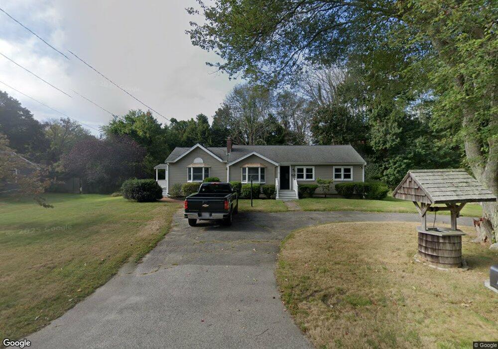
129 Branch St Scituate, MA 02066
Estimated Value: $688,000 - $846,000
3
Beds
1
Bath
1,415
Sq Ft
$544/Sq Ft
Est. Value
About This Home
This home is located at 129 Branch St, Scituate, MA 02066 and is currently estimated at $769,740, approximately $543 per square foot. 129 Branch St is a home located in Plymouth County with nearby schools including Cushing Elementary School, Lester J. Gates Middle School, and Scituate High School.
Ownership History
Date
Name
Owned For
Owner Type
Purchase Details
Closed on
Mar 25, 2025
Sold by
Short Stafford A and Short Alison E
Bought by
Short Stafford A
Current Estimated Value
Home Financials for this Owner
Home Financials are based on the most recent Mortgage that was taken out on this home.
Original Mortgage
$420,000
Outstanding Balance
$417,850
Interest Rate
6.87%
Mortgage Type
New Conventional
Estimated Equity
$351,890
Purchase Details
Closed on
Sep 24, 2008
Sold by
Sharry Paul F and Maloney Mary Elizabeth
Bought by
Short Stafford A and Short Alison E
Purchase Details
Closed on
Feb 16, 1999
Sold by
Sharry Paul F and Shary Michelle B
Bought by
Sharry Richard W and Sharry Florence M
Purchase Details
Closed on
Jul 1, 1988
Sold by
Wade William
Bought by
Sharry Paul F
Home Financials for this Owner
Home Financials are based on the most recent Mortgage that was taken out on this home.
Original Mortgage
$142,000
Interest Rate
10.47%
Mortgage Type
Purchase Money Mortgage
Create a Home Valuation Report for This Property
The Home Valuation Report is an in-depth analysis detailing your home's value as well as a comparison with similar homes in the area
Home Values in the Area
Average Home Value in this Area
Purchase History
| Date | Buyer | Sale Price | Title Company |
|---|---|---|---|
| Short Stafford A | -- | None Available | |
| Short Stafford A | $320,000 | -- | |
| Short Stafford A | $320,000 | -- | |
| Sharry Richard W | $219,900 | -- | |
| Sharry Paul F | $167,000 | -- |
Source: Public Records
Mortgage History
| Date | Status | Borrower | Loan Amount |
|---|---|---|---|
| Open | Short Stafford A | $420,000 | |
| Previous Owner | Sharry Paul F | $140,000 | |
| Previous Owner | Sharry Paul F | $142,000 | |
| Previous Owner | Sharry Paul F | $142,000 |
Source: Public Records
Tax History Compared to Growth
Tax History
| Year | Tax Paid | Tax Assessment Tax Assessment Total Assessment is a certain percentage of the fair market value that is determined by local assessors to be the total taxable value of land and additions on the property. | Land | Improvement |
|---|---|---|---|---|
| 2025 | $6,571 | $657,800 | $380,500 | $277,300 |
| 2024 | $6,401 | $617,900 | $345,900 | $272,000 |
| 2023 | $6,672 | $573,800 | $331,900 | $241,900 |
| 2022 | $6,672 | $528,700 | $302,100 | $226,600 |
| 2021 | $6,410 | $480,900 | $287,700 | $193,200 |
| 2020 | $6,114 | $452,900 | $276,600 | $176,300 |
| 2019 | $6,011 | $437,500 | $271,200 | $166,300 |
| 2018 | $5,849 | $419,300 | $281,700 | $137,600 |
| 2017 | $5,749 | $408,000 | $270,400 | $137,600 |
| 2016 | $5,451 | $385,500 | $247,900 | $137,600 |
| 2015 | $4,902 | $374,200 | $236,600 | $137,600 |
Source: Public Records
Map
Nearby Homes
- 123 Branch St
- 2 Briarwood Ln
- 9 Seaboard Cir
- 141 Branch St
- 115 Branch St
- 138 Branch St
- 10 Seaboard Cir
- 8 Briarwood Ln
- 114 Branch St Unit 14
- 114 Branch St Unit 13
- 114 Branch St Unit 12
- 114 Branch St Unit 11
- 114 Branch St Unit 10
- 114 Branch St Unit 9
- 114 Branch St Unit 8
- 114 Branch St Unit 7
- 114 Branch St Unit 6
- 114 Branch St Unit 5
- 114 Branch St Unit 4
- 114 Branch St Unit 2