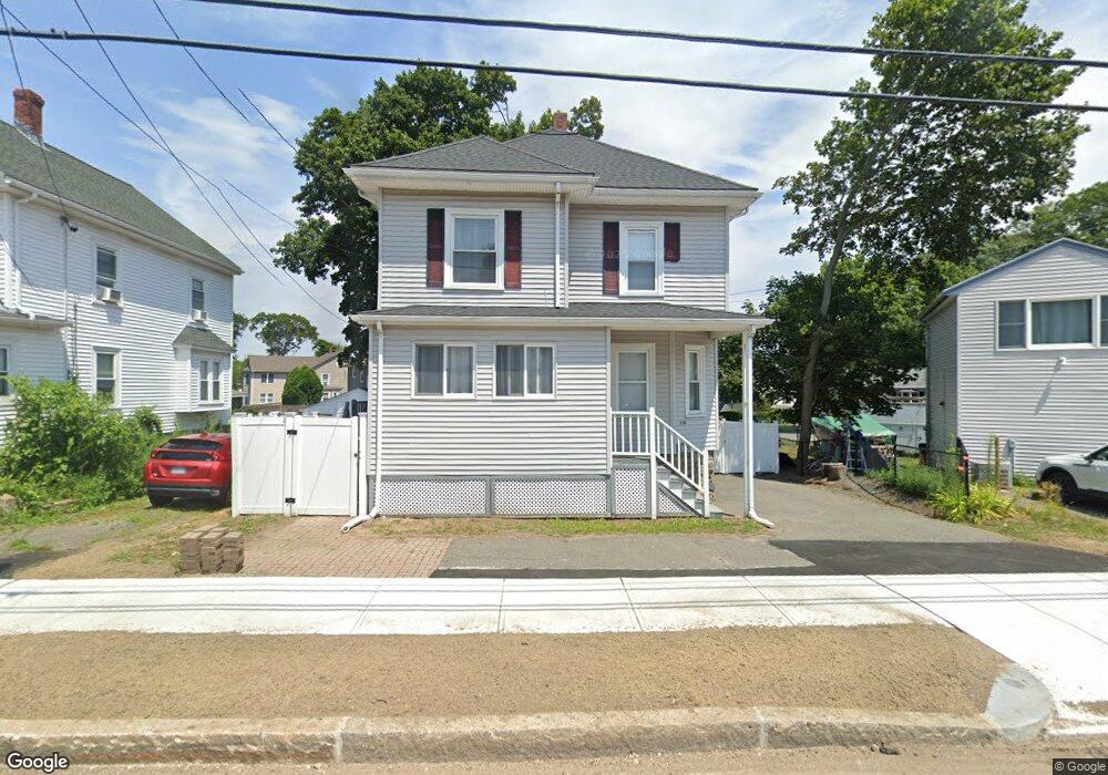
129 Bridge St Beverly, MA 01915
Ryal Side NeighborhoodEstimated Value: $668,000 - $705,000
4
Beds
2
Baths
1,584
Sq Ft
$431/Sq Ft
Est. Value
About This Home
This home is located at 129 Bridge St, Beverly, MA 01915 and is currently estimated at $683,451, approximately $431 per square foot. 129 Bridge St is a home located in Essex County with nearby schools including Beverly High School, The Saints Academy, and Mrs Alexander's School.
Ownership History
Date
Name
Owned For
Owner Type
Purchase Details
Closed on
Mar 31, 2006
Sold by
Gold Stephen P
Bought by
Armenta Blanca and Cadena Elias
Current Estimated Value
Home Financials for this Owner
Home Financials are based on the most recent Mortgage that was taken out on this home.
Original Mortgage
$357,000
Outstanding Balance
$200,100
Interest Rate
6.32%
Mortgage Type
Purchase Money Mortgage
Estimated Equity
$483,351
Purchase Details
Closed on
Nov 30, 1998
Sold by
Stlinger Paul H
Bought by
Gold Stephen P
Home Financials for this Owner
Home Financials are based on the most recent Mortgage that was taken out on this home.
Original Mortgage
$133,200
Interest Rate
6.83%
Mortgage Type
Purchase Money Mortgage
Create a Home Valuation Report for This Property
The Home Valuation Report is an in-depth analysis detailing your home's value as well as a comparison with similar homes in the area
Home Values in the Area
Average Home Value in this Area
Purchase History
| Date | Buyer | Sale Price | Title Company |
|---|---|---|---|
| Armenta Blanca | $357,000 | -- | |
| Gold Stephen P | $148,000 | -- |
Source: Public Records
Mortgage History
| Date | Status | Borrower | Loan Amount |
|---|---|---|---|
| Open | Armenta Blanca | $357,000 | |
| Previous Owner | Gold Stephen P | $133,200 |
Source: Public Records
Tax History
| Year | Tax Paid | Tax Assessment Tax Assessment Total Assessment is a certain percentage of the fair market value that is determined by local assessors to be the total taxable value of land and additions on the property. | Land | Improvement |
|---|---|---|---|---|
| 2025 | $6,212 | $565,200 | $362,600 | $202,600 |
| 2024 | $5,932 | $528,200 | $325,600 | $202,600 |
| 2023 | $5,698 | $506,000 | $303,400 | $202,600 |
| 2022 | $5,504 | $452,300 | $249,700 | $202,600 |
| 2021 | $5,109 | $402,300 | $220,100 | $182,200 |
| 2020 | $4,922 | $385,700 | $203,500 | $182,200 |
| 2019 | $4,917 | $365,200 | $188,700 | $176,500 |
| 2018 | $4,704 | $345,900 | $185,000 | $160,900 |
| 2017 | $4,358 | $305,200 | $144,300 | $160,900 |
| 2016 | $4,232 | $294,100 | $133,200 | $160,900 |
| 2015 | $4,150 | $294,100 | $133,200 | $160,900 |
Source: Public Records
Map
Nearby Homes
- 13 Giles Ave Unit 2
- 123 Livingstone Ave
- 125 Livingstone Ave
- 6 Pilgrim Heights
- 59 Riverview Ave
- 348 Rantoul St Unit 202
- 261 Rantoul St
- 315 Rantoul St Unit 406
- 60 Rantoul St Unit 604N
- 60 Rantoul St Unit 114N
- 50 Rantoul St Unit 509S
- 34 Chase St
- 16 School St Unit 3
- 28 Arthur St Unit 3
- 6 Mcdewell Ave Unit 4
- 12 Summit Ave Unit 4
- 50 Balch St Unit 300
- 50 Balch St Unit 200
- 50 Balch St Unit 205
- 50 Balch St Unit 511
- 127 Bridge St
- 127 Bridge St Unit 1R
- 131 Bridge St
- 127 1/2 Bridge St
- 133 Bridge St
- 10 County Way
- 5 County Way
- 135 Bridge St
- 130 Bridge St Unit 128
- 130 Bridge St
- 130 Bridge St Unit 130
- 124 Bridge St
- 12 County Way
- 7 County Way
- 9 County Way
- 126 Bridge St
- 122 Bridge St Unit 3
- 122 Bridge St Unit 1R
- 128- 130 Bridge St Unit 128
- 128 Bridge St Unit 130
Your Personal Tour Guide
Ask me questions while you tour the home.