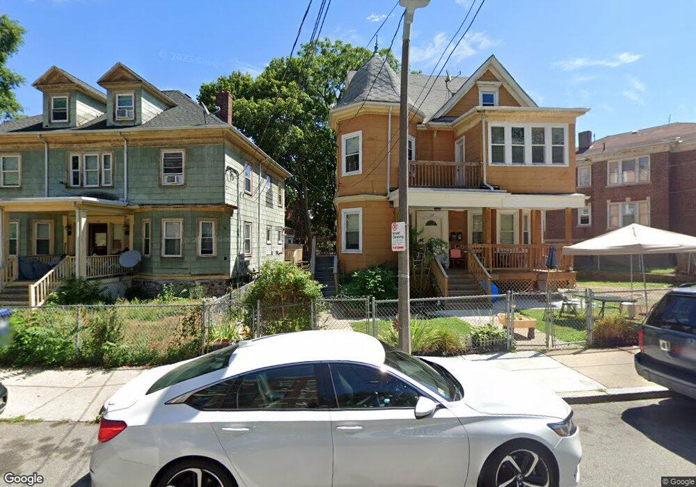
129 Crawford St Dorchester, MA 02121
Washington Park NeighborhoodEstimated Value: $715,430 - $858,000
7
Beds
1
Bath
2,824
Sq Ft
$273/Sq Ft
Est. Value
About This Home
This home is located at 129 Crawford St, Dorchester, MA 02121 and is currently estimated at $771,608, approximately $273 per square foot. 129 Crawford St is a home located in Suffolk County with nearby schools including Bridge Boston Charter School.
Ownership History
Date
Name
Owned For
Owner Type
Purchase Details
Closed on
Dec 22, 2004
Sold by
Claytor-Dunning R Ea
Bought by
Sy Fatou B
Current Estimated Value
Home Financials for this Owner
Home Financials are based on the most recent Mortgage that was taken out on this home.
Original Mortgage
$320,000
Outstanding Balance
$160,363
Interest Rate
5.74%
Mortgage Type
Purchase Money Mortgage
Estimated Equity
$611,245
Create a Home Valuation Report for This Property
The Home Valuation Report is an in-depth analysis detailing your home's value as well as a comparison with similar homes in the area
Home Values in the Area
Average Home Value in this Area
Purchase History
| Date | Buyer | Sale Price | Title Company |
|---|---|---|---|
| Sy Fatou B | $400,000 | -- |
Source: Public Records
Mortgage History
| Date | Status | Borrower | Loan Amount |
|---|---|---|---|
| Open | Sy Fatou B | $320,000 | |
| Closed | Sy Fatou B | $80,000 | |
| Previous Owner | Sy Fatou B | $19,800 |
Source: Public Records
Tax History Compared to Growth
Tax History
| Year | Tax Paid | Tax Assessment Tax Assessment Total Assessment is a certain percentage of the fair market value that is determined by local assessors to be the total taxable value of land and additions on the property. | Land | Improvement |
|---|---|---|---|---|
| 2025 | $5,930 | $512,100 | $180,300 | $331,800 |
| 2024 | $4,654 | $427,000 | $161,500 | $265,500 |
| 2023 | $4,586 | $427,000 | $161,500 | $265,500 |
| 2022 | $4,343 | $399,200 | $151,000 | $248,200 |
| 2021 | $4,175 | $391,300 | $148,000 | $243,300 |
| 2020 | $3,243 | $307,100 | $125,200 | $181,900 |
| 2019 | $3,025 | $287,000 | $104,100 | $182,900 |
| 2018 | $2,810 | $268,100 | $104,100 | $164,000 |
| 2017 | $2,839 | $268,100 | $104,100 | $164,000 |
| 2016 | $3,612 | $328,400 | $104,100 | $224,300 |
| 2015 | $3,168 | $261,600 | $99,700 | $161,900 |
| 2014 | $3,195 | $254,000 | $99,700 | $154,300 |
Source: Public Records
Map
Nearby Homes
- 9 Abbotsford St Unit 1
- 4 Ruthven St
- 75 Ruthven St
- 99 Harrishof St
- 151 Townsend St
- 214 Humboldt Ave
- 41 W Walnut Park
- 28 Wabon St
- 90 Munroe St
- 164 Ruthven St Unit 1
- 78 Hutchings St Unit 1
- 27 Dixwell St Unit 11
- 27 Dixwell St Unit 12
- 27 Dixwell St Unit 4
- 35-37 Notre Dame St
- 26-28-30 Notre Dame St
- 16 Mayfair St
- 8 Brinton St Unit 2
- 3 Atherton St
- 1-3 Glines Ave
- 131 Crawford St
- 131 Crawford St Unit 1
- 127 Crawford St
- 110 Waumbeck St
- 108 Waumbeck St
- 125 Crawford St
- 130 Crawford St
- 177 Harold St
- 109 Waumbeck St
- 113 Waumbeck St
- 105 Waumbeck St
- 101 Waumbeck St
- 126 Crawford St
- 121 Crawford St
- 165 Harold St
- 139 Crawford St
- 139 Crawford St Unit 1
- 139 Crawford St Unit 3
- 139 Crawford St Unit 2
- 30 Abbotsford St