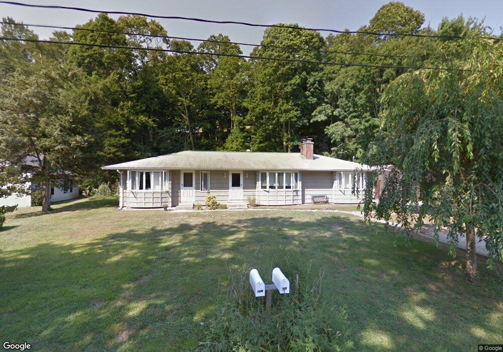
129 Dunk Rock Rd Guilford, CT 06437
Estimated Value: $448,000 - $582,000
4
Beds
2
Baths
1,787
Sq Ft
$288/Sq Ft
Est. Value
About This Home
This home is located at 129 Dunk Rock Rd, Guilford, CT 06437 and is currently estimated at $514,505, approximately $287 per square foot. 129 Dunk Rock Rd is a home located in New Haven County with nearby schools including E.C. Adams Middle School, A. Baldwin Middle School, and Guilford High School.
Ownership History
Date
Name
Owned For
Owner Type
Purchase Details
Closed on
Jan 17, 2020
Sold by
Leslie Roger N
Bought by
Leslie Gregg C
Current Estimated Value
Home Financials for this Owner
Home Financials are based on the most recent Mortgage that was taken out on this home.
Original Mortgage
$40,000
Outstanding Balance
$35,355
Interest Rate
3.73%
Mortgage Type
New Conventional
Estimated Equity
$479,150
Purchase Details
Closed on
Nov 18, 2013
Sold by
Leslie Sidney A
Bought by
Gilbert T and Riccitelli Richard
Purchase Details
Closed on
Aug 23, 2010
Sold by
Leslie Gregg C
Bought by
Leslie Gregg C and Leslie Roger N
Purchase Details
Closed on
Oct 4, 2004
Sold by
Leslie Roger N
Bought by
Leslie Gregg C and Leslie Cheryl-Ann
Home Financials for this Owner
Home Financials are based on the most recent Mortgage that was taken out on this home.
Original Mortgage
$182,000
Interest Rate
5.81%
Create a Home Valuation Report for This Property
The Home Valuation Report is an in-depth analysis detailing your home's value as well as a comparison with similar homes in the area
Home Values in the Area
Average Home Value in this Area
Purchase History
| Date | Buyer | Sale Price | Title Company |
|---|---|---|---|
| Leslie Gregg C | -- | None Available | |
| Gilbert T | $299,900 | -- | |
| Leslie Gregg C | -- | -- | |
| Leslie Gregg C | -- | -- | |
| Leslie Gregg C | $250,000 | -- |
Source: Public Records
Mortgage History
| Date | Status | Borrower | Loan Amount |
|---|---|---|---|
| Open | Leslie Gregg C | $40,000 | |
| Previous Owner | Leslie Gregg C | $45,000 | |
| Previous Owner | Leslie Gregg C | $182,000 |
Source: Public Records
Tax History Compared to Growth
Tax History
| Year | Tax Paid | Tax Assessment Tax Assessment Total Assessment is a certain percentage of the fair market value that is determined by local assessors to be the total taxable value of land and additions on the property. | Land | Improvement |
|---|---|---|---|---|
| 2025 | $6,453 | $233,380 | $130,830 | $102,550 |
| 2024 | $6,203 | $233,380 | $130,830 | $102,550 |
| 2023 | $6,040 | $233,380 | $130,830 | $102,550 |
| 2022 | $5,092 | $153,130 | $106,530 | $46,600 |
| 2021 | $4,995 | $153,130 | $106,530 | $46,600 |
| 2020 | $4,948 | $153,130 | $106,530 | $46,600 |
| 2019 | $4,905 | $153,130 | $106,530 | $46,600 |
| 2018 | $4,790 | $153,130 | $106,530 | $46,600 |
| 2017 | $5,041 | $171,710 | $112,140 | $59,570 |
| 2016 | $4,923 | $171,710 | $112,140 | $59,570 |
| 2015 | $4,849 | $171,710 | $112,140 | $59,570 |
| 2014 | $4,708 | $171,710 | $112,140 | $59,570 |
Source: Public Records
Map
Nearby Homes
- 120 N Fair St Unit 2C
- 181 Denison Dr
- 274 Church St Unit 1A
- 427 Three Mile Course
- 1054 Boston Post Rd
- 82 State St
- 522 Peddlers Rd
- 134 Water St
- 65 Water St
- 140 Wildrose Ave
- 18 Copper Hill Dr
- 20 Copper Hill Dr Unit 20
- 28 Village Cir Unit 28
- 14 Village Cir Unit 14
- 16 Village Cir Unit 16
- 7 Village Cir Unit 7
- 24 Copper Hill Dr
- 64 Boston St
- 42 Copper Hill Dr
- 66 High St Unit 17
- 139 Dunk Rock Rd
- 109 Dunk Rock Rd
- 8 Cobblefield Ln
- 8 Cobblefield Ln Unit MONTH OF JUNE
- 8 Cobblefield Ln Unit MONTH OF JULY
- 8 Cobblefield Ln Unit MONTH OF AUGUST
- 130 Dunk Rock Rd
- 122 Dunk Rock Rd
- 152 Dunk Rock Rd
- 106 Dunk Rock Rd
- 161 Dunk Rock Rd
- 140 Dunk Rock Rd
- 91 Dunk Rock Rd
- 112 Dunk Rock Rd
- 3 Cobblefield Ln
- 90 Dunk Rock Rd
- 162 Dunk Rock Rd
- 116 Dunk Rock Rd
- 6 Cobblefield Ln
- 176 Dunk Rock Rd