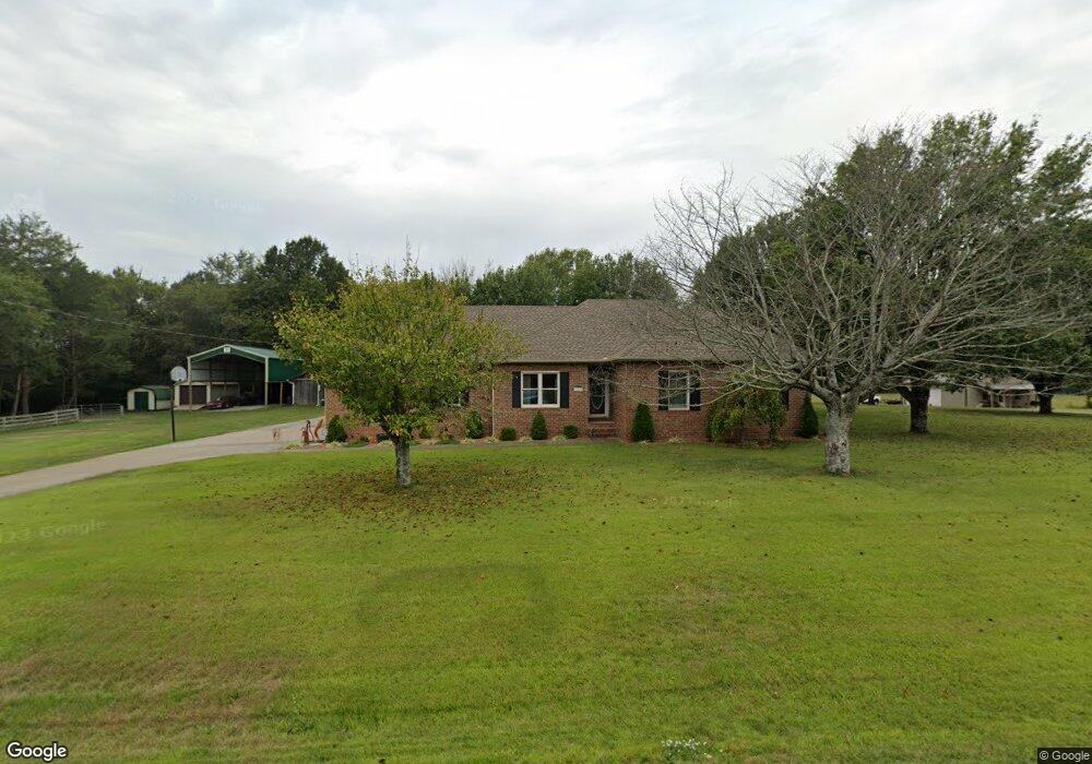
129 Elmhurst Dr Murfreesboro, TN 37129
Estimated Value: $469,000 - $602,000
--
Bed
2
Baths
1,761
Sq Ft
$310/Sq Ft
Est. Value
About This Home
This home is located at 129 Elmhurst Dr, Murfreesboro, TN 37129 and is currently estimated at $545,548, approximately $309 per square foot. 129 Elmhurst Dr is a home located in Rutherford County with nearby schools including Walter Hill Elementary School, Siegel Middle School, and Siegel High School.
Ownership History
Date
Name
Owned For
Owner Type
Purchase Details
Closed on
Mar 29, 2005
Sold by
Wyatt Bowman
Bought by
Lee Mingle Wendell and Lee Patricia
Current Estimated Value
Home Financials for this Owner
Home Financials are based on the most recent Mortgage that was taken out on this home.
Original Mortgage
$188,000
Outstanding Balance
$96,764
Interest Rate
5.74%
Estimated Equity
$448,784
Purchase Details
Closed on
Sep 22, 1994
Sold by
Harvey James S
Bought by
Wyatt Bowman
Purchase Details
Closed on
May 27, 1994
Sold by
D & H Development Company
Bought by
Harvey James S
Create a Home Valuation Report for This Property
The Home Valuation Report is an in-depth analysis detailing your home's value as well as a comparison with similar homes in the area
Home Values in the Area
Average Home Value in this Area
Purchase History
| Date | Buyer | Sale Price | Title Company |
|---|---|---|---|
| Lee Mingle Wendell | $235,000 | -- | |
| Wyatt Bowman | -- | -- | |
| Harvey James S | -- | -- |
Source: Public Records
Mortgage History
| Date | Status | Borrower | Loan Amount |
|---|---|---|---|
| Open | Harvey James S | $188,000 |
Source: Public Records
Tax History Compared to Growth
Tax History
| Year | Tax Paid | Tax Assessment Tax Assessment Total Assessment is a certain percentage of the fair market value that is determined by local assessors to be the total taxable value of land and additions on the property. | Land | Improvement |
|---|---|---|---|---|
| 2025 | $576 | $122,725 | $31,650 | $91,075 |
| 2024 | $576 | $122,725 | $31,650 | $91,075 |
| 2023 | $2,303 | $122,725 | $31,650 | $91,075 |
| 2022 | $1,983 | $122,725 | $31,650 | $91,075 |
| 2021 | $1,818 | $81,925 | $17,550 | $64,375 |
| 2020 | $1,818 | $81,925 | $17,550 | $64,375 |
| 2019 | $1,818 | $81,925 | $17,550 | $64,375 |
Source: Public Records
Map
Nearby Homes
- 0 Leanna Rd
- 1061 Alford Rd
- 1201 Cranberry Dr
- 2245 N Ranch Rd
- 4204 Leanna Rd
- 0 Joe Brown Rd
- 3811 Acorn Ave
- 3543 John Richards Dr
- 1123 Bramble Trail
- 3533 John Richards Dr
- 1831 Pennington Dr
- 3417 Leanna Rd Unit LT 10A
- 0 Unit RTC3002253
- 3433 Cortona Way
- 3538 Winterfell Dr
- 3534 Winterfell Dr
- 3530 Winterfell Dr
- 1124 General Marshall Ct
- 3526 Winterfell Dr
- 3187 N Thompson Ln
- 133 Elmhurst Dr
- 130 Elmhurst Dr
- 137 Elmhurst Dr
- 136 Elmhurst Dr
- 141 Elmhurst Dr
- 946 Allen Rd
- 140 Elmhurst Dr
- 125 Wyndham Cove
- 145 Elmhurst Dr
- 135 Wyndham Cove
- 144 Elmhurst Dr
- 110 Overcast Ct
- 962 Allen Rd
- 2206 Hollow Tree Way
- 106 Overcast Ct
- 114 Overcast Ct
- 115 Wyndham Cove
- 134 Wyndham Cove
- 124 Wyndham Cove
- 130 Wyndham Cove