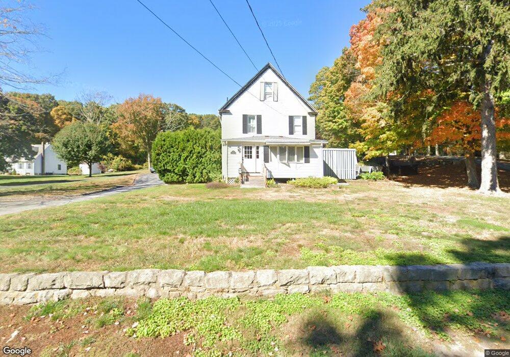
129 Fog Plain Rd Waterford, CT 06385
Estimated Value: $385,000 - $505,000
3
Beds
2
Baths
1,756
Sq Ft
$245/Sq Ft
Est. Value
About This Home
This home is located at 129 Fog Plain Rd, Waterford, CT 06385 and is currently estimated at $429,927, approximately $244 per square foot. 129 Fog Plain Rd is a home located in New London County with nearby schools including Clark Lane Middle School, Waterford High School, and New London High School Multi-Magnet Campus.
Ownership History
Date
Name
Owned For
Owner Type
Purchase Details
Closed on
Nov 7, 2024
Sold by
Dawley William F and Dawley Joanne C
Bought by
Dawley T T and Dawley D
Current Estimated Value
Purchase Details
Closed on
Jun 21, 2000
Sold by
King Larned H
Bought by
Dawley William F
Purchase Details
Closed on
Mar 31, 1995
Sold by
Maiorano Guy M
Bought by
Dawley William F
Create a Home Valuation Report for This Property
The Home Valuation Report is an in-depth analysis detailing your home's value as well as a comparison with similar homes in the area
Home Values in the Area
Average Home Value in this Area
Purchase History
| Date | Buyer | Sale Price | Title Company |
|---|---|---|---|
| Dawley T T | -- | None Available | |
| Dawley T T | -- | None Available | |
| Dawley William F | $11,000 | -- | |
| Dawley William F | $11,000 | -- | |
| Dawley William F | $40,000 | -- | |
| Dawley William F | $40,000 | -- |
Source: Public Records
Mortgage History
| Date | Status | Borrower | Loan Amount |
|---|---|---|---|
| Previous Owner | Dawley William F | $180,000 | |
| Previous Owner | Dawley William F | $230,000 |
Source: Public Records
Tax History Compared to Growth
Tax History
| Year | Tax Paid | Tax Assessment Tax Assessment Total Assessment is a certain percentage of the fair market value that is determined by local assessors to be the total taxable value of land and additions on the property. | Land | Improvement |
|---|---|---|---|---|
| 2025 | $4,635 | $198,420 | $71,360 | $127,060 |
| 2024 | $4,425 | $198,420 | $71,360 | $127,060 |
| 2023 | $4,207 | $198,420 | $71,360 | $127,060 |
| 2022 | $4,423 | $160,500 | $52,830 | $107,670 |
| 2021 | $4,436 | $160,500 | $52,830 | $107,670 |
| 2020 | $4,473 | $160,500 | $52,830 | $107,670 |
| 2019 | $4,491 | $160,500 | $52,830 | $107,670 |
| 2018 | $4,401 | $160,500 | $52,830 | $107,670 |
| 2017 | $4,423 | $163,620 | $55,950 | $107,670 |
| 2016 | $4,382 | $163,620 | $55,950 | $107,670 |
| 2015 | $4,226 | $163,620 | $55,950 | $107,670 |
| 2014 | $4,058 | $163,620 | $55,950 | $107,670 |
Source: Public Records
Map
Nearby Homes
- 267 Boston Post Rd
- 270 Boston Post Rd Unit 22
- 7 Robin St
- 27 Mullen Hill Rd
- 310 Boston Post Rd Unit 86
- 213 Boston Post Rd
- 164 Stoneheights Dr Unit 164
- 32 Stoneheights Dr Unit 32
- 24 Stoneheights Dr
- 54 Rope Ferry Rd Unit H133
- 9 Rock Ridge Rd
- 127 Spithead Rd
- 140 Waterford Pkwy S
- 398 & 402 Boston Post Rd
- 398 Boston Post Rd
- 16 Beechwood Dr
- 9 Arrowhead Trail
- 168 Waterford Pkwy S Unit B25
- 37 Spithead Rd
- 26 Fulmore Dr
- 127 Fog Plain Rd
- 130 Fog Plain Rd
- 133 Fog Plain Rd
- 132 Fog Plain Rd
- 123 Fog Plain Rd
- 135 Fog Plain Rd
- 5 Reynolds Ln
- 131 Fog Plain Rd
- 134 Fog Plain Rd
- 137 Fog Plain Rd
- 9 Reynolds Ln
- 119 Fog Plain Rd
- 136 Fog Plain Rd
- 4 Reynolds Ln
- 6 Reynolds Ln
- 117 Fog Plain Rd
- 7 Reynolds Ln
- 275 Boston Post Rd
- 138 Fog Plain Rd
- 122 Fog Plain Rd