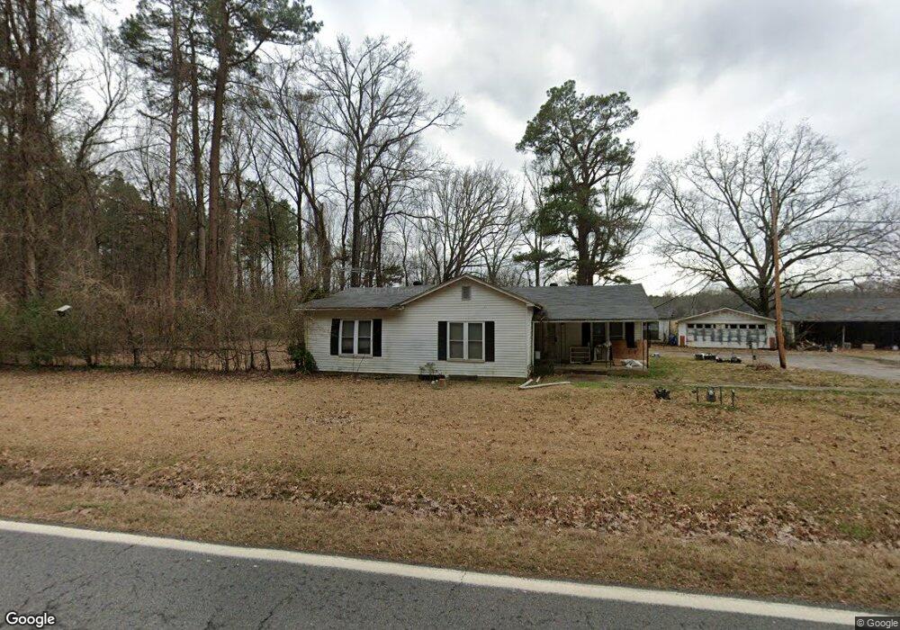
129 Highway 53 N Gurdon, AR 71743
Estimated Value: $104,292 - $167,000
3
Beds
2
Baths
1,888
Sq Ft
$75/Sq Ft
Est. Value
About This Home
This home is located at 129 Highway 53 N, Gurdon, AR 71743 and is currently estimated at $141,823, approximately $75 per square foot. 129 Highway 53 N is a home located in Clark County with nearby schools including Gurdon Primary School, Cabe Middle School, and Gurdon High School.
Ownership History
Date
Name
Owned For
Owner Type
Purchase Details
Closed on
Jul 10, 2023
Sold by
Mcneal Jeffrey L and Mcneal Mindy J
Bought by
Jarrett Shawn and Adams Sierra
Current Estimated Value
Home Financials for this Owner
Home Financials are based on the most recent Mortgage that was taken out on this home.
Original Mortgage
$100,000
Outstanding Balance
$96,320
Interest Rate
6.57%
Mortgage Type
New Conventional
Estimated Equity
$45,503
Purchase Details
Closed on
Oct 25, 2005
Bought by
Bailey Harrison Rich
Purchase Details
Closed on
Dec 2, 1997
Bought by
Bailey Sylvia Jean and Bailey Harrison
Create a Home Valuation Report for This Property
The Home Valuation Report is an in-depth analysis detailing your home's value as well as a comparison with similar homes in the area
Home Values in the Area
Average Home Value in this Area
Purchase History
| Date | Buyer | Sale Price | Title Company |
|---|---|---|---|
| Jarrett Shawn | $125,000 | First National Title | |
| Bailey Harrison Rich | -- | -- | |
| Bailey Sylvia Jean | -- | -- |
Source: Public Records
Mortgage History
| Date | Status | Borrower | Loan Amount |
|---|---|---|---|
| Open | Jarrett Shawn | $100,000 |
Source: Public Records
Tax History Compared to Growth
Tax History
| Year | Tax Paid | Tax Assessment Tax Assessment Total Assessment is a certain percentage of the fair market value that is determined by local assessors to be the total taxable value of land and additions on the property. | Land | Improvement |
|---|---|---|---|---|
| 2024 | $47 | $10,920 | $300 | $10,620 |
| 2023 | $547 | $10,920 | $300 | $10,620 |
| 2022 | $471 | $10,920 | $300 | $10,620 |
| 2021 | $454 | $10,920 | $300 | $10,620 |
| 2020 | $39 | $10,920 | $300 | $10,620 |
| 2019 | $19 | $9,150 | $300 | $8,850 |
| 2018 | $40 | $9,150 | $300 | $8,850 |
| 2017 | $40 | $9,150 | $300 | $8,850 |
| 2016 | $40 | $9,150 | $300 | $8,850 |
| 2015 | $40 | $9,150 | $300 | $8,850 |
| 2014 | -- | $7,625 | $160 | $7,465 |
Source: Public Records
Map
Nearby Homes
- TBD Hwy 67 S
- 313 W Miller St
- 7104 Highway 67 S
- 109 N 7th St
- 326 Arkansas 53
- 0000 Arkansas 53
- 110 S 10th St
- 103 Stonegate Ct
- 51 South St
- 1795 Bowen Hill Rd
- TBD Kansas Rd
- 000 Kansas Rd
- 236 Lockie Rd
- 845 Stevenson Rd
- 196 Stevenson Rd
- 602 Stevenson Rd
- 505 Stevenson Rd
- 58 Dodgen Rd
- 652 Center Point
- TBD Hwy 67
- 143 Highway 53 N
- 181 Highway 53 N
- 0 Highway 53 Unit 17008331
- 93 Highway 53 N
- 204 Highway 53 N
- 25 Highway 53 N
- 19 Highway 53 N
- 1306 N Elm St
- 49 Clarence Rd
- 1312 N Elm St
- 0 Clarence Rd
- 43 Clarence Rd
- 805 N Elm St
- 34 Brewer Rd
- 300 Highway 53 N
- 326 Highway 53 N
- 332 Highway 53 N
- 1002 N Elm St
- 710 N Elm St
- 100 Potter Rd