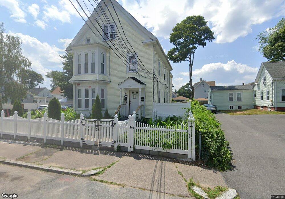
129 Laureston St Brockton, MA 02301
Clifton Heights NeighborhoodEstimated Value: $611,940 - $752,000
4
Beds
2
Baths
2,384
Sq Ft
$296/Sq Ft
Est. Value
About This Home
This home is located at 129 Laureston St, Brockton, MA 02301 and is currently estimated at $705,985, approximately $296 per square foot. 129 Laureston St is a home located in Plymouth County with nearby schools including John F. Kennedy Elementary School, Davis K-8 School, and South Middle School.
Ownership History
Date
Name
Owned For
Owner Type
Purchase Details
Closed on
Aug 31, 2016
Sold by
Resendes Helder
Bought by
Moreira Raimundo R
Current Estimated Value
Home Financials for this Owner
Home Financials are based on the most recent Mortgage that was taken out on this home.
Original Mortgage
$283,765
Outstanding Balance
$226,222
Interest Rate
3.37%
Mortgage Type
FHA
Estimated Equity
$479,763
Purchase Details
Closed on
Dec 30, 1993
Sold by
Monarch Sb Fsb
Bought by
Teixeira John
Purchase Details
Closed on
Sep 28, 1988
Sold by
Waleigh Harry
Bought by
Telson Charlotin
Home Financials for this Owner
Home Financials are based on the most recent Mortgage that was taken out on this home.
Original Mortgage
$211,500
Interest Rate
10.66%
Mortgage Type
Purchase Money Mortgage
Create a Home Valuation Report for This Property
The Home Valuation Report is an in-depth analysis detailing your home's value as well as a comparison with similar homes in the area
Home Values in the Area
Average Home Value in this Area
Purchase History
| Date | Buyer | Sale Price | Title Company |
|---|---|---|---|
| Moreira Raimundo R | $289,000 | -- | |
| Teixeira John | $25,000 | -- | |
| Telson Charlotin | $135,000 | -- |
Source: Public Records
Mortgage History
| Date | Status | Borrower | Loan Amount |
|---|---|---|---|
| Open | Moreira Raimundo R | $283,765 | |
| Previous Owner | Telson Charlotin | $211,500 |
Source: Public Records
Tax History Compared to Growth
Tax History
| Year | Tax Paid | Tax Assessment Tax Assessment Total Assessment is a certain percentage of the fair market value that is determined by local assessors to be the total taxable value of land and additions on the property. | Land | Improvement |
|---|---|---|---|---|
| 2025 | $6,826 | $563,700 | $140,400 | $423,300 |
| 2024 | $7,000 | $582,400 | $140,400 | $442,000 |
| 2023 | $6,380 | $491,500 | $105,800 | $385,700 |
| 2022 | $6,312 | $451,800 | $96,200 | $355,600 |
| 2021 | $9,540 | $400,100 | $80,200 | $319,900 |
| 2020 | $5,022 | $331,500 | $74,800 | $256,700 |
| 2019 | $5,179 | $333,300 | $72,900 | $260,400 |
| 2018 | $4,675 | $291,100 | $72,900 | $218,200 |
| 2017 | $4,239 | $263,300 | $72,900 | $190,400 |
| 2016 | $3,937 | $226,800 | $70,800 | $156,000 |
| 2015 | $3,120 | $171,900 | $70,800 | $101,100 |
| 2014 | $3,082 | $170,000 | $70,800 | $99,200 |
Source: Public Records
Map
Nearby Homes
- 936 Warren Ave
- 99 Tribou St Unit 6
- 977 Warren Ave
- 16 Hancock St
- 29 Hancock St
- 15 1st St
- 103 Clinton St
- 18 Florence St
- 65 Tremont St
- 61 Myrtle St
- 20 Custer St
- 99 Grove St
- 23 Foster St
- 223 Clinton St Unit 10
- 223 Clinton St Unit 3
- 115 Market St
- 137 Channing Ave
- 184 Myrtle St
- 228 Forest Ave
- 153 Bouve Ave
- 123 Laureston St
- 53 Nilsson St
- 51 Nilsson St
- 57 Nilsson St
- 136 Laureston St Unit 2
- 136 Laureston St Unit 1
- 136 Laureston St
- 890 Warren Ave
- 880 Warren Ave
- 124 Laureston St
- 874 Warren Ave
- 130 Laureston St
- 117 Laureston St
- 117 Laureston St Unit 2
- 122 Laureston St
- 52 Nilsson St
- 52 Nilsson St Unit 1
- 896 Warren Ave
- 48 Nilsson St
- 864 Warren Ave