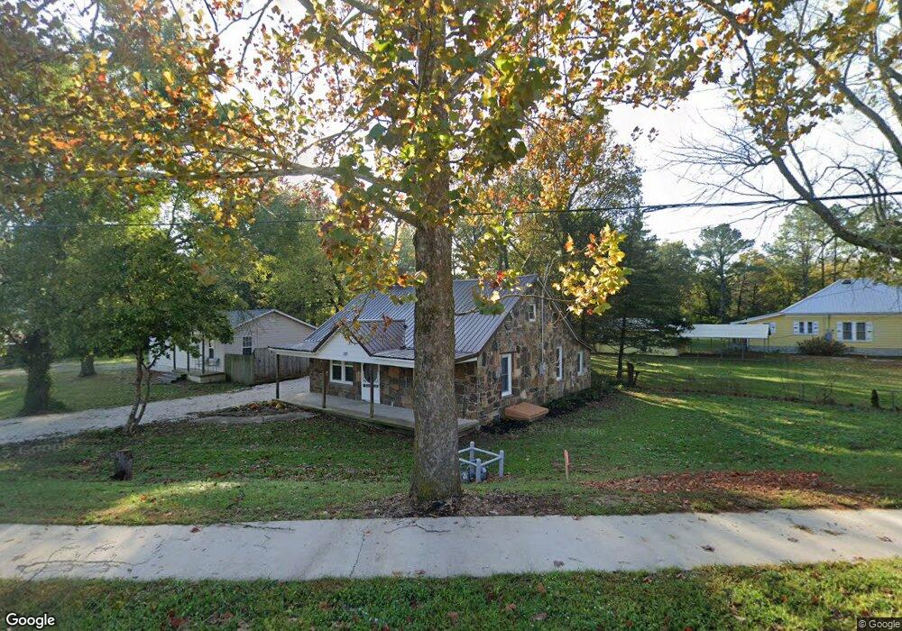
129 Main St West Fork, AR 72774
Estimated Value: $162,000 - $312,000
3
Beds
1
Bath
1,152
Sq Ft
$181/Sq Ft
Est. Value
About This Home
This home is located at 129 Main St, West Fork, AR 72774 and is currently estimated at $208,343, approximately $180 per square foot. 129 Main St is a home located in Washington County with nearby schools including West Fork Elementary School, West Fork Middle School, and West Fork High School.
Ownership History
Date
Name
Owned For
Owner Type
Purchase Details
Closed on
Jan 6, 2026
Sold by
Reaves Steve and Reaves Steven C
Bought by
Leichner Mackenzie Carl and Leichner Andrea Jane
Current Estimated Value
Home Financials for this Owner
Home Financials are based on the most recent Mortgage that was taken out on this home.
Original Mortgage
$255,000
Outstanding Balance
$254,647
Interest Rate
6.26%
Mortgage Type
Construction
Estimated Equity
-$46,304
Purchase Details
Closed on
Feb 19, 2004
Sold by
Kennedy Gail Ann
Bought by
Reaves Steven and Reaves Rhonda
Purchase Details
Closed on
Jan 21, 1955
Bought by
Brown Rosie
Create a Home Valuation Report for This Property
The Home Valuation Report is an in-depth analysis detailing your home's value as well as a comparison with similar homes in the area
Home Values in the Area
Average Home Value in this Area
Purchase History
| Date | Buyer | Sale Price | Title Company |
|---|---|---|---|
| Leichner Mackenzie Carl | $302,000 | Waco Title | |
| Reaves Steven | -- | -- | |
| Brown Rosie | -- | -- |
Source: Public Records
Mortgage History
| Date | Status | Borrower | Loan Amount |
|---|---|---|---|
| Open | Leichner Mackenzie Carl | $255,000 |
Source: Public Records
Tax History
| Year | Tax Paid | Tax Assessment Tax Assessment Total Assessment is a certain percentage of the fair market value that is determined by local assessors to be the total taxable value of land and additions on the property. | Land | Improvement |
|---|---|---|---|---|
| 2025 | $1,634 | $34,740 | $7,000 | $27,740 |
| 2024 | $1,506 | $34,740 | $7,000 | $27,740 |
| 2023 | $1,388 | $34,740 | $7,000 | $27,740 |
| 2022 | $1,262 | $24,400 | $3,500 | $20,900 |
| 2021 | $1,165 | $24,400 | $3,500 | $20,900 |
| 2020 | $1,068 | $24,400 | $3,500 | $20,900 |
| 2019 | $971 | $18,280 | $3,000 | $15,280 |
| 2018 | $971 | $18,280 | $3,000 | $15,280 |
| 2017 | $943 | $18,280 | $3,000 | $15,280 |
| 2016 | $943 | $18,280 | $3,000 | $15,280 |
| 2015 | $886 | $18,280 | $3,000 | $15,280 |
| 2014 | $805 | $15,610 | $3,600 | $12,010 |
Source: Public Records
Map
Nearby Homes
- 0000 Highway 170
- 224 Maple Ave
- 185 Wheeler St
- 67 S Red Oak Ave
- 222 Rivendale Dr
- 0 W Smith St Unit 1334508
- 365 W Smith St
- 353 W Smith St
- 327 W Smith St
- 385 W Smith St
- 503 Clark Ave
- 338 Hidden Creek Place
- 260 Culp Trail
- 846 James Place
- 815 James Place
- 696 E Thornstone Ave
- 13582 S Highway 170
- 13653 W Mountain Rd
Your Personal Tour Guide
Ask me questions while you tour the home.