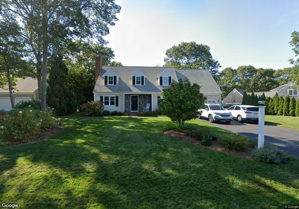
129 River Ridge Rd Barnstable, MA 02648
Marstons Mills NeighborhoodEstimated Value: $851,386 - $979,000
3
Beds
3
Baths
2,701
Sq Ft
$336/Sq Ft
Est. Value
About This Home
This home is located at 129 River Ridge Rd, Barnstable, MA 02648 and is currently estimated at $908,847, approximately $336 per square foot. 129 River Ridge Rd is a home located in Barnstable County with nearby schools including West Villages Elementary School, Barnstable United Elementary School, and Barnstable Intermediate School.
Ownership History
Date
Name
Owned For
Owner Type
Purchase Details
Closed on
Nov 14, 2022
Sold by
Mezzano Mark and Mezzano Anna L
Bought by
M T & A L Mezzano 2022 Lt
Current Estimated Value
Purchase Details
Closed on
Oct 15, 2010
Sold by
Mccoy Rosemary E
Bought by
Mezzano Mark
Home Financials for this Owner
Home Financials are based on the most recent Mortgage that was taken out on this home.
Original Mortgage
$354,000
Interest Rate
4.36%
Mortgage Type
Purchase Money Mortgage
Purchase Details
Closed on
Jul 9, 1993
Sold by
Lynch Richard C and Lynch Richard C
Bought by
Mccoy Rosemary E
Purchase Details
Closed on
May 17, 1993
Sold by
Howe Richard W and Barnstable Comnty Fcu
Bought by
Lynch Richard C
Create a Home Valuation Report for This Property
The Home Valuation Report is an in-depth analysis detailing your home's value as well as a comparison with similar homes in the area
Home Values in the Area
Average Home Value in this Area
Purchase History
| Date | Buyer | Sale Price | Title Company |
|---|---|---|---|
| M T & A L Mezzano 2022 Lt | -- | None Available | |
| Mezzano Mark | $373,000 | -- | |
| Mccoy Rosemary E | $145,000 | -- | |
| Lynch Richard C | $107,250 | -- |
Source: Public Records
Mortgage History
| Date | Status | Borrower | Loan Amount |
|---|---|---|---|
| Previous Owner | Mezzano Mark | $354,000 | |
| Previous Owner | Lynch Richard C | $70,000 |
Source: Public Records
Tax History
| Year | Tax Paid | Tax Assessment Tax Assessment Total Assessment is a certain percentage of the fair market value that is determined by local assessors to be the total taxable value of land and additions on the property. | Land | Improvement |
|---|---|---|---|---|
| 2025 | $6,073 | $750,700 | $180,000 | $570,700 |
| 2024 | $5,624 | $720,100 | $180,000 | $540,100 |
| 2023 | $5,479 | $657,000 | $177,800 | $479,200 |
| 2022 | $5,145 | $533,700 | $126,500 | $407,200 |
| 2021 | $5,012 | $477,800 | $126,500 | $351,300 |
| 2020 | $5,127 | $467,800 | $126,500 | $341,300 |
| 2019 | $4,849 | $429,900 | $126,500 | $303,400 |
| 2018 | $4,525 | $403,300 | $138,700 | $264,600 |
| 2017 | $4,149 | $385,600 | $138,700 | $246,900 |
| 2016 | $4,224 | $387,500 | $140,000 | $247,500 |
| 2015 | $4,090 | $377,000 | $137,100 | $239,900 |
Source: Public Records
Map
Nearby Homes
- 68 Hilltop Dr
- 23 Middle Pond Path
- 1415 Old Post Rd
- 244 Wakeby Rd
- 15 Geraldine Rd
- 192 Sandy Valley Rd
- 78 Brittany Dr
- 359 Baxter Neck Rd
- 165 Baxter Neck Rd
- 280 Ice Valley Rd
- 602 Putnam Ave
- 170 Forest Hills Rd
- 1456 Santuit-Newtown Rd
- 318 Old Mill Rd
- 564 Cotuit Bay Dr
- 564 Cotuit Bay Dr
- 19 Oriole Ln
- 585 Old Falmouth Rd
- 835 Old Post Rd
- 98 Bunker Hill Rd
- 129 River Ridge Dr
- 129 River Ridge Dr
- 139 River Ridge Dr
- 126 River Ridge Dr
- 118 River Ridge Dr
- 118 River Ridge Rd
- 115 River Ridge Rd
- 152 River Ridge Rd
- 152 River Ridge Dr
- 155 River Ridge Dr
- 155 River Ridge Rd
- 152 River Ridge Dr
- 164 River Ridge Dr
- 164 River Ridge Rd
- 83 River Ridge Dr
- 83 River Ridge Rd
- 167 River Ridge Rd
- 167 River Ridge Dr
- 174 River Ridge Rd
- 174 River Ridge Dr
Your Personal Tour Guide
Ask me questions while you tour the home.