Estimated Value: $107,491 - $171,000
--
Bed
--
Bath
950
Sq Ft
$142/Sq Ft
Est. Value
About This Home
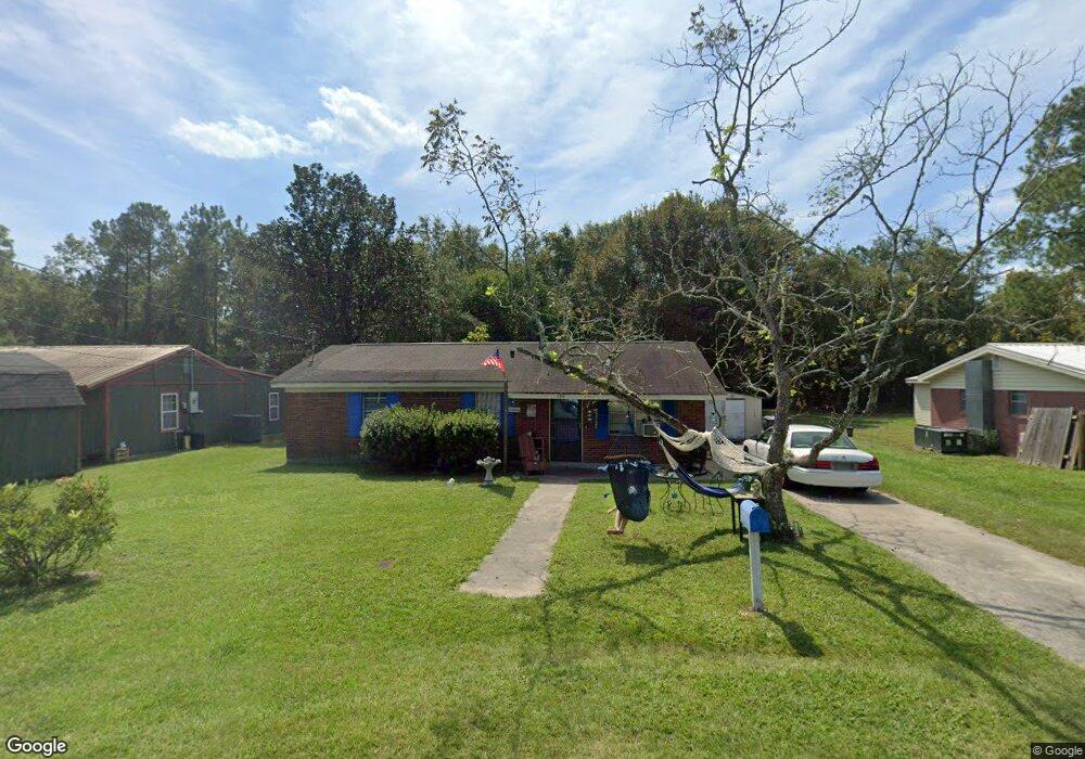
This home is located at 129 S Deborah Cir, Jesup, GA 31546 and is currently estimated at $135,123, approximately $142 per square foot. 129 S Deborah Cir is a home with nearby schools including Martha Rawls Smith Elementary School, Arthur Williams Middle School, and Wayne County High School.
Ownership History
Date
Name
Owned For
Owner Type
Purchase Details
Closed on
Sep 24, 2024
Sold by
Gillespie Real Estate Llc
Bought by
Charriere Leonard E and Rogers Bridgett
Current Estimated Value
Purchase Details
Closed on
Jun 6, 2016
Sold by
Brinson Kimberly L
Bought by
Gillespie Real Estate Llc
Purchase Details
Closed on
Nov 1, 1997
Sold by
Exley Edmund D and Exley Lucy L
Bought by
Exley Lucy L
Purchase Details
Closed on
Dec 1, 1993
Bought by
Exley Edmund D and Exley Lucy L
Purchase Details
Closed on
Sep 1, 1993
Purchase Details
Closed on
Sep 1, 1992
Purchase Details
Closed on
Oct 1, 1987
Purchase Details
Closed on
Apr 1, 1972
Create a Home Valuation Report for This Property
The Home Valuation Report is an in-depth analysis detailing your home's value as well as a comparison with similar homes in the area
Home Values in the Area
Average Home Value in this Area
Purchase History
| Date | Buyer | Sale Price | Title Company |
|---|---|---|---|
| Charriere Leonard E | -- | -- | |
| Gillespie Real Estate Llc | $72,000 | -- | |
| Exley Lucy L | -- | -- | |
| Exley Edmund D | $18,000 | -- | |
| -- | -- | -- | |
| -- | $19,400 | -- | |
| -- | -- | -- | |
| -- | -- | -- |
Source: Public Records
Tax History Compared to Growth
Tax History
| Year | Tax Paid | Tax Assessment Tax Assessment Total Assessment is a certain percentage of the fair market value that is determined by local assessors to be the total taxable value of land and additions on the property. | Land | Improvement |
|---|---|---|---|---|
| 2024 | $738 | $24,142 | $2,100 | $22,042 |
| 2023 | $491 | $16,739 | $2,070 | $14,669 |
| 2022 | $527 | $16,739 | $2,070 | $14,669 |
| 2021 | $564 | $16,739 | $2,070 | $14,669 |
| 2020 | $584 | $16,739 | $2,070 | $14,669 |
| 2019 | $601 | $16,739 | $2,070 | $14,669 |
| 2018 | $601 | $16,739 | $2,070 | $14,669 |
| 2017 | $501 | $16,739 | $2,070 | $14,669 |
| 2016 | $501 | $16,739 | $2,070 | $14,669 |
| 2014 | $502 | $16,739 | $2,070 | $14,669 |
| 2013 | -- | $16,738 | $2,070 | $14,668 |
Source: Public Records
Map
Nearby Homes
- 0 S Palm St Unit 10609054
- 0 S Palm St Unit 1656795
- 1300 S Palm St
- 158 N Deborah Cir
- 1101 S Palm St
- 805 Littlefield St
- 775 Catherine St
- 985 Seven Oaks Rd
- 50 Ac Hwy 301
- 655 Littlefield St
- 210 Purser Dr
- 945 S Palm St
- 1816 S Palm St
- 1812 S Palm St
- 0 U S 301
- 156 Hannah Dr
- 112 Vixenhill Dr
- 353 Chase Dr
- 113 Vixenhill Dr
- 00 U S 301
- 127 S Deborah Cir
- 123 S Deborah Cir
- 133 S Deborah Cir
- 126 S Deborah Cir
- 119 S Deborah Cir
- 122 S Deborah Cir
- 118 S Deborah Cir
- 135 S Deborah Cir
- 115 S Deborah Cir
- 131 N Deborah Cir
- 127 N Deborah Cir
- 114 S Deborah Cir
- 123 N Deborah Cir
- 135 N Deborah Cir
- 140 S Deborah Cir
- 140 Ross Siding Rd
- 147 Nancy St
- 141 N Deborah Cir
- LT28 Blk B Harrison Village
- 143 N Deborah Cir