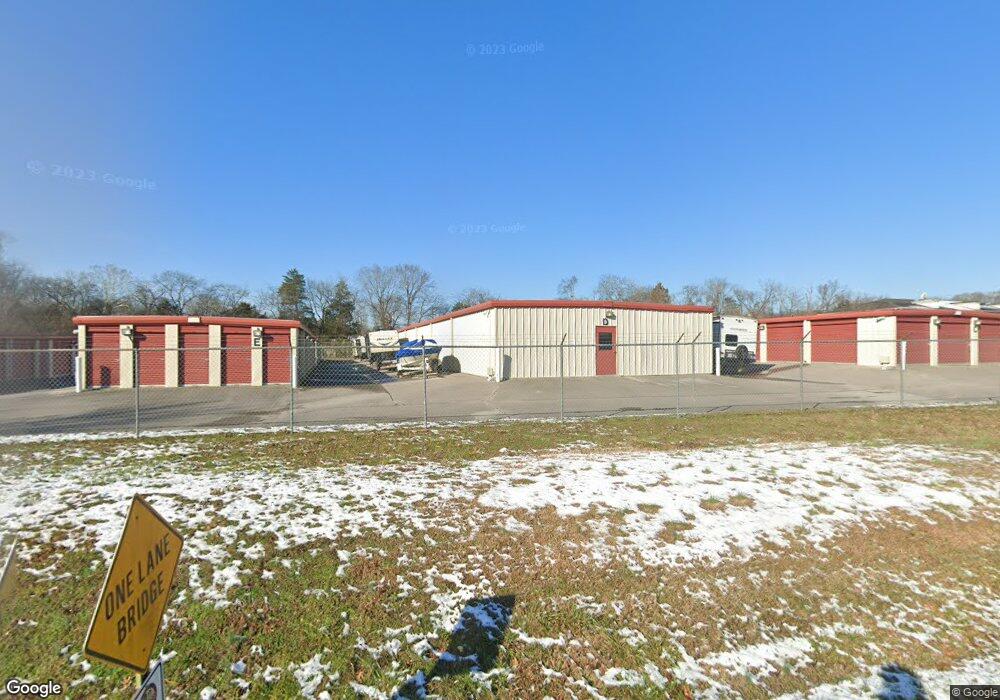
129 Sunset Cir Mount Juliet, TN 37122
Estimated Value: $986,766
--
Bed
--
Bath
200
Sq Ft
$4,934/Sq Ft
Est. Value
About This Home
This home is located at 129 Sunset Cir, Mount Juliet, TN 37122 and is currently estimated at $986,766, approximately $4,933 per square foot. 129 Sunset Cir is a home located in Wilson County with nearby schools including Elzie D. Patton Elementary School, Mt. Juliet Middle School, and Green Hill High School.
Ownership History
Date
Name
Owned For
Owner Type
Purchase Details
Closed on
Jul 26, 2012
Sold by
B & B Enterprises Of Wilso
Bought by
Hal Bone Enterprises Llc
Current Estimated Value
Purchase Details
Closed on
Aug 25, 2008
Sold by
Kenneth Hawkins
Bought by
B B Enterprises Of Wilson Coun
Purchase Details
Closed on
Apr 6, 2004
Sold by
Wc Development Llc
Bought by
B & H Rentals Llc
Home Financials for this Owner
Home Financials are based on the most recent Mortgage that was taken out on this home.
Original Mortgage
$880,000
Interest Rate
5.93%
Purchase Details
Closed on
Nov 7, 2003
Sold by
Wc Development Llc
Bought by
B & H Rentals Llc
Purchase Details
Closed on
Dec 18, 1997
Bought by
W C Dev Llc
Create a Home Valuation Report for This Property
The Home Valuation Report is an in-depth analysis detailing your home's value as well as a comparison with similar homes in the area
Home Values in the Area
Average Home Value in this Area
Purchase History
| Date | Buyer | Sale Price | Title Company |
|---|---|---|---|
| Hal Bone Enterprises Llc | -- | -- | |
| B B Enterprises Of Wilson Coun | $383,333 | -- | |
| Kenneth Hawkins | -- | -- | |
| B & H Rentals Llc | -- | -- | |
| B & H Rentals Llc | $200,000 | -- | |
| W C Dev Llc | $350,000 | -- |
Source: Public Records
Mortgage History
| Date | Status | Borrower | Loan Amount |
|---|---|---|---|
| Previous Owner | W C Dev Llc | $880,000 |
Source: Public Records
Tax History Compared to Growth
Tax History
| Year | Tax Paid | Tax Assessment Tax Assessment Total Assessment is a certain percentage of the fair market value that is determined by local assessors to be the total taxable value of land and additions on the property. | Land | Improvement |
|---|---|---|---|---|
| 2024 | $6,239 | $326,840 | $148,040 | $178,800 |
| 2022 | $6,239 | $326,840 | $148,040 | $178,800 |
| 2021 | $6,599 | $326,840 | $148,040 | $178,800 |
| 2020 | $8,384 | $326,840 | $148,040 | $178,800 |
| 2019 | $1,040 | $312,200 | $98,680 | $213,520 |
| 2018 | $8,384 | $312,200 | $98,680 | $213,520 |
| 2017 | $8,384 | $312,200 | $98,680 | $213,520 |
| 2016 | $8,384 | $312,200 | $98,680 | $213,520 |
| 2015 | $8,649 | $312,200 | $98,680 | $213,520 |
| 2014 | $8,466 | $305,602 | $0 | $0 |
Source: Public Records
Map
Nearby Homes
- 110 Morningside Dr
- 1 Lebanon Rd
- 137 Sunset Dr
- 122 Creekwood Dr
- 143 Windtree Club Dr
- 1077 Watermark Way
- 551 Montrose Dr
- 4020 Welty Ln
- 1076 Watermark Way
- 1040 Charlie Daniels Pkwy Unit 108
- 1040 Charlie Daniels Pkwy Unit 207
- 1040 Charlie Daniels Pkwy Unit 176
- 10645 Lebanon Rd
- 613 Club View Way
- 621 Club View Way
- 10615 Lebanon Rd
- 620 Club View Way
- 632 Club View Way
- 503 Montrose Dr
- Weston Plan at Windtree - Signatures
- 8 Meb Ct
- 2 Meb Ct
- 105 Morningside Dr
- 101 Morningside Dr
- 118 Sunset Cir
- 118 Sunset Cir
- 2 Sunset Dr
- 116 Sunset Cir
- 807 Sunset Point
- 809 Sunset Point
- 816 Sunset Point
- 125 Sunset Dr
- 11338 Lebanon Rd
- 11328 Lebanon Rd
- 114 Sunset Cir
- 11324 Lebanon Rd
- 11381 Lebanon Rd
- 11381 Lebanon Rd
- 11316 Lebanon Rd
- 805 Sunset Point
