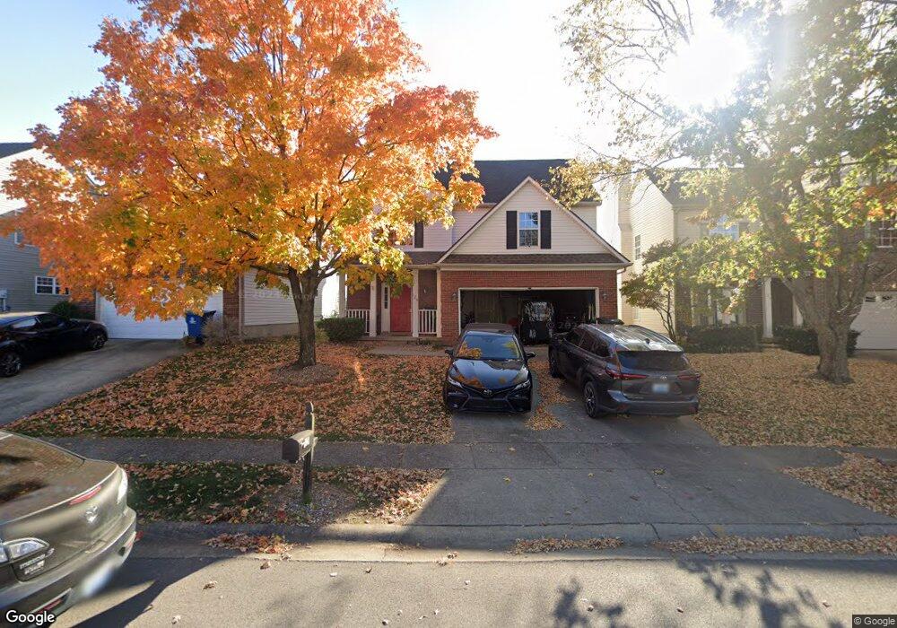
129 The Masters Georgetown, KY 40324
Estimated Value: $308,639 - $328,000
3
Beds
3
Baths
1,968
Sq Ft
$161/Sq Ft
Est. Value
About This Home
This home is located at 129 The Masters, Georgetown, KY 40324 and is currently estimated at $317,160, approximately $161 per square foot. 129 The Masters is a home located in Scott County with nearby schools including Western Elementary School, Royal Spring Middle School, and Scott County High School.
Ownership History
Date
Name
Owned For
Owner Type
Purchase Details
Closed on
Mar 25, 2011
Sold by
Secretary Of Housing & Urban Development
Bought by
Mullins Alan
Current Estimated Value
Home Financials for this Owner
Home Financials are based on the most recent Mortgage that was taken out on this home.
Original Mortgage
$92,760
Outstanding Balance
$63,430
Interest Rate
4.92%
Mortgage Type
New Conventional
Estimated Equity
$253,730
Purchase Details
Closed on
Aug 18, 2010
Sold by
Smith Jon D and Smith Cara M
Bought by
Secretary Of Housing & Urban Development
Purchase Details
Closed on
Oct 4, 2005
Sold by
Clark Michael B and Clark Stacye W
Bought by
Smith Jon D and Smith Cara M
Home Financials for this Owner
Home Financials are based on the most recent Mortgage that was taken out on this home.
Original Mortgage
$169,251
Interest Rate
5.72%
Mortgage Type
FHA
Create a Home Valuation Report for This Property
The Home Valuation Report is an in-depth analysis detailing your home's value as well as a comparison with similar homes in the area
Purchase History
| Date | Buyer | Sale Price | Title Company |
|---|---|---|---|
| Mullins Alan | $115,950 | Regional First Title Group | |
| Secretary Of Housing & Urban Development | $114,500 | None Available | |
| Smith Jon D | $170,775 | None Available |
Source: Public Records
Mortgage History
| Date | Status | Borrower | Loan Amount |
|---|---|---|---|
| Open | Mullins Alan | $92,760 | |
| Previous Owner | Smith Jon D | $169,251 |
Source: Public Records
Tax History
| Year | Tax Paid | Tax Assessment Tax Assessment Total Assessment is a certain percentage of the fair market value that is determined by local assessors to be the total taxable value of land and additions on the property. | Land | Improvement |
|---|---|---|---|---|
| 2025 | $2,213 | $248,400 | $0 | $0 |
| 2024 | $2,171 | $241,400 | $0 | $0 |
| 2023 | $2,063 | $227,500 | $42,000 | $185,500 |
| 2022 | $1,648 | $193,800 | $37,500 | $156,300 |
| 2021 | $1,679 | $178,200 | $37,500 | $140,700 |
| 2020 | $1,531 | $178,200 | $37,500 | $140,700 |
| 2019 | $1,520 | $174,100 | $0 | $0 |
| 2018 | $1,450 | $167,100 | $0 | $0 |
| 2017 | $1,397 | $160,250 | $0 | $0 |
| 2016 | $1,243 | $154,400 | $0 | $0 |
| 2015 | $1,204 | $150,500 | $0 | $0 |
| 2014 | $1,248 | $150,500 | $0 | $0 |
| 2011 | $89 | $144,000 | $0 | $0 |
Source: Public Records
Map
Nearby Homes
- 305 Glass Cir
- 110 Sea Pines Way
- 100 Winding Creek Dr
- 149 McClelland Springs Dr
- 135 Shinnecock Hill Dr
- 104 Lloyd Rd
- 144 Winding Creek Dr
- 131 Spring Bluff Dr
- 98 Delissa Dr
- 111 Paul Revere Dr
- 111 Hillside Dr
- 164 Stapleton Way
- 110 Hannsons Path
- 102 Hansons Path
- 251 W Showalter Dr
- 1010 Walker Way
- 214 Sturbridge Dr
- 132 Stapleton Way
- 113 Stapleton Way
- 232 W Showalter Dr
- 131 The Masters
- 127 The Masters
- 133 The Masters
- 135 The Masters
- 125 The Masters
- 137 The Masters
- 100 Muirfield Place
- 128 The Masters
- 130 The Masters
- 139 The Masters
- 121 The Masters
- 132 The Masters
- 102 Muirfield Place
- 141 The Masters
- 119 The Masters
- 136 The Masters
- 104 Muirfield Place
- 117 The Masters
- 111 Raes Creek Ct
Your Personal Tour Guide
Ask me questions while you tour the home.