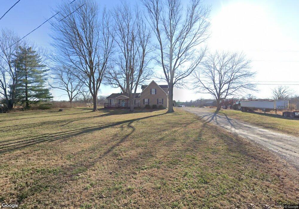
129 Tom Link Rd Cottontown, TN 37048
Estimated Value: $458,000 - $690,000
--
Bed
2
Baths
2,590
Sq Ft
$223/Sq Ft
Est. Value
About This Home
This home is located at 129 Tom Link Rd, Cottontown, TN 37048 and is currently estimated at $576,582, approximately $222 per square foot. 129 Tom Link Rd is a home located in Sumner County with nearby schools including Oakmont Elementary School, Portland East Middle School, and Portland High School.
Ownership History
Date
Name
Owned For
Owner Type
Purchase Details
Closed on
Jun 8, 2005
Sold by
Carroll William L
Bought by
Eidson Galen D and Eidson Nikki
Current Estimated Value
Home Financials for this Owner
Home Financials are based on the most recent Mortgage that was taken out on this home.
Original Mortgage
$125,000
Outstanding Balance
$64,963
Interest Rate
5.69%
Mortgage Type
Fannie Mae Freddie Mac
Estimated Equity
$511,619
Purchase Details
Closed on
Jul 29, 1994
Sold by
Gosnell Glyn D
Bought by
Carroll William L
Create a Home Valuation Report for This Property
The Home Valuation Report is an in-depth analysis detailing your home's value as well as a comparison with similar homes in the area
Home Values in the Area
Average Home Value in this Area
Purchase History
| Date | Buyer | Sale Price | Title Company |
|---|---|---|---|
| Eidson Galen D | $125,000 | Castleman Title | |
| Carroll William L | -- | -- |
Source: Public Records
Mortgage History
| Date | Status | Borrower | Loan Amount |
|---|---|---|---|
| Open | Eidson Galen D | $125,000 |
Source: Public Records
Tax History Compared to Growth
Tax History
| Year | Tax Paid | Tax Assessment Tax Assessment Total Assessment is a certain percentage of the fair market value that is determined by local assessors to be the total taxable value of land and additions on the property. | Land | Improvement |
|---|---|---|---|---|
| 2024 | $2,041 | $143,650 | $55,000 | $88,650 |
| 2023 | $1,241 | $55,125 | $14,850 | $40,275 |
| 2022 | $1,247 | $55,125 | $14,850 | $40,275 |
| 2021 | $1,247 | $55,125 | $14,850 | $40,275 |
| 2020 | $1,247 | $55,125 | $14,850 | $40,275 |
| 2019 | $1,247 | $0 | $0 | $0 |
| 2018 | $1,149 | $0 | $0 | $0 |
| 2017 | $1,149 | $0 | $0 | $0 |
| 2016 | $1,149 | $0 | $0 | $0 |
| 2015 | -- | $0 | $0 | $0 |
| 2014 | -- | $0 | $0 | $0 |
Source: Public Records
Map
Nearby Homes
- 721 New Deal Potts Rd
- 0 New Deal Pots Rd
- 782 New Deal Potts Rd
- 0 Jake Link Rd
- 686 Clearview Rd
- 3172 Highway 76
- 1 Clearview Rd
- 541 Clearview Rd
- 199 Broaderick Ln
- 3011 Highway 76
- 1003 Roland Ct
- 3371 Highway 76
- 290 Dink Rut Rd
- 101 Riggs Rd
- 155 S Ray Rd
- 105 Riggs Rd
- 1031 Kennedy Ln
- 293 Aplin Branch Rd
- 572 Buntin Mill Rd
- 512 N Happy Hollow Rd
- 138 Tom Link Rd
- 701 New Deal Potts Rd
- 161 Tom Link Rd
- 610 New Deal Potts Rd
- 605 New Deal Potts Rd
- 727 New Deal Potts Rd
- 601 New Deal Potts Rd
- 733 New Deal Potts Rd
- 724 New Deal Potts Rd
- 591 New Deal Potts Rd
- 600 New Deal Potts Rd
- 733 New Deal Potts Rd
- 743 New Deal Potts Rd
- 728 New Deal Potts Rd
- 583 New Deal Potts Rd
- 732 New Deal Potts Rd
- 569 New Deal Potts Rd
- 747 New Deal Potts Rd
- 752 New Deal Potts Rd
- 115 Claude Hardin Rd