Estimated Value: $1,062,811 - $1,173,000
6
Beds
6
Baths
4,120
Sq Ft
$276/Sq Ft
Est. Value
About This Home
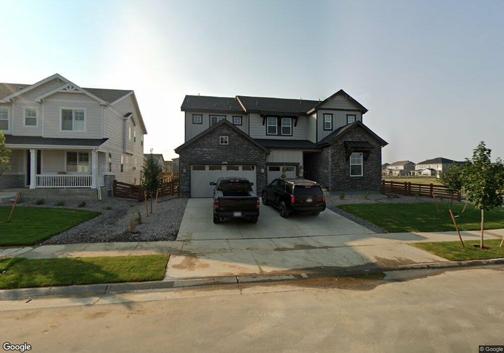
This home is located at 1290 Ascent Trail Cir, Erie, CO 80516 and is currently estimated at $1,136,453, approximately $275 per square foot. 1290 Ascent Trail Cir is a home with nearby schools including Erie Elementary School, Erie Middle School, and Erie High School.
Ownership History
Date
Name
Owned For
Owner Type
Purchase Details
Closed on
Jun 18, 2021
Sold by
Richmond American Homes Of Colorado Inc
Bought by
Franklin Chelsey and Franklin Daniel M
Current Estimated Value
Home Financials for this Owner
Home Financials are based on the most recent Mortgage that was taken out on this home.
Original Mortgage
$548,250
Outstanding Balance
$490,083
Interest Rate
2.12%
Mortgage Type
New Conventional
Estimated Equity
$646,370
Create a Home Valuation Report for This Property
The Home Valuation Report is an in-depth analysis detailing your home's value as well as a comparison with similar homes in the area
Home Values in the Area
Average Home Value in this Area
Purchase History
| Date | Buyer | Sale Price | Title Company |
|---|---|---|---|
| Franklin Chelsey | $945,900 | American Home T&E Co | |
| Franklin Chelsey | $945,900 | American Home T&E Co |
Source: Public Records
Mortgage History
| Date | Status | Borrower | Loan Amount |
|---|---|---|---|
| Open | Franklin Chelsey | $548,250 | |
| Closed | Franklin Chelsey | $548,250 |
Source: Public Records
Tax History Compared to Growth
Tax History
| Year | Tax Paid | Tax Assessment Tax Assessment Total Assessment is a certain percentage of the fair market value that is determined by local assessors to be the total taxable value of land and additions on the property. | Land | Improvement |
|---|---|---|---|---|
| 2025 | $10,181 | $61,630 | $10,000 | $51,630 |
| 2024 | $10,181 | $61,630 | $10,000 | $51,630 |
| 2023 | $9,950 | $64,330 | $9,470 | $54,860 |
| 2022 | $8,759 | $53,130 | $7,300 | $45,830 |
| 2021 | $1,714 | $10,540 | $7,510 | $3,030 |
| 2020 | $1,088 | $6,720 | $6,720 | $0 |
| 2019 | $1,062 | $6,520 | $6,520 | $0 |
| 2018 | $7 | $10 | $10 | $0 |
| 2017 | $7 | $0 | $0 | $0 |
Source: Public Records
Map
Nearby Homes
- 784 Sundown Way
- 797 Flora View Dr
- 723 Eva Peak Dr
- 777 Gold Hill Dr
- 1060 Ascent Trail Cir
- 833 Audubon Peak Dr
- 800 Boulder Peak Ave
- 741 Green Mountain Dr
- 938 Flora View Dr
- 671 Green Mountain Dr
- 1222 Summit Rise Dr
- 902 Pinecliff Dr
- 716 Split Rock Dr
- 700 Split Rock Dr
- 1354 Lumber Ridge Cir S
- 1373 Lumber Ridge Cir S
- 1422 Lumber Ridge Cir S
- 1353 Lumber Ridge Cir S
- 1434 Lumber Ridge Cir S
- Coronado Plan at Colliers Hill
- 1278 Ascent Trail Cir
- 1264 Ascent Trail Cir
- 761 Flora View Dr
- 1252 Ascent Trail Cir
- 773 Flora View Dr
- 796 Sundown Way
- 1240 Ascent Trail Cir
- 724 Audubon Peak Dr
- 716 Audubon Peak Dr
- 732 Audubon Peak Dr
- 785 Flora View Dr
- 740 Audubon Peak Dr
- 1228 Ascent Trail Cir
- 808 Sundown Way
- 811 Sundown Way
- 748 Audubon Peak Dr
- 823 Sundown Way
- 756 Audubon Peak Dr
- 899 Green Mountain Dr
- 1216 Ascent Trail Cir