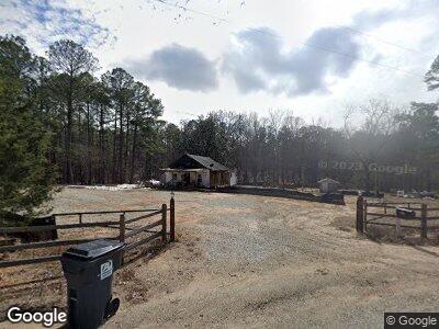
1290 Red Rd White Plains, GA 30678
Estimated Value: $403,000 - $660,000
--
Bed
1
Bath
952
Sq Ft
$564/Sq Ft
Est. Value
About This Home
This home is located at 1290 Red Rd, White Plains, GA 30678 and is currently estimated at $537,344, approximately $564 per square foot. 1290 Red Rd is a home located in Greene County with nearby schools including Greene County High School.
Ownership History
Date
Name
Owned For
Owner Type
Purchase Details
Closed on
Jul 2, 2019
Sold by
Timbervest Partners Iii Georgia Llc
Bought by
Dodson Jack
Current Estimated Value
Purchase Details
Closed on
Oct 18, 2012
Sold by
Empire Lflb Holdings Llc
Bought by
Timbervest Partners Iii Geoerg
Purchase Details
Closed on
Sep 28, 2012
Sold by
Empire Lflb Holdings Llc
Bought by
Timbervest Partners Iii Geoerg
Purchase Details
Closed on
Jan 31, 2012
Home Financials for this Owner
Home Financials are based on the most recent Mortgage that was taken out on this home.
Original Mortgage
$137,500
Interest Rate
3.92%
Mortgage Type
New Conventional
Purchase Details
Closed on
Mar 23, 2007
Sold by
Strickland David Roland
Bought by
Ppiedmont Fall Line Grp Llc
Purchase Details
Closed on
Mar 22, 2007
Sold by
Strickland Grace M
Bought by
Strickland David Roland and Duffy Arlie Joycelyn
Purchase Details
Closed on
Aug 23, 1994
Sold by
Strickland Grace Mrs
Bought by
Strickland Grace
Purchase Details
Closed on
Jan 1, 1973
Sold by
Strickland Lanis
Bought by
Strickland Grace Mrs
Purchase Details
Closed on
Jan 1, 1961
Bought by
Strickland Lanis
Create a Home Valuation Report for This Property
The Home Valuation Report is an in-depth analysis detailing your home's value as well as a comparison with similar homes in the area
Home Values in the Area
Average Home Value in this Area
Purchase History
| Date | Buyer | Sale Price | Title Company |
|---|---|---|---|
| Dodson Jack | $500,000 | -- | |
| Timbervest Partners Iii Geoerg | $282,071 | -- | |
| Timbervest Partners Iii Geoerg | -- | -- | |
| -- | $137,500 | -- | |
| Empire Lflb Holdings Llc | $137,500 | -- | |
| Ppiedmont Fall Line Grp Llc | $264,000 | -- | |
| Strickland David Roland | -- | -- | |
| Strickland Grace | -- | -- | |
| Strickland Grace Mrs | -- | -- | |
| Strickland Lanis | -- | -- |
Source: Public Records
Mortgage History
| Date | Status | Borrower | Loan Amount |
|---|---|---|---|
| Open | Dodson Jack L | $200,000 | |
| Previous Owner | Empire Lflb Holdings Llc | $137,500 |
Source: Public Records
Tax History Compared to Growth
Tax History
| Year | Tax Paid | Tax Assessment Tax Assessment Total Assessment is a certain percentage of the fair market value that is determined by local assessors to be the total taxable value of land and additions on the property. | Land | Improvement |
|---|---|---|---|---|
| 2024 | $1,011 | $194,560 | $180,920 | $13,640 |
| 2023 | $968 | $142,280 | $129,200 | $13,080 |
| 2022 | $880 | $106,800 | $99,360 | $7,440 |
| 2021 | $889 | $106,040 | $99,360 | $6,680 |
| 2020 | $890 | $91,052 | $86,440 | $4,612 |
| 2019 | $599 | $20,360 | $15,960 | $4,400 |
| 2018 | $578 | $20,360 | $15,960 | $4,400 |
| 2017 | $549 | $20,383 | $15,967 | $4,416 |
| 2016 | $550 | $20,383 | $15,967 | $4,416 |
| 2015 | $529 | $20,382 | $15,967 | $4,416 |
| 2014 | $570 | $22,219 | $18,195 | $4,024 |
Source: Public Records
Map
Nearby Homes
- 2630 Liberty Church Rd
- 1889 Flat Rock Church Rd
- 1809 Flat Rock Church Rd
- 2205 Flat Rock Church Rd
- 2127 Flat Rock Church Rd
- 1271 Howard Lewis Rd
- 1521 White Oak Dr
- 1041 Emerald Shores Dr
- 1881 Armour Bridge Rd
- 1221 Emerald Shores Dr
- 1251 Lake Club Dr
- 2381 Armour Bridge Rd
- 1611 A P Roper Rd
- 1230 Lake Club Dr
- 1031 Fish Trap Shoals
- 1020 Hawthorne Heights