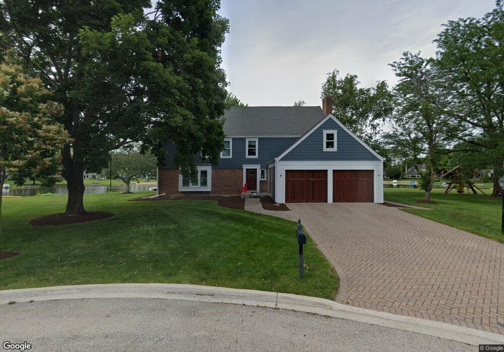
1290 The Point St Unit 7 Barrington, IL 60010
Estimated Value: $999,516 - $1,048,000
5
Beds
3
Baths
3,564
Sq Ft
$286/Sq Ft
Est. Value
About This Home
This home is located at 1290 The Point St Unit 7, Barrington, IL 60010 and is currently estimated at $1,020,379, approximately $286 per square foot. 1290 The Point St Unit 7 is a home located in Lake County with nearby schools including Arnett C. Lines Elementary School, Barrington Middle School Station Campus, and Barrington High School.
Ownership History
Date
Name
Owned For
Owner Type
Purchase Details
Closed on
May 30, 2017
Sold by
Cieslak John E and Cieslak Gwendolyn F
Bought by
Gries Thomas J and Gries Katherine K
Current Estimated Value
Home Financials for this Owner
Home Financials are based on the most recent Mortgage that was taken out on this home.
Original Mortgage
$500,000
Outstanding Balance
$416,010
Interest Rate
4.03%
Mortgage Type
New Conventional
Estimated Equity
$604,369
Purchase Details
Closed on
Jul 20, 2011
Sold by
Morgan Frank J and Mary Cunningham Morgan Trust
Bought by
Cieslak John E and Cieslak Gwendolyn F
Home Financials for this Owner
Home Financials are based on the most recent Mortgage that was taken out on this home.
Original Mortgage
$417,000
Interest Rate
3.5%
Mortgage Type
New Conventional
Purchase Details
Closed on
Jan 29, 2009
Sold by
Morgan Frank J and Will Of Mary C Morgan
Bought by
Morgan Frank J and Mary Cunningham Morgan Trust
Create a Home Valuation Report for This Property
The Home Valuation Report is an in-depth analysis detailing your home's value as well as a comparison with similar homes in the area
Home Values in the Area
Average Home Value in this Area
Purchase History
| Date | Buyer | Sale Price | Title Company |
|---|---|---|---|
| Gries Thomas J | $645,000 | Fidelity National Title | |
| Cieslak John E | $635,000 | Chicago Title Insurance Co | |
| Morgan Frank J | -- | None Available |
Source: Public Records
Mortgage History
| Date | Status | Borrower | Loan Amount |
|---|---|---|---|
| Open | Gries Thomas J | $500,000 | |
| Previous Owner | Cieslak John E | $417,000 |
Source: Public Records
Tax History Compared to Growth
Tax History
| Year | Tax Paid | Tax Assessment Tax Assessment Total Assessment is a certain percentage of the fair market value that is determined by local assessors to be the total taxable value of land and additions on the property. | Land | Improvement |
|---|---|---|---|---|
| 2024 | $18,138 | $272,194 | $65,830 | $206,364 |
| 2023 | $16,669 | $249,890 | $60,436 | $189,454 |
| 2022 | $16,669 | $228,241 | $59,267 | $168,974 |
| 2021 | $16,323 | $222,392 | $57,748 | $164,644 |
| 2020 | $15,964 | $222,392 | $57,748 | $164,644 |
| 2019 | $15,627 | $220,452 | $57,244 | $163,208 |
| 2018 | $15,174 | $217,602 | $61,577 | $156,025 |
| 2017 | $15,154 | $214,979 | $60,835 | $154,144 |
| 2016 | $16,376 | $226,126 | $58,909 | $167,217 |
| 2015 | $15,733 | $215,378 | $56,109 | $159,269 |
| 2014 | $15,482 | $204,878 | $54,302 | $150,576 |
| 2012 | $14,920 | $205,309 | $54,416 | $150,893 |
Source: Public Records
Map
Nearby Homes
- 1288 The Point St
- 1312 Lake Shore Dr N Unit 7
- 290 Cold Spring Rd
- 101 Surrey Ln
- 185 Cold Spring Rd
- 175 Hilltop Ave
- 523 N Ela Rd
- 104 Howe Terrace
- 248 Beverly Rd
- 216 Beverly Rd
- 117 Beverly Rd
- 432 Whitney Dr
- 110 Tudor Dr
- 104 Lois Ln
- 534 E Main St
- 145 Walton St
- 336 Eastern Ave Unit C4
- 319 S Glendale Ave Unit 204
- 1010 Oakland Dr
- 44 Oak Ridge Ln
- 1386 The Point St
- 1289 The Point St
- 1388 The Point St
- 1291 The Point St
- 1387 The Point St
- 1390 The Point St
- 1389 The Point St
- 1311 Lake Shore Dr N
- 1217 Lake Shore Dr N
- 1309 Lake Shore Dr N Unit 7
- 1215 Lake Shore Dr N
- 1213 Lake Shore Dr N
- 1301 Lake Shore Dr N
- 1211 Lake Shore Dr N
- 1207 Lake Shore Dr N
- 1209 Lake Shore Dr N Unit 7
- 1205 Lake Shore Dr N
- 1391 The Point St
- 1307 Lake Shore Dr N
- 1303 Lake Shore Dr N