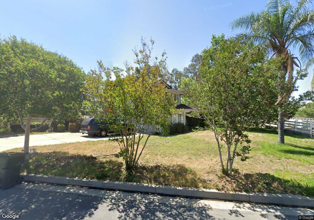
12905 Arapaho Rd Rancho Cucamonga, CA 91739
Etiwanda NeighborhoodEstimated Value: $1,213,989 - $1,527,000
5
Beds
3
Baths
2,915
Sq Ft
$483/Sq Ft
Est. Value
About This Home
This home is located at 12905 Arapaho Rd, Rancho Cucamonga, CA 91739 and is currently estimated at $1,409,247, approximately $483 per square foot. 12905 Arapaho Rd is a home located in San Bernardino County with nearby schools including Etiwanda Colony Elementary, Summit Intermediate, and Etiwanda High.
Ownership History
Date
Name
Owned For
Owner Type
Purchase Details
Closed on
Aug 21, 2025
Sold by
Delnero Thomas G
Bought by
Thomas Del Nero Living Trust and Del Nero
Current Estimated Value
Purchase Details
Closed on
Feb 11, 1998
Sold by
Delnero Thomas and Delnero Joanne
Bought by
State Of California
Purchase Details
Closed on
Sep 17, 1996
Sold by
Medina Luis A
Bought by
Delnero Thomas G and Delnero Joanne L
Home Financials for this Owner
Home Financials are based on the most recent Mortgage that was taken out on this home.
Original Mortgage
$225,165
Interest Rate
7.87%
Purchase Details
Closed on
Feb 22, 1994
Sold by
Nadft
Bought by
Medina Luis A
Home Financials for this Owner
Home Financials are based on the most recent Mortgage that was taken out on this home.
Original Mortgage
$238,400
Interest Rate
7%
Create a Home Valuation Report for This Property
The Home Valuation Report is an in-depth analysis detailing your home's value as well as a comparison with similar homes in the area
Home Values in the Area
Average Home Value in this Area
Purchase History
| Date | Buyer | Sale Price | Title Company |
|---|---|---|---|
| Thomas Del Nero Living Trust | -- | None Listed On Document | |
| State Of California | -- | -- | |
| Delnero Thomas G | $265,000 | Continental Lawyers Title Co | |
| Medina Luis A | $265,000 | Chicago Title Company |
Source: Public Records
Mortgage History
| Date | Status | Borrower | Loan Amount |
|---|---|---|---|
| Previous Owner | Delnero Thomas G | $225,165 | |
| Previous Owner | Medina Luis A | $238,400 | |
| Closed | Delnero Thomas G | $13,245 |
Source: Public Records
Tax History Compared to Growth
Tax History
| Year | Tax Paid | Tax Assessment Tax Assessment Total Assessment is a certain percentage of the fair market value that is determined by local assessors to be the total taxable value of land and additions on the property. | Land | Improvement |
|---|---|---|---|---|
| 2025 | $5,349 | $462,461 | $107,491 | $354,970 |
| 2024 | $5,349 | $453,393 | $105,383 | $348,010 |
| 2023 | $5,228 | $444,503 | $103,317 | $341,186 |
| 2022 | $5,172 | $435,787 | $101,291 | $334,496 |
| 2021 | $5,091 | $427,242 | $99,305 | $327,937 |
| 2020 | $5,029 | $422,861 | $98,287 | $324,574 |
| 2019 | $4,899 | $414,570 | $96,360 | $318,210 |
| 2018 | $5,071 | $406,442 | $94,471 | $311,971 |
| 2017 | $4,862 | $398,473 | $92,619 | $305,854 |
| 2016 | $4,740 | $390,660 | $90,803 | $299,857 |
| 2015 | $4,712 | $384,792 | $89,439 | $295,353 |
| 2014 | $4,601 | $377,254 | $87,687 | $289,567 |
Source: Public Records
Map
Nearby Homes
- 6525 Etiwanda Ave
- 6575 Etiwanda Ave
- 6264 Shore Pine Ct
- 12794 Windstar Dr
- 13060 Carnesi Dr
- 6197 Greenwood Place
- 13031 Vista St
- 6502 Dogwood Place
- 6732 Plum Way
- 6822 Foxtail Ct
- 12420 Silk Oak Ct
- 13042 Larrera St
- 13408 Silver Sky Rd
- 12331 Dove Tree Dr
- 13428 Silver Sky Rd
- 12356 Thistle Dr
- 6921 Dahlia Ct
- 13548 Smokestone St
- 12325 Bellflower Ct
- 7334 Nightfall
- 12875 Vintage Dr
- 12937 Arapaho Rd
- 12902 Arapaho Rd
- 12918 Arapaho Rd
- 12934 Arapaho Rd Unit 1/2
- 12934 Arapaho Rd
- 12953 Arapaho Rd
- 12950 Arapaho Rd
- 12877 Bridge Water Dr
- 12865 Bridge Water Dr
- 12969 Arapaho Rd
- 12966 Arapaho Rd
- 12855 Vintage Dr
- 12901 Cherokee Rd
- 12860 Vintage Dr
- 12917 Cherokee Rd
- 12933 Cherokee Rd
- 12982 Arapaho Rd
- 12949 Cherokee Rd
- 12843 Bridge Water Dr