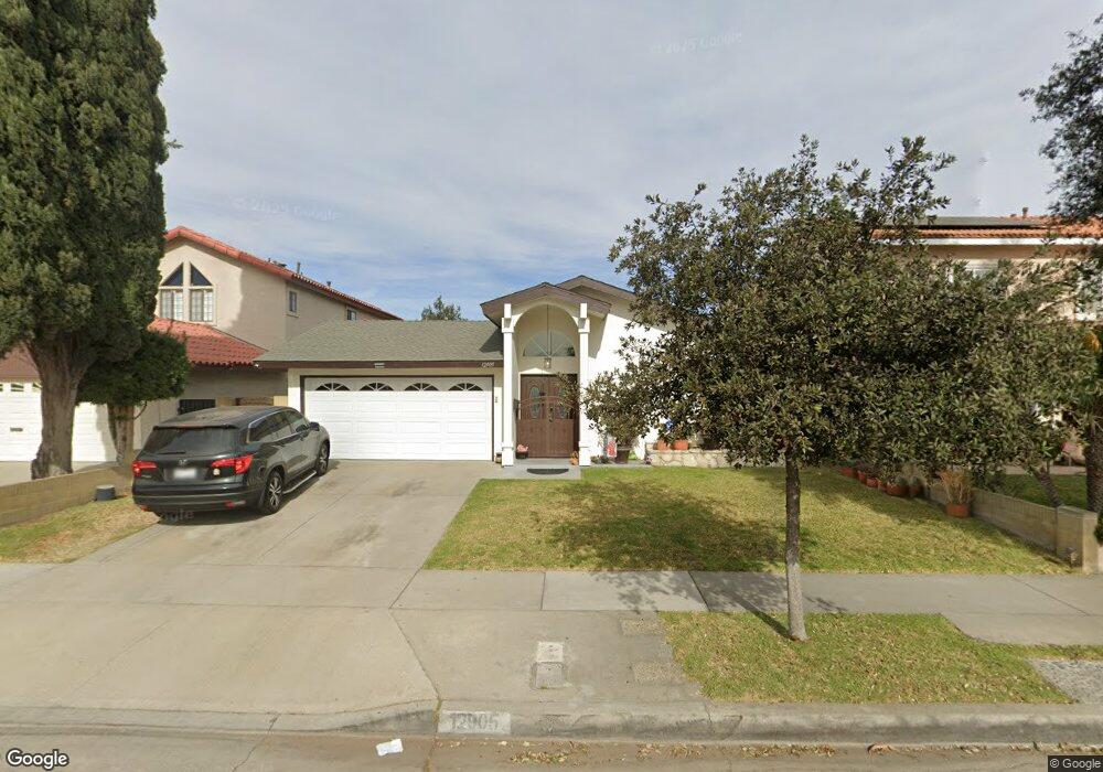
12905 Droxford St Cerritos, CA 90703
Estimated Value: $1,007,340 - $1,232,000
3
Beds
2
Baths
1,462
Sq Ft
$781/Sq Ft
Est. Value
About This Home
This home is located at 12905 Droxford St, Cerritos, CA 90703 and is currently estimated at $1,142,335, approximately $781 per square foot. 12905 Droxford St is a home located in Los Angeles County with nearby schools including Frank C. Leal Elementary School, Tetzlaff (Martin B.) Middle School, and Cerritos High School.
Ownership History
Date
Name
Owned For
Owner Type
Purchase Details
Closed on
Mar 24, 2003
Sold by
Reeder Robert and Reeder Sue
Bought by
Reeder Robert
Current Estimated Value
Purchase Details
Closed on
Mar 14, 2002
Sold by
Reeder Sue H
Bought by
Reeder Robert P
Purchase Details
Closed on
May 16, 2001
Sold by
Reeder Robert P
Bought by
Reeder Sue H
Home Financials for this Owner
Home Financials are based on the most recent Mortgage that was taken out on this home.
Original Mortgage
$199,000
Interest Rate
7.15%
Purchase Details
Closed on
Mar 28, 2001
Sold by
Powdrill Violet S
Bought by
Reeder Sue H
Home Financials for this Owner
Home Financials are based on the most recent Mortgage that was taken out on this home.
Original Mortgage
$199,000
Interest Rate
7.15%
Create a Home Valuation Report for This Property
The Home Valuation Report is an in-depth analysis detailing your home's value as well as a comparison with similar homes in the area
Home Values in the Area
Average Home Value in this Area
Purchase History
| Date | Buyer | Sale Price | Title Company |
|---|---|---|---|
| Reeder Robert | -- | -- | |
| Reeder Robert P | -- | -- | |
| Reeder Sue H | -- | Lawyers Title Company | |
| Reeder Sue H | $279,000 | Lawyers Title Company |
Source: Public Records
Mortgage History
| Date | Status | Borrower | Loan Amount |
|---|---|---|---|
| Previous Owner | Reeder Sue H | $199,000 |
Source: Public Records
Tax History Compared to Growth
Tax History
| Year | Tax Paid | Tax Assessment Tax Assessment Total Assessment is a certain percentage of the fair market value that is determined by local assessors to be the total taxable value of land and additions on the property. | Land | Improvement |
|---|---|---|---|---|
| 2025 | $5,204 | $420,386 | $286,441 | $133,945 |
| 2024 | $5,204 | $412,144 | $280,825 | $131,319 |
| 2023 | $5,038 | $404,064 | $275,319 | $128,745 |
| 2022 | $4,962 | $396,142 | $269,921 | $126,221 |
| 2021 | $4,845 | $388,376 | $264,629 | $123,747 |
| 2019 | $4,735 | $376,859 | $256,781 | $120,078 |
| 2018 | $4,365 | $369,471 | $251,747 | $117,724 |
| 2016 | $4,188 | $355,125 | $241,972 | $113,153 |
| 2015 | $4,135 | $349,792 | $238,338 | $111,454 |
| 2014 | $4,057 | $342,941 | $233,670 | $109,271 |
Source: Public Records
Map
Nearby Homes
- 19008 Jeffrey Ave
- 13044 Hedda Ln
- 18006 Point Conception Place
- 12711 Castleford Ln
- 19335 Derbyshire Ln
- 13210 Sutton St
- 19118 Martha Ave
- 12361 Caravel Place
- 12360 Hedda Dr
- 12967 Moorshire Dr
- 12567 Semora St
- 0 Parcel: 7016-014-017 Ave Unit PW25183248
- 18517 Betty Way
- 12356 Reva St
- 13010 Artesia Blvd
- 12525 Semora St
- 7862 Squaw Valley Way
- 19657 Sequoia Ave
- 12132 Cambrian Cir
- 7152 Caprice Cir
- 12913 Droxford St
- 12903 Droxford St
- 12906 Andy Dr
- 12915 Droxford St
- 12912 Andy Dr
- 12904 Andy Dr
- 12916 Andy Dr
- 12923 Droxford St
- 12922 Andy Dr
- 18737 Kamstra Ave
- 18743 Kamstra Ave
- 18735 Kamstra Ave
- 12925 Droxford St
- 12926 Andy Dr
- 18727 Kamstra Ave
- 12933 Droxford St
- 12909 Andy Dr
- 18725 Kamstra Ave
- 12913 Andy Dr
- 12903 Andy Dr