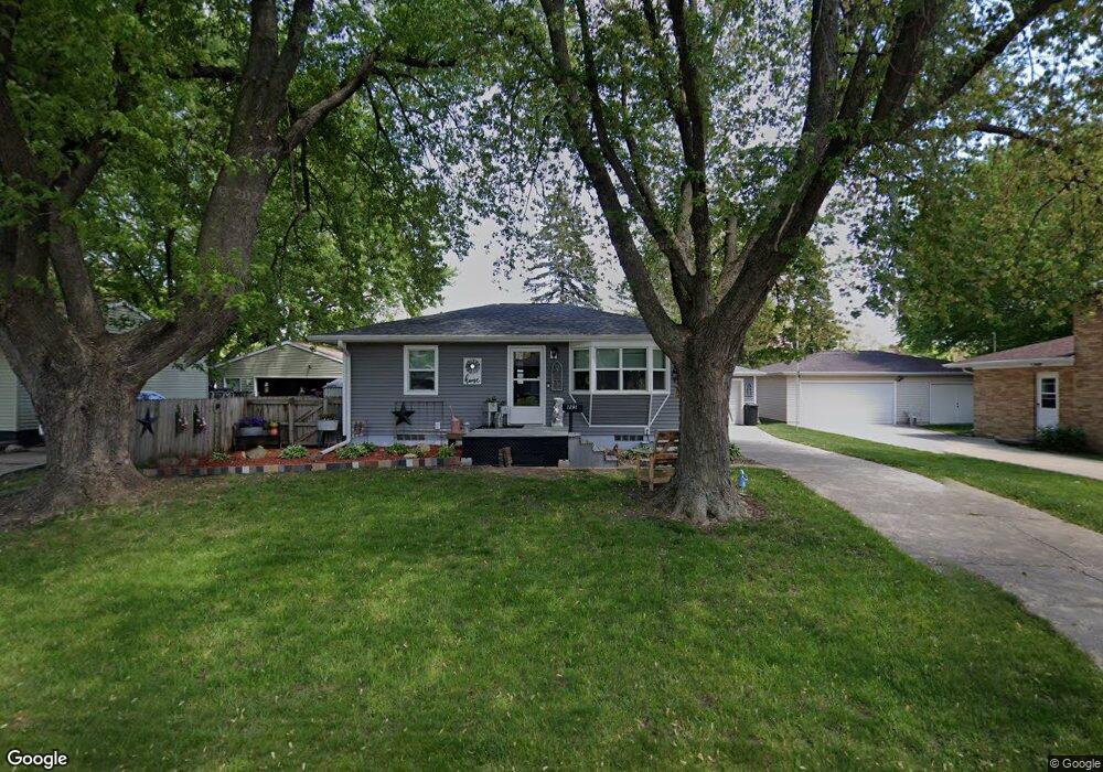
1291 Saint Andrews Ave Waterloo, IA 50701
Alabar Hills NeighborhoodEstimated Value: $164,000 - $197,000
2
Beds
2
Baths
768
Sq Ft
$234/Sq Ft
Est. Value
About This Home
This home is located at 1291 Saint Andrews Ave, Waterloo, IA 50701 and is currently estimated at $179,588, approximately $233 per square foot. 1291 Saint Andrews Ave is a home located in Black Hawk County with nearby schools including Becker Elementary School, Central Middle School, and West High School.
Ownership History
Date
Name
Owned For
Owner Type
Purchase Details
Closed on
Feb 29, 2008
Sold by
Gebel Dennis A and Gebel Terri A
Bought by
Miller Ronald J
Current Estimated Value
Home Financials for this Owner
Home Financials are based on the most recent Mortgage that was taken out on this home.
Original Mortgage
$98,500
Outstanding Balance
$60,321
Interest Rate
5.51%
Mortgage Type
New Conventional
Estimated Equity
$119,267
Purchase Details
Closed on
Jun 15, 2005
Sold by
Netty John A and Netty Lori L
Bought by
Gebel Dennis A and Gebel Terri A
Create a Home Valuation Report for This Property
The Home Valuation Report is an in-depth analysis detailing your home's value as well as a comparison with similar homes in the area
Home Values in the Area
Average Home Value in this Area
Purchase History
| Date | Buyer | Sale Price | Title Company |
|---|---|---|---|
| Miller Ronald J | $98,500 | None Available | |
| Gebel Dennis A | $94,000 | None Available |
Source: Public Records
Mortgage History
| Date | Status | Borrower | Loan Amount |
|---|---|---|---|
| Open | Miller Ronald J | $98,500 |
Source: Public Records
Tax History Compared to Growth
Tax History
| Year | Tax Paid | Tax Assessment Tax Assessment Total Assessment is a certain percentage of the fair market value that is determined by local assessors to be the total taxable value of land and additions on the property. | Land | Improvement |
|---|---|---|---|---|
| 2025 | $2,886 | $158,400 | $17,700 | $140,700 |
| 2024 | $2,886 | $143,270 | $17,700 | $125,570 |
| 2023 | $2,410 | $143,270 | $17,700 | $125,570 |
| 2022 | $2,344 | $118,630 | $17,700 | $100,930 |
| 2021 | $2,230 | $118,630 | $17,700 | $100,930 |
| 2020 | $2,188 | $107,020 | $17,700 | $89,320 |
| 2019 | $2,188 | $107,020 | $17,700 | $89,320 |
| 2018 | $2,076 | $103,850 | $17,700 | $86,150 |
| 2017 | $2,142 | $101,810 | $17,700 | $84,110 |
| 2016 | $2,112 | $101,810 | $17,700 | $84,110 |
| 2015 | $2,112 | $101,810 | $17,700 | $84,110 |
| 2014 | $2,152 | $101,810 | $17,700 | $84,110 |
Source: Public Records
Map
Nearby Homes
- 1269 Scott Ave
- 1742 Sager Ave
- 102 Bergen Dr
- 104 Bergen Dr
- 1726 Huntington Rd
- 3913 Onawa Dr
- 3816 Monterey Dr
- 1137 Fleur Dr
- 3824 Monterey Dr
- 3917 Del Matro Rd
- 915 Alabar Ave
- 1114 Eleanor Dr
- 814 Heartland Hills Dr
- Lot 19 Mark Dr
- Lot 22 Mark Dr
- Lot 20 Mark Dr
- Lot 15 Mark Dr
- Lot 21 Mark Dr
- Lot 16 Mark Dr
- Lot 23 Mark Dr
- 1295 Saint Andrews Ave
- 1287 Saint Andrews Ave
- 1281 St Andrews Ave
- 1281 Saint Andrews Ave
- 1290 Westland Ave
- 1286 Westland Ave
- 1299 Saint Andrews Ave
- 1294 Saint Andrews Ave
- 1280 Westland Ave
- 1298 Saint Andrews Ave
- 1290 Saint Andrews Ave
- 1275 Saint Andrews Ave
- 1286 Saint Andrews Ave
- 1294 Westland Ave
- 1298 St Andrews
- 1298 Westland Ave
- 1280 Saint Andrews Ave
- 1274 Westland Ave
- 1269 Saint Andrews Ave
- 1269 St Andrews Ave