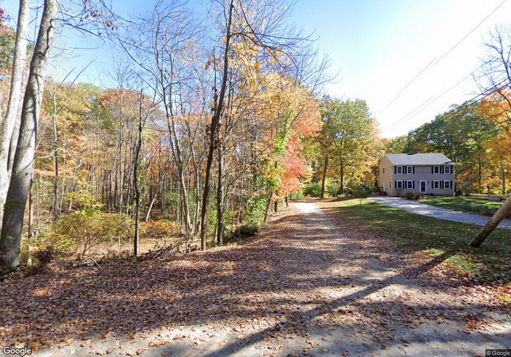
1291 Smyth Rd Hooksett, NH 03106
Estimated Value: $544,355 - $702,000
3
Beds
2
Baths
1,768
Sq Ft
$346/Sq Ft
Est. Value
About This Home
This home is located at 1291 Smyth Rd, Hooksett, NH 03106 and is currently estimated at $612,589, approximately $346 per square foot. 1291 Smyth Rd is a home located in Merrimack County with nearby schools including Fred C. Underhill School, Hooksett Memorial School, and David R. Cawley Middle School.
Ownership History
Date
Name
Owned For
Owner Type
Purchase Details
Closed on
Oct 4, 2019
Sold by
Cooper Linda S and Manning Robert
Bought by
Manning Ft 2019
Current Estimated Value
Purchase Details
Closed on
Jun 14, 2017
Sold by
Manning Robert
Bought by
Cooper Linda S and Manning Robert
Purchase Details
Closed on
Apr 16, 1998
Sold by
Flagstone Props Inc
Bought by
Manning Robert A
Home Financials for this Owner
Home Financials are based on the most recent Mortgage that was taken out on this home.
Original Mortgage
$118,850
Interest Rate
7.11%
Create a Home Valuation Report for This Property
The Home Valuation Report is an in-depth analysis detailing your home's value as well as a comparison with similar homes in the area
Home Values in the Area
Average Home Value in this Area
Purchase History
| Date | Buyer | Sale Price | Title Company |
|---|---|---|---|
| Manning Ft 2019 | -- | -- | |
| Cooper Linda S | -- | -- | |
| Manning Robert A | $120,000 | -- |
Source: Public Records
Mortgage History
| Date | Status | Borrower | Loan Amount |
|---|---|---|---|
| Previous Owner | Manning Robert A | $212,000 | |
| Previous Owner | Manning Robert A | $118,850 |
Source: Public Records
Tax History
| Year | Tax Paid | Tax Assessment Tax Assessment Total Assessment is a certain percentage of the fair market value that is determined by local assessors to be the total taxable value of land and additions on the property. | Land | Improvement |
|---|---|---|---|---|
| 2024 | $7,515 | $443,100 | $126,100 | $317,000 |
| 2023 | $7,081 | $443,100 | $122,900 | $320,200 |
| 2022 | $6,241 | $259,500 | $84,100 | $175,400 |
| 2021 | $5,766 | $259,500 | $84,100 | $175,400 |
| 2020 | $5,841 | $259,500 | $84,100 | $175,400 |
| 2019 | $5,592 | $259,500 | $84,100 | $175,400 |
| 2018 | $5,740 | $259,500 | $84,100 | $175,400 |
| 2017 | $5,680 | $212,400 | $82,800 | $129,600 |
| 2016 | $5,605 | $212,400 | $82,800 | $129,600 |
| 2015 | $207 | $212,400 | $82,800 | $129,600 |
| 2014 | $5,274 | $212,400 | $82,800 | $129,600 |
| 2013 | $4,987 | $212,400 | $82,800 | $129,600 |
Source: Public Records
Map
Nearby Homes
- 13 Johns Dr
- 36 Prescott Heights Rd
- 146 Brookview Dr
- 191 Brookview Dr
- 15 Joanne Dr
- 135 Brookview Dr
- 41 Golden Gate Dr
- 192 Londonderry Turnpike
- 14 Overlook Cir
- 543 Fox Hollow Way
- 6 Golden Gate Dr
- 22 Sunrise Cir
- 1409 Wellington Rd
- 10 Harvard Ave
- 100 Dartmouth Dr
- 1095 1097 1099 Hooksett Rd Unit 73, 74, 75
- 1099 Hooksett Rd Unit 73
- 1097 Hooksett Rd Unit 74
- 1095 Hooksett Rd
- 80 Dartmouth Dr
- 1289 Smyth Rd
- 1283 Smyth Rd
- 1281 Smyth Rd
- 1287 Smyth Rd
- 1279 Smyth Rd
- 1275 Smyth Rd
- 4 Prescott Heights Rd
- 1 Prescott Heights Rd
- 1286 Smyth Rd
- 6 Prescott Heights Rd
- 1284 Smyth Rd
- 1288 Smyth Rd
- 8 Prescott Heights Rd
- 1282 Smyth Rd
- 1293 Smyth Rd
- 1271 Smyth Rd
- 3 Prescott Heights Rd
- 1292 Smyth Rd
- 5 Prescott Heights Rd
- 114 Londonderry Turnpike
Your Personal Tour Guide
Ask me questions while you tour the home.