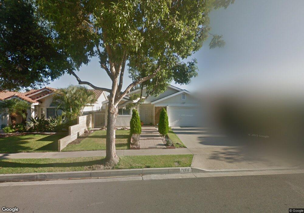
12910 La Jara Cir Cerritos, CA 90703
Estimated Value: $1,160,728 - $1,365,000
4
Beds
3
Baths
1,682
Sq Ft
$747/Sq Ft
Est. Value
About This Home
This home is located at 12910 La Jara Cir, Cerritos, CA 90703 and is currently estimated at $1,256,432, approximately $746 per square foot. 12910 La Jara Cir is a home located in Los Angeles County with nearby schools including Frank C. Leal Elementary School, Tetzlaff (Martin B.) Middle School, and Cerritos High School.
Ownership History
Date
Name
Owned For
Owner Type
Purchase Details
Closed on
Apr 2, 2002
Sold by
Tung Louis Chih Yang
Bought by
Easton Randy Ray and Chung Sandi Shu Lan
Current Estimated Value
Home Financials for this Owner
Home Financials are based on the most recent Mortgage that was taken out on this home.
Original Mortgage
$263,200
Outstanding Balance
$111,209
Interest Rate
7.08%
Estimated Equity
$1,145,223
Purchase Details
Closed on
Jan 30, 2002
Sold by
Tung Louis C
Bought by
Tung Louis Chih Yang and Tung Emma Jiunn
Purchase Details
Closed on
Jan 20, 1998
Sold by
Jackson Emmett C
Bought by
Tung Louis C and Tung Emma J
Create a Home Valuation Report for This Property
The Home Valuation Report is an in-depth analysis detailing your home's value as well as a comparison with similar homes in the area
Home Values in the Area
Average Home Value in this Area
Purchase History
| Date | Buyer | Sale Price | Title Company |
|---|---|---|---|
| Easton Randy Ray | $329,000 | Equity Title | |
| Tung Louis Chih Yang | -- | -- | |
| Tung Louis C | $205,000 | Lawyers Title Company |
Source: Public Records
Mortgage History
| Date | Status | Borrower | Loan Amount |
|---|---|---|---|
| Open | Easton Randy Ray | $263,200 |
Source: Public Records
Tax History Compared to Growth
Tax History
| Year | Tax Paid | Tax Assessment Tax Assessment Total Assessment is a certain percentage of the fair market value that is determined by local assessors to be the total taxable value of land and additions on the property. | Land | Improvement |
|---|---|---|---|---|
| 2025 | $6,632 | $554,574 | $324,992 | $229,582 |
| 2024 | $6,632 | $543,701 | $318,620 | $225,081 |
| 2023 | $6,416 | $533,041 | $312,373 | $220,668 |
| 2022 | $6,317 | $522,591 | $306,249 | $216,342 |
| 2021 | $6,166 | $512,345 | $300,245 | $212,100 |
| 2019 | $6,023 | $497,151 | $291,341 | $205,810 |
| 2018 | $5,574 | $487,404 | $285,629 | $201,775 |
| 2016 | $5,348 | $468,480 | $274,539 | $193,941 |
| 2015 | $5,280 | $461,444 | $270,416 | $191,028 |
| 2014 | $5,174 | $452,406 | $265,119 | $187,287 |
Source: Public Records
Map
Nearby Homes
- 13044 Hedda Ln
- 18006 Point Conception Place
- 13210 Sutton St
- 19008 Jeffrey Ave
- 13010 Artesia Blvd
- 12525 Semora St
- 12360 Hedda Dr
- 0 Parcel: 7016-014-017 Ave Unit PW25183248
- 12356 Reva St
- 12711 Castleford Ln
- 19335 Derbyshire Ln
- 12361 Caravel Place
- 19118 Martha Ave
- 18517 Betty Way
- 12967 Moorshire Dr
- 13370 Holly Oak Cir
- 18430 Horst Ave
- 12251 Carver Ln
- 17721 Norwalk Blvd Unit 47
- 18035 Horst Ave
- 12914 La Jara Cir
- 12904 La Jara Cir
- 12920 La Jara Cir
- 12911 Hedda St
- 12915 Hedda St
- 12905 Hedda St
- 12921 Hedda St
- 12925 La Jara Cir
- 12924 La Jara Cir
- 12915 La Jara Cir
- 12911 La Jara Cir
- 12905 La Jara Cir
- 12925 Hedda St
- 18323 Kamstra Ave
- 18319 Kamstra Ave
- 12921 La Jara Cir
- 18329 Kamstra Ave
- 18313 Kamstra Ave
- 18403 Kamstra Ave
- 12931 Hedda St