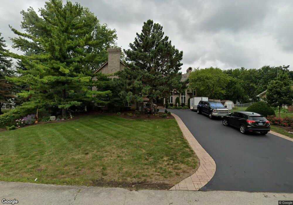
12910 S Hadfield Dr Plainfield, IL 60585
North Plainfield NeighborhoodEstimated Value: $474,000 - $668,000
--
Bed
1
Bath
3,147
Sq Ft
$182/Sq Ft
Est. Value
About This Home
This home is located at 12910 S Hadfield Dr, Plainfield, IL 60585 and is currently estimated at $571,498, approximately $181 per square foot. 12910 S Hadfield Dr is a home located in Will County with nearby schools including Lincoln Elementary School, Heritage Grove Middle School, and Plainfield North High School.
Ownership History
Date
Name
Owned For
Owner Type
Purchase Details
Closed on
Nov 4, 2014
Sold by
Maloney Katherine L
Bought by
Maloney Katherine L and Katherine L Maloney Trust
Current Estimated Value
Purchase Details
Closed on
Apr 13, 2002
Sold by
Hunke Dennis C
Bought by
Hunke Dennis C and Maloney Katherine L
Purchase Details
Closed on
Jul 19, 1996
Sold by
Ward Brenda D
Bought by
Hunke Dennis C
Create a Home Valuation Report for This Property
The Home Valuation Report is an in-depth analysis detailing your home's value as well as a comparison with similar homes in the area
Home Values in the Area
Average Home Value in this Area
Purchase History
| Date | Buyer | Sale Price | Title Company |
|---|---|---|---|
| Maloney Katherine L | -- | None Available | |
| Hunke Dennis C | -- | -- | |
| Hunke Dennis C | -- | -- |
Source: Public Records
Tax History Compared to Growth
Tax History
| Year | Tax Paid | Tax Assessment Tax Assessment Total Assessment is a certain percentage of the fair market value that is determined by local assessors to be the total taxable value of land and additions on the property. | Land | Improvement |
|---|---|---|---|---|
| 2024 | $11,092 | $180,073 | $25,252 | $154,821 |
| 2023 | $11,092 | $159,075 | $22,307 | $136,768 |
| 2022 | $9,109 | $133,959 | $21,102 | $112,857 |
| 2021 | $8,781 | $127,580 | $20,097 | $107,483 |
| 2020 | $8,791 | $125,559 | $19,779 | $105,780 |
| 2019 | $8,670 | $122,021 | $19,222 | $102,799 |
| 2018 | $8,028 | $111,133 | $18,798 | $92,335 |
| 2017 | $8,010 | $108,264 | $18,313 | $89,951 |
| 2016 | $8,049 | $105,934 | $17,919 | $88,015 |
| 2015 | $7,063 | $101,860 | $17,230 | $84,630 |
| 2014 | $7,063 | $101,860 | $17,230 | $84,630 |
| 2013 | $7,063 | $90,189 | $17,230 | $72,959 |
Source: Public Records
Map
Nearby Homes
- 12929 Alpine Way
- 12921 Shelly Ln
- 13035 Grande Pines Blvd
- 26307 Whispering Woods Ct
- 26315 Elizabeth Ct
- 12740 Hawks Bill Ln
- 12802 Grande Poplar Cir
- 26414 Rustling Birch Way
- 12922 Grande Poplar Cir
- 12501 S Willowgate Ln
- 26115 Mapleview Dr
- 12840 Shenandoah Trail
- 26208 W Sablewood Cir
- 26200 W Sablewood Cir
- 26114 W Sherwood Cir
- 5291 S Ridge Rd
- 26118 W Sherwood Cir
- 26109 W Sherwood Cir
- 13416 S Olivewood Dr
- 26543 W Countryside Ln
- 12830 S Hadfield Dr
- 12932 S Hadfield Dr
- 12911 S Elizabeth Dr Unit 1
- 12831 S Elizabeth Dr
- 12933 S Elizabeth Dr
- 12950 S Hadfield Dr
- 12911 S Hadfield Dr
- 12933 S Hadfield Dr
- 12831 S Hadfield Dr
- 12821 S Elizabeth Dr
- 12951 S Hadfield Dr
- 12821 S Hadfield Dr
- 12964 S Hadfield Dr
- 12951 S Elizabeth Dr
- 12811 S Elizabeth Dr
- 12965 S Elizabeth Dr
- 12811 S Hadfield Dr
- 26301 W 128th St
- 12910 S Elizabeth Dr
- 12910 S Elaine Dr