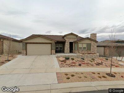
12915 Elkhorn Rd Broomfield, CO 80021
Skyestone NeighborhoodEstimated Value: $893,000 - $956,884
2
Beds
4
Baths
2,153
Sq Ft
$430/Sq Ft
Est. Value
About This Home
This home is located at 12915 Elkhorn Rd, Broomfield, CO 80021 and is currently estimated at $925,471, approximately $429 per square foot. 12915 Elkhorn Rd is a home with nearby schools including Lukas Elementary School, Wayne Carle Middle School, and Standley Lake High School.
Ownership History
Date
Name
Owned For
Owner Type
Purchase Details
Closed on
Jul 2, 2018
Sold by
Mahan Gary R and Mahan Janet F
Bought by
Mahan Joint Living Trust
Current Estimated Value
Purchase Details
Closed on
Jun 19, 2018
Sold by
Maham Gary R and Maham Janet F
Bought by
Maham Joint Living Trust
Purchase Details
Closed on
Sep 27, 2016
Sold by
Taylor Morrison Of Colordo Inc
Bought by
Mahan Gary R and Mahan Janet F
Home Financials for this Owner
Home Financials are based on the most recent Mortgage that was taken out on this home.
Original Mortgage
$417,000
Interest Rate
3.46%
Mortgage Type
New Conventional
Create a Home Valuation Report for This Property
The Home Valuation Report is an in-depth analysis detailing your home's value as well as a comparison with similar homes in the area
Home Values in the Area
Average Home Value in this Area
Purchase History
| Date | Buyer | Sale Price | Title Company |
|---|---|---|---|
| Maham Joint Living Trust | -- | None Available | |
| Mahan Gary R | $552,127 | First American Title |
Source: Public Records
Mortgage History
| Date | Status | Borrower | Loan Amount |
|---|---|---|---|
| Previous Owner | Mahan Gary R | $417,000 |
Source: Public Records
Tax History Compared to Growth
Tax History
| Year | Tax Paid | Tax Assessment Tax Assessment Total Assessment is a certain percentage of the fair market value that is determined by local assessors to be the total taxable value of land and additions on the property. | Land | Improvement |
|---|---|---|---|---|
| 2024 | $7,269 | $60,950 | $10,610 | $50,340 |
| 2023 | $7,269 | $67,050 | $11,680 | $55,370 |
| 2022 | $6,076 | $49,200 | $8,390 | $40,810 |
| 2021 | $5,790 | $47,030 | $8,630 | $38,400 |
| 2020 | $6,357 | $43,650 | $8,260 | $35,390 |
| 2019 | $6,317 | $43,960 | $8,320 | $35,640 |
| 2018 | $6,109 | $41,670 | $9,000 | $32,670 |
| 2017 | $5,777 | $46,070 | $9,950 | $36,120 |
| 2016 | $1,553 | $10 | $10 | $0 |
Source: Public Records
Map
Nearby Homes
- 12930 Bobcat Ct
- 10771 N Montane Dr
- 10761 N Montane Dr
- 10786 Bear Cub Dr
- 10845 N Bear Cub Dr
- 12746 Meadowlark Ln
- 12636 Sandstone Dr
- 10834 Graphite St
- 12575 Sandstone Dr
- 12431 Red Fox Way
- 10622 Van Gordon Way
- 10679 Union Way
- 11896 W 107th Ave
- 11875 W 107th Ave
- 10753 Routt Ct
- 10630 NW Routt Way
- 10550 Routt St
- 11446 W 105th Dr
- 11551 W 103rd Dr
- 11256 W 104th Ave