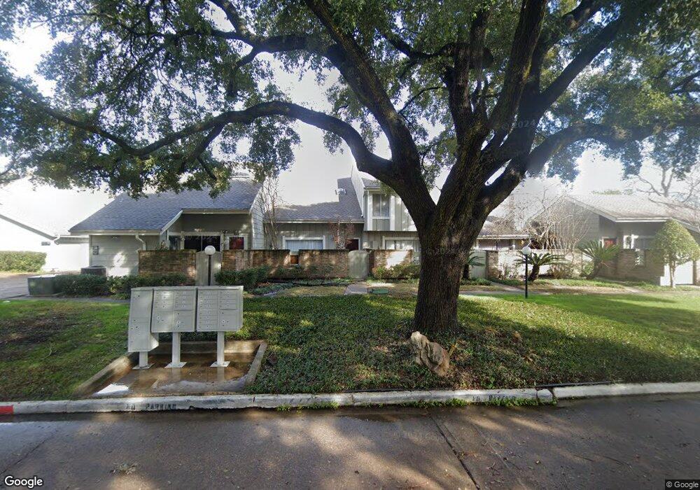
12916 Leader St Unit 2916 Houston, TX 77072
Alief NeighborhoodEstimated Value: $164,000 - $179,000
3
Beds
3
Baths
1,383
Sq Ft
$124/Sq Ft
Est. Value
About This Home
This home is located at 12916 Leader St Unit 2916, Houston, TX 77072 and is currently estimated at $170,905, approximately $123 per square foot. 12916 Leader St Unit 2916 is a home located in Harris County with nearby schools including Mahanay Elementary School, Youngblood Intermediate School, and Elsik High School.
Ownership History
Date
Name
Owned For
Owner Type
Purchase Details
Closed on
Mar 1, 2024
Sold by
Ally Properties Llc
Bought by
Quest Trust and Rafael Flamenco 36352-21
Current Estimated Value
Purchase Details
Closed on
Jul 6, 1998
Sold by
White James Ray and White Camille Sproul
Bought by
Phelps Lenora J
Home Financials for this Owner
Home Financials are based on the most recent Mortgage that was taken out on this home.
Original Mortgage
$45,450
Interest Rate
7.09%
Purchase Details
Closed on
Mar 25, 1997
Sold by
Allaire Steven Anton and Allaire Joanne Loe
Bought by
White James Ray and White Camille Sproul
Home Financials for this Owner
Home Financials are based on the most recent Mortgage that was taken out on this home.
Original Mortgage
$44,982
Interest Rate
7.65%
Create a Home Valuation Report for This Property
The Home Valuation Report is an in-depth analysis detailing your home's value as well as a comparison with similar homes in the area
Home Values in the Area
Average Home Value in this Area
Purchase History
| Date | Buyer | Sale Price | Title Company |
|---|---|---|---|
| Quest Trust | -- | None Listed On Document | |
| Phelps Lenora J | -- | First Southwestern Title Co | |
| White James Ray | -- | -- |
Source: Public Records
Mortgage History
| Date | Status | Borrower | Loan Amount |
|---|---|---|---|
| Previous Owner | Phelps Lenora J | $45,450 | |
| Previous Owner | White James Ray | $44,982 |
Source: Public Records
Tax History Compared to Growth
Tax History
| Year | Tax Paid | Tax Assessment Tax Assessment Total Assessment is a certain percentage of the fair market value that is determined by local assessors to be the total taxable value of land and additions on the property. | Land | Improvement |
|---|---|---|---|---|
| 2025 | $3,512 | $151,825 | $28,847 | $122,978 |
| 2024 | $3,512 | $154,585 | $29,371 | $125,214 |
| 2023 | $3,512 | $160,170 | $30,432 | $129,738 |
| 2022 | $3,666 | $151,146 | $28,718 | $122,428 |
| 2021 | $2,948 | $120,780 | $22,948 | $97,832 |
| 2020 | $2,914 | $115,219 | $21,892 | $93,327 |
| 2019 | $3,173 | $115,219 | $21,892 | $93,327 |
| 2018 | $1,352 | $101,652 | $19,314 | $82,338 |
| 2017 | $1,929 | $101,652 | $19,314 | $82,338 |
| 2016 | $1,753 | $90,273 | $17,152 | $73,121 |
| 2015 | $360 | $75,545 | $14,354 | $61,191 |
| 2014 | $360 | $53,142 | $10,097 | $43,045 |
Source: Public Records
Map
Nearby Homes
- 6855 Greenway Chase St Unit 6855
- 13020 Greenway Chase Ct Unit 3020
- 12934 Greenway Chase Ct Unit 2934
- 12773 Leader St
- 12922 Wirevine Ln
- 7054 Greenway Chase St Unit 513
- 7064 Greenway Chase St
- 6734 Westwick Dr
- 7111 Brendam Ln
- 13119 S Bellaire Estates Dr
- 12989 Bellaire Blvd Unit 3
- 12991 Wirevine Ln
- 7140 S Dairy Ashford Rd
- 13043 Clarewood Dr
- 13207 Robinglen Dr
- 12819 Carvel Ln
- 6551 S Briar Bayou Dr
- 6541 S Briar Bayou Dr
- 12709 Carvel Ln
- 13206 Sharpbill Dr
- 12918 Leader St Unit 2918
- 12914 Leader St Unit 2914
- 12920 Leader St Unit 2920
- 12912 Leader St
- 12904 Leader St Unit 2904
- 12906 Leader St Unit 2906
- 12908 Leader St Unit 2908
- 12902 Leader St
- 12910 Leader St Unit 2910
- 12811 Westbranch Ct
- 12924 Leader St Unit 2924
- 12922 Leader St Unit 2922
- 12926 Leader St Unit 2926
- 6863 Greenway Chase St Unit 6863
- 6865 Greenway Chase St Unit 6865
- 12928 Leader St Unit 2928
- 6859 Greenway Chase St Unit 6859
- 6867 Greenway Chase St Unit 6867
- 12813 Westbranch Ct
- 6861 Greenway Chase St Unit 6861