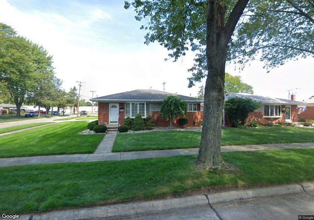
12917 Stanley Dr Warren, MI 48088
Northeast Warren NeighborhoodEstimated Value: $238,954 - $248,000
3
Beds
2
Baths
1,218
Sq Ft
$199/Sq Ft
Est. Value
About This Home
This home is located at 12917 Stanley Dr, Warren, MI 48088 and is currently estimated at $242,989, approximately $199 per square foot. 12917 Stanley Dr is a home located in Macomb County with nearby schools including Warren Woods Tower High School, Frontier International Academy Elementary, and Warren Woods Christian School.
Ownership History
Date
Name
Owned For
Owner Type
Purchase Details
Closed on
Feb 28, 2022
Sold by
Griggs Edsel F
Bought by
Griggs Eva M
Current Estimated Value
Purchase Details
Closed on
Jun 10, 2019
Sold by
Griggs Griggs Edsel F Edsel F
Bought by
Griggs Edsel F and Griggs Eva M
Purchase Details
Closed on
Jun 27, 2012
Sold by
Griggs Edsel F and Griggs Eva M
Bought by
Griggs Edsel F and Griggs Eva M
Purchase Details
Closed on
Jan 20, 2012
Sold by
Griggs Edsel F and Griggs Eva M
Bought by
Griggs Edsel F and Griggs Eva M
Purchase Details
Closed on
Jul 26, 1999
Sold by
Borkowski Barbara
Bought by
Griggs Edsel F
Create a Home Valuation Report for This Property
The Home Valuation Report is an in-depth analysis detailing your home's value as well as a comparison with similar homes in the area
Home Values in the Area
Average Home Value in this Area
Purchase History
| Date | Buyer | Sale Price | Title Company |
|---|---|---|---|
| Griggs Eva M | -- | None Listed On Document | |
| Griggs Edsel F | -- | None Available | |
| Griggs Edsel F | -- | None Available | |
| Griggs Edsel F | -- | None Available | |
| Griggs Edsel F | $152,000 | -- |
Source: Public Records
Tax History
| Year | Tax Paid | Tax Assessment Tax Assessment Total Assessment is a certain percentage of the fair market value that is determined by local assessors to be the total taxable value of land and additions on the property. | Land | Improvement |
|---|---|---|---|---|
| 2025 | $2,963 | $112,490 | $0 | $0 |
| 2024 | $29 | $102,670 | $0 | $0 |
| 2023 | $2,732 | $92,340 | $0 | $0 |
| 2022 | $2,678 | $81,360 | $0 | $0 |
| 2021 | $2,628 | $77,050 | $0 | $0 |
| 2020 | $2,519 | $73,640 | $0 | $0 |
| 2019 | $2,406 | $69,350 | $0 | $0 |
| 2018 | $2,431 | $62,310 | $0 | $0 |
| 2017 | $2,299 | $56,730 | $11,460 | $45,270 |
| 2016 | $2,281 | $56,730 | $0 | $0 |
| 2015 | -- | $51,070 | $0 | $0 |
| 2013 | $2,203 | $43,120 | $0 | $0 |
Source: Public Records
Map
Nearby Homes
- 29143 Dover Ave
- 29105 Palomino Dr
- 54765 Palomino Ave
- 28540 Roan Dr
- 28127 Suburban Dr
- 29337 Roan Dr
- 29091 Wagner Dr
- 29366 Wagner Dr
- 29134 Bonnie Dr
- 29820 Palomino Dr
- 12876 Martin Rd
- 30032 Iroquois Dr
- 12531 Common Rd
- 30045 Iroquois Dr
- 12855 Ray Dr
- 13517 Yvonne Dr
- 29454 Scarborough Dr Unit 7
- 29460 Hoover Rd Unit D37
- 29346 Hoover Rd
- 29368 Hoover Rd Unit A3
- 12929 Stanley Dr
- 12941 Stanley Dr
- 12980 E 12 Mile Rd
- 12953 Stanley Dr
- 28811 Adler Dr
- 28825 Adler Dr
- 12916 Stanley Dr
- 12928 Stanley Dr
- 28801 Adler Dr
- 28837 Adler Dr
- 12940 Stanley Dr
- 13000 E 12 Mile Rd
- 12965 Stanley Dr
- 28771 Adler Dr
- 28849 Adler Dr
- 12954 Stanley Dr
- 13012 E 12 Mile Rd
- 28748 Adler Dr
- 28759 Adler Dr
- 13007 Stanley Dr
Your Personal Tour Guide
Ask me questions while you tour the home.