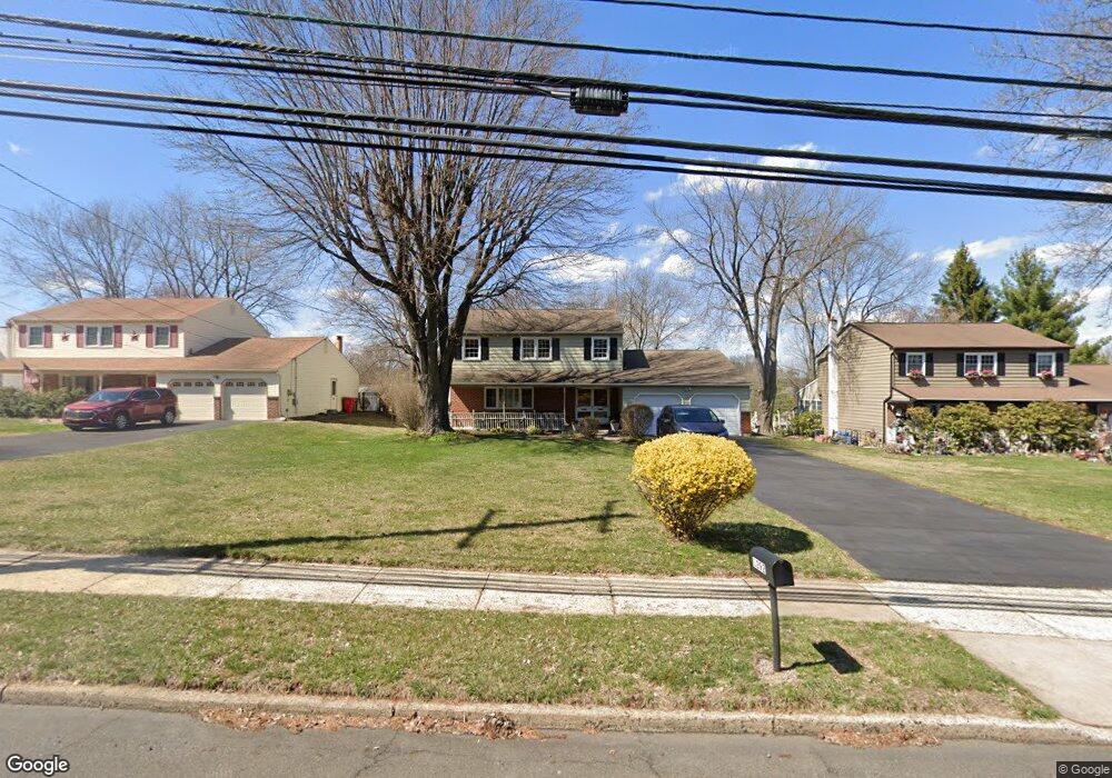
1292 Mearns Rd Warminster, PA 18974
Estimated Value: $510,000 - $559,142
4
Beds
3
Baths
2,132
Sq Ft
$252/Sq Ft
Est. Value
About This Home
This home is located at 1292 Mearns Rd, Warminster, PA 18974 and is currently estimated at $537,536, approximately $252 per square foot. 1292 Mearns Rd is a home located in Bucks County with nearby schools including McDonald Elementary School, Log College Middle School, and William Tennent High School.
Ownership History
Date
Name
Owned For
Owner Type
Purchase Details
Closed on
Oct 28, 1998
Sold by
Rogers Donald H and Rogers Doris C
Bought by
Legore Philip and Leukhardt Legore Laura J
Current Estimated Value
Home Financials for this Owner
Home Financials are based on the most recent Mortgage that was taken out on this home.
Original Mortgage
$114,400
Outstanding Balance
$25,081
Interest Rate
6.64%
Estimated Equity
$512,455
Purchase Details
Closed on
Sep 7, 1989
Bought by
Rogers Donald H
Create a Home Valuation Report for This Property
The Home Valuation Report is an in-depth analysis detailing your home's value as well as a comparison with similar homes in the area
Home Values in the Area
Average Home Value in this Area
Purchase History
| Date | Buyer | Sale Price | Title Company |
|---|---|---|---|
| Legore Philip | $143,000 | -- | |
| Rogers Donald H | $155,000 | -- |
Source: Public Records
Mortgage History
| Date | Status | Borrower | Loan Amount |
|---|---|---|---|
| Open | Legore Philip | $114,400 |
Source: Public Records
Tax History Compared to Growth
Tax History
| Year | Tax Paid | Tax Assessment Tax Assessment Total Assessment is a certain percentage of the fair market value that is determined by local assessors to be the total taxable value of land and additions on the property. | Land | Improvement |
|---|---|---|---|---|
| 2025 | $6,231 | $29,520 | $5,760 | $23,760 |
| 2024 | $6,231 | $29,520 | $5,760 | $23,760 |
| 2023 | $6,039 | $29,520 | $5,760 | $23,760 |
| 2022 | $5,910 | $29,520 | $5,760 | $23,760 |
| 2021 | $5,772 | $29,520 | $5,760 | $23,760 |
| 2020 | $5,691 | $29,520 | $5,760 | $23,760 |
| 2019 | $5,389 | $29,520 | $5,760 | $23,760 |
| 2018 | $5,260 | $29,520 | $5,760 | $23,760 |
| 2017 | $5,106 | $29,520 | $5,760 | $23,760 |
| 2016 | $5,106 | $29,520 | $5,760 | $23,760 |
| 2015 | $4,981 | $29,520 | $5,760 | $23,760 |
| 2014 | $4,981 | $29,520 | $5,760 | $23,760 |
Source: Public Records
Map
Nearby Homes
- 1229 Manor Dr
- 667 Arbor Ln
- 675 Cheryl Dr
- 1252 Dahlia Rd
- 115 Grandview Dr
- 202 Strawberry Ct Unit 249
- 109 Wilson Ave
- 1075 Roberts Rd
- 902 Hamilton Way
- 868 Aster Rd
- 921 Nathaniel Trail
- 1000 Jacksonville Rd Unit 12
- 934 Nathaniel Trail
- 36 Parry Way
- 950 Nathaniel Trail
- 56 Parry Way
- 9 Spring Mill Dr
- 11 Spring Mill Dr
- 905 Holden Ct
- 632 Longfellow Ct
- 1284 Mearns Rd
- 1300 Mearns Rd
- 1310 Mearns Rd
- 436 Homestead Ct
- 442 Homestead Ct
- 430 Homestead Ct
- 1268 Mearns Rd
- 1301 Sturbridge Dr
- 1307 Sturbridge Dr
- 448 Homestead Ct
- 1295 Sturbridge Dr
- 424 Homestead Ct
- 1287 Sturbridge Dr
- 501 Lafayette Ln
- 445 Homestead Ct
- 431 Homestead Ct
- 418 Homestead Ct
- 491 W Bristol Rd
- 1275 Sturbridge Dr
- 437 Homestead Ct