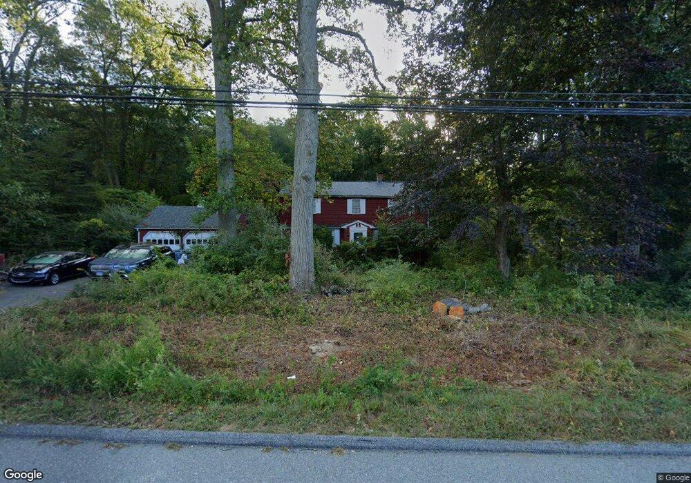
1292 Route 12 Groton, CT 06340
Estimated Value: $350,000 - $505,766
3
Beds
3
Baths
2,674
Sq Ft
$157/Sq Ft
Est. Value
About This Home
This home is located at 1292 Route 12, Groton, CT 06340 and is currently estimated at $419,442, approximately $156 per square foot. 1292 Route 12 is a home located in New London County with nearby schools including Pleasant Valley School, Groton Middle School, and Robert E. Fitch High School.
Ownership History
Date
Name
Owned For
Owner Type
Purchase Details
Closed on
Apr 19, 2006
Sold by
Pearson Mark
Bought by
Hodgdon Anne and Hodgdon Gary E
Current Estimated Value
Home Financials for this Owner
Home Financials are based on the most recent Mortgage that was taken out on this home.
Original Mortgage
$203,000
Outstanding Balance
$116,724
Interest Rate
6.37%
Estimated Equity
$302,718
Create a Home Valuation Report for This Property
The Home Valuation Report is an in-depth analysis detailing your home's value as well as a comparison with similar homes in the area
Home Values in the Area
Average Home Value in this Area
Purchase History
| Date | Buyer | Sale Price | Title Company |
|---|---|---|---|
| Hodgdon Anne | $200,000 | -- |
Source: Public Records
Mortgage History
| Date | Status | Borrower | Loan Amount |
|---|---|---|---|
| Open | Hodgdon Anne | $203,000 |
Source: Public Records
Tax History Compared to Growth
Tax History
| Year | Tax Paid | Tax Assessment Tax Assessment Total Assessment is a certain percentage of the fair market value that is determined by local assessors to be the total taxable value of land and additions on the property. | Land | Improvement |
|---|---|---|---|---|
| 2025 | $5,385 | $182,490 | $83,559 | $98,931 |
| 2024 | $5,070 | $182,490 | $83,559 | $98,931 |
| 2023 | $4,969 | $182,490 | $41,160 | $141,330 |
| 2022 | $4,854 | $182,490 | $41,160 | $141,330 |
| 2021 | $6,069 | $186,900 | $45,710 | $141,190 |
| 2020 | $5,910 | $186,900 | $45,710 | $141,190 |
| 2019 | $5,691 | $186,900 | $45,710 | $141,190 |
| 2018 | $5,633 | $186,900 | $45,710 | $141,190 |
| 2017 | $5,487 | $186,900 | $45,710 | $141,190 |
| 2016 | $6,272 | $223,370 | $63,420 | $159,950 |
| 2015 | $6,031 | $223,370 | $63,420 | $159,950 |
| 2014 | $5,870 | $223,370 | $63,420 | $159,950 |
Source: Public Records
Map
Nearby Homes
- 95 Murphys Dr Unit 95
- 1010 Long Cove Rd
- 621 Military Hwy
- 1513 Connecticut 12
- 17 Inchcliffe Dr
- 64 Scotch Cap Rd Unit 102
- 62 Benham Ave
- 31 Richard Rd
- 9 James Ave
- 932 Long Cove Rd Unit TRLR 4
- 14 Woodland Ln
- 141 Starr Hill Rd
- 176 Old Norwich Rd
- 22 Toll Gate Rd
- 205 Old Norwich Rd
- 5 Ledgewood Dr
- 7 Harvard Rd
- 21 Grove Ave
- 517-571 Gold Star Hwy
- 271 Crystal Ave
- 1302 Route 12
- 1260 Route 12
- 1140 Pleasant Valley Rd N
- 1130 Pleasant Valley Rd N
- 1198 Pleasant Valley Rd N
- 1216 Pleasant Valley Rd N
- 1185 Pleasant Valley Rd N
- 1199 Pleasant Valley Rd N
- 1215 Pleasant Valley Rd N
- 1101 Pleasant Valley Rd N
- 1187 Pleasant Valley Rd N
- 18 Murphys Dr
- 18 Murphys Dr Unit 18
- 20 Murphys Dr
- 1079 Pleasant Valley Rd N
- 1079 Pleasant Valley Rd N Unit 10
- 1079 Pleasant Valley Rd N Unit 1079
- 1077 Pleasant Valley Rd N
- 1077 Pleasant Valley Rd N Unit 17A
- 1077 Pleasant Valley Rd N Unit na